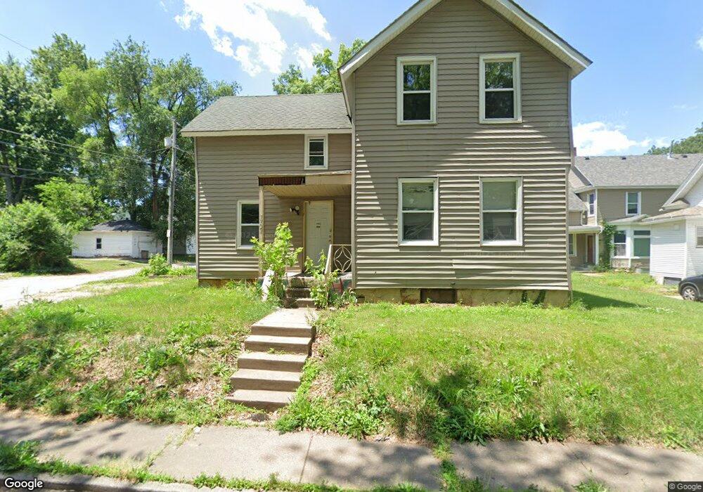
1722 Scott St Davenport, IA 52803
Central Davenport NeighborhoodEstimated Value: $108,000 - $140,000
4
Beds
3
Baths
1,197
Sq Ft
$101/Sq Ft
Est. Value
About This Home
This home is located at 1722 Scott St, Davenport, IA 52803 and is currently estimated at $120,455, approximately $100 per square foot. 1722 Scott St is a home located in Scott County with nearby schools including Crofton Elementary School, Casey County Middle School, and Williams Intermediate School.
Ownership History
Date
Name
Owned For
Owner Type
Purchase Details
Closed on
Jun 30, 2023
Sold by
Ambrose Four Scott Lc
Bought by
St Ambrose University
Current Estimated Value
Purchase Details
Closed on
Jun 21, 2011
Sold by
Hanson Benjamin R
Bought by
Ambrose Four Scott Lc
Purchase Details
Closed on
Mar 16, 2009
Sold by
Bytnar Robert and Bytnar Sara E
Bought by
Hanson Benjamin R
Home Financials for this Owner
Home Financials are based on the most recent Mortgage that was taken out on this home.
Original Mortgage
$66,500
Interest Rate
5.09%
Mortgage Type
Purchase Money Mortgage
Create a Home Valuation Report for This Property
The Home Valuation Report is an in-depth analysis detailing your home's value as well as a comparison with similar homes in the area
Home Values in the Area
Average Home Value in this Area
Purchase History
| Date | Buyer | Sale Price | Title Company |
|---|---|---|---|
| St Ambrose University | $90,000 | None Listed On Document | |
| Ambrose Four Scott Lc | -- | None Available | |
| Hanson Benjamin R | $70,000 | None Available |
Source: Public Records
Mortgage History
| Date | Status | Borrower | Loan Amount |
|---|---|---|---|
| Previous Owner | Hanson Benjamin R | $66,500 |
Source: Public Records
Tax History Compared to Growth
Tax History
| Year | Tax Paid | Tax Assessment Tax Assessment Total Assessment is a certain percentage of the fair market value that is determined by local assessors to be the total taxable value of land and additions on the property. | Land | Improvement |
|---|---|---|---|---|
| 2025 | -- | $89,630 | $11,280 | $78,350 |
| 2024 | $1,368 | $78,430 | $0 | $0 |
| 2023 | $1,330 | $78,430 | $11,280 | $67,150 |
| 2022 | $1,334 | $62,300 | $5,560 | $56,740 |
| 2021 | $1,334 | $62,170 | $5,560 | $56,610 |
| 2020 | $1,188 | $54,660 | $5,560 | $49,100 |
| 2019 | $1,359 | $53,160 | $5,560 | $47,600 |
| 2018 | $535 | $53,160 | $5,560 | $47,600 |
| 2017 | $1,208 | $53,160 | $5,560 | $47,600 |
| 2016 | $1,164 | $53,160 | $0 | $0 |
| 2015 | $1,164 | $56,060 | $0 | $0 |
| 2014 | $1,244 | $56,060 | $0 | $0 |
| 2013 | $1,224 | $0 | $0 | $0 |
| 2012 | -- | $58,570 | $6,090 | $52,480 |
Source: Public Records
Map
Nearby Homes
- 503 W 17th St
- 1605 N Harrison St
- 734 W 17th St
- 1518 N Main St
- 2211 Western Ave
- 617 W 13th St
- 2218 Western Ave
- 822 W 14th St
- 1925 Vine St
- 2133 Warren St
- 1321 N Main St
- 1319 Warren St
- 1127 N Ripley St
- 930 W 14th St
- 816 Spalding Blvd
- 922 W Lombard St
- 230 Kirkwood Blvd
- 1812 Pershing Ave
- 2230 Warren St
- 1034 W 14th St
- 507 W Locust St
- 505 W Locust St
- 431 W Locust St
- 502 W 17th St
- 508 W 17th St
- 423 W Locust St
- 428 W 17th St
- 514 W 17th St
- 502 W 17th St
- 426 W 17th St
- 521 W Locust St
- 417 W Locust St
- 522 W 17th St
- 522 W 17th St Unit 2
- 418 W 17th St
- 524 W 17th St
- 411 W Locust St
- 529 W Locust St
- 414 W 17th St
- 530 W 17th St