Estimated Value: $127,000 - $169,000
3
Beds
2
Baths
1,512
Sq Ft
$96/Sq Ft
Est. Value
About This Home
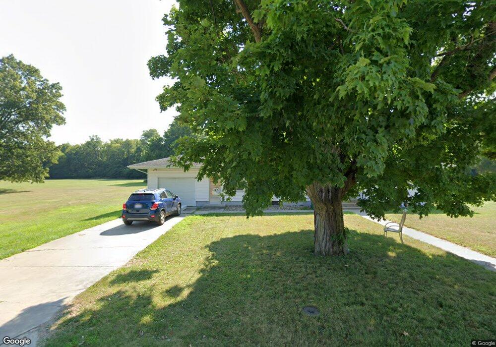
This home is located at 1723 N 12th St, Niles, MI 49120 and is currently estimated at $145,024, approximately $95 per square foot. 1723 N 12th St is a home located in Berrien County with nearby schools including James Ellis School, Howard-Ellis Elementary School, and Ring Lardner Middle School.
Ownership History
Date
Name
Owned For
Owner Type
Purchase Details
Closed on
Oct 17, 2018
Sold by
Hanlon Anna M and Mazzotta Philip
Bought by
Hafer Cody T and Mazzotta Philip
Current Estimated Value
Home Financials for this Owner
Home Financials are based on the most recent Mortgage that was taken out on this home.
Original Mortgage
$80,000
Outstanding Balance
$69,913
Interest Rate
4.6%
Mortgage Type
New Conventional
Estimated Equity
$75,111
Purchase Details
Closed on
Oct 1, 2012
Sold by
Estate Of Angela Mazzotta
Bought by
Hanlon Anna M and Mazzotta Philip
Create a Home Valuation Report for This Property
The Home Valuation Report is an in-depth analysis detailing your home's value as well as a comparison with similar homes in the area
Home Values in the Area
Average Home Value in this Area
Purchase History
| Date | Buyer | Sale Price | Title Company |
|---|---|---|---|
| Hafer Cody T | $100,000 | First American Title Co | |
| Hanlon Anna M | -- | None Available |
Source: Public Records
Mortgage History
| Date | Status | Borrower | Loan Amount |
|---|---|---|---|
| Open | Hafer Cody T | $80,000 |
Source: Public Records
Tax History Compared to Growth
Tax History
| Year | Tax Paid | Tax Assessment Tax Assessment Total Assessment is a certain percentage of the fair market value that is determined by local assessors to be the total taxable value of land and additions on the property. | Land | Improvement |
|---|---|---|---|---|
| 2025 | $1,073 | $52,800 | $0 | $0 |
| 2024 | $834 | $51,500 | $0 | $0 |
| 2023 | $799 | $40,600 | $0 | $0 |
| 2022 | $761 | $29,800 | $0 | $0 |
| 2021 | $940 | $27,100 | $3,600 | $23,500 |
| 2020 | $930 | $25,400 | $0 | $0 |
| 2019 | $918 | $22,300 | $2,500 | $19,800 |
| 2018 | $865 | $22,300 | $0 | $0 |
| 2017 | $901 | $25,700 | $0 | $0 |
| 2016 | $882 | $23,300 | $0 | $0 |
| 2015 | $986 | $29,600 | $0 | $0 |
| 2014 | $767 | $25,700 | $0 | $0 |
Source: Public Records
Map
Nearby Homes
- 1630 Forest Trail
- 31829 Heritage Place
- 1603 N 5th St
- 534 James St
- 1610 N 5th St
- 2802 Primrose Ct
- 1405 Sheffield Ave
- 1201 N 6th St
- 501 & 505 N Twelfth St
- 645 N 11th St
- 712 Wayne St
- 2028 N Old Us 31 Unit 11
- 2000 N Old Us 31 Unit 2
- 2002 N Old Us 31 Unit 7
- 2002 N Old Us 31 Unit 12S
- 2026 N Old Us 31 Unit 2
- 626 N 12th St
- 622 N 13th St
- VL N 5th St
- 232 Pokagon St
- 0 N 12 St Unit 69022047666
- 0 N 12 St
- 1713 N 12th St
- 1627 N 12th St
- 1712 N 12th St
- 1702 N 12th St
- 1715 N 11th St
- 1623 N 12th St
- 1622 N 12th St
- 1726 N 11th St
- 1615 N 12th St
- 0 Old Us 31 Unit 69016023833
- V/L 9 Bertrand Rd Unit Tract 9
- 1451 Broardway St
- 109 Ridgewood Ct
- 1580 Whitetail Cir
- 0 Old Us 31 Unit 1 M13068673
- 0 S V L 13th Unit M15023955
- 0 Old Us 31 Unit M16023833
- 0 Niles-Buchanan Rd at Us 31 Unit M19006389