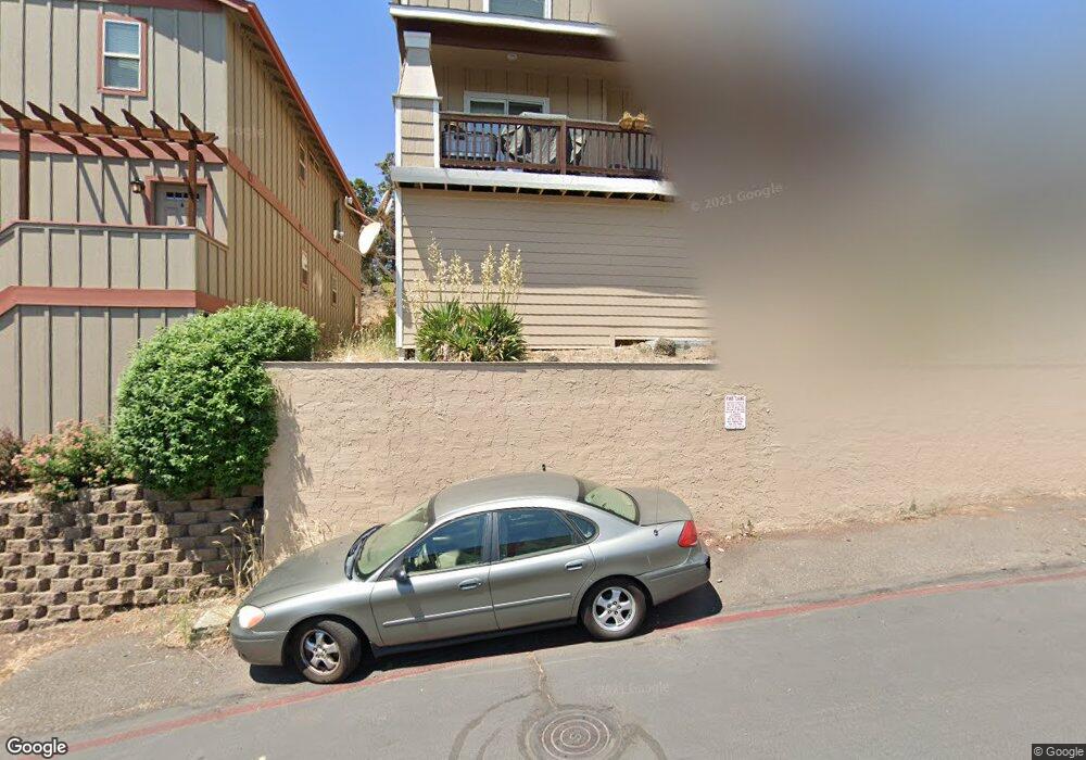
1723 NE Lotus Dr Bend, OR 97701
Mountain View NeighborhoodEstimated Value: $754,000 - $956,735
6
Beds
6
Baths
4,272
Sq Ft
$198/Sq Ft
Est. Value
About This Home
This home is located at 1723 NE Lotus Dr, Bend, OR 97701 and is currently estimated at $845,934, approximately $198 per square foot. 1723 NE Lotus Dr is a home located in Deschutes County with nearby schools including Juniper Elementary School, Bend Senior High School, and Eastmont Community School.
Ownership History
Date
Name
Owned For
Owner Type
Purchase Details
Closed on
Apr 20, 2011
Sold by
Wells Fargo Bank Na
Bought by
Osher James W and Osher Janice L
Current Estimated Value
Purchase Details
Closed on
Dec 10, 2010
Sold by
Young Steven A
Bought by
Wells Fargo Bank N A
Purchase Details
Closed on
Sep 13, 2007
Sold by
Young Steven A
Bought by
Young Enterprises Bend Llc
Create a Home Valuation Report for This Property
The Home Valuation Report is an in-depth analysis detailing your home's value as well as a comparison with similar homes in the area
Home Values in the Area
Average Home Value in this Area
Purchase History
| Date | Buyer | Sale Price | Title Company |
|---|---|---|---|
| Osher James W | $192,000 | Deschutes County Title Co | |
| Wells Fargo Bank N A | $205,917 | Amerititle | |
| Young Enterprises Bend Llc | -- | None Available |
Source: Public Records
Tax History Compared to Growth
Tax History
| Year | Tax Paid | Tax Assessment Tax Assessment Total Assessment is a certain percentage of the fair market value that is determined by local assessors to be the total taxable value of land and additions on the property. | Land | Improvement |
|---|---|---|---|---|
| 2025 | $7,026 | $415,810 | -- | -- |
| 2024 | $6,759 | $403,700 | -- | -- |
| 2023 | $6,266 | $391,950 | $0 | $0 |
| 2022 | $5,846 | $369,460 | $0 | $0 |
| 2021 | $5,855 | $358,700 | $0 | $0 |
| 2020 | $5,555 | $358,700 | $0 | $0 |
| 2019 | $5,400 | $348,260 | $0 | $0 |
| 2018 | $5,248 | $338,120 | $0 | $0 |
| 2017 | $5,094 | $328,280 | $0 | $0 |
| 2016 | $4,858 | $318,720 | $0 | $0 |
| 2015 | $4,723 | $309,440 | $0 | $0 |
| 2014 | $4,584 | $300,430 | $0 | $0 |
Source: Public Records
Map
Nearby Homes
- 1419 NE Lucinda Ct
- 1687 NE Lotus Dr
- 1767 NE Lotus Dr Unit 1 and 2
- 1072 NE Parkview Ct
- 1622 NE Parkridge Dr
- 1630 NE 13th St
- 1848 NE 14th St
- 1401 NE 10th St
- 2025 NE Neil Way
- 970 NE Norton Ave Unit Lot 7
- 2011 NE Neil Way
- 2026 NE Neil Way
- 1532 NE 9th St
- 940 NE Purcell Blvd
- 2101 NE Holliday Ave
- 1333 NE Dempsey Dr
- 940 NE Paula Dr Unit 21
- 2109 NE 11th Place
- 717 NE Olney Ct
- 2170 NE 8th St
- 1723 NE Lotus Dr Unit 1 & 2
- 1719 NE Lotus Dr
- 1727 NE Lotus Dr
- 1727 NE Lotus Dr Unit 1&2
- 1731 NE Lotus Dr
- 1731 NE Lotus Dr Unit A&B
- 1722 NE Lotus Dr
- 1515 NE Frank McClean Ct
- 1511 NE F J McClean Ct
- 1718 NE Lotus Dr
- 1736 NE Lotus Dr
- 1519 NE Frank McClean Ct
- 1737 NE Lotus Dr
- 1737 NE Lotus Dr Unit 1-2
- 1519 NE F J McClean Ct
- 1714 NE Lotus Dr
- 1742 NE Lotus Dr
- 1743 NE Lotus Dr
- 1523 NE F J McClean Ct