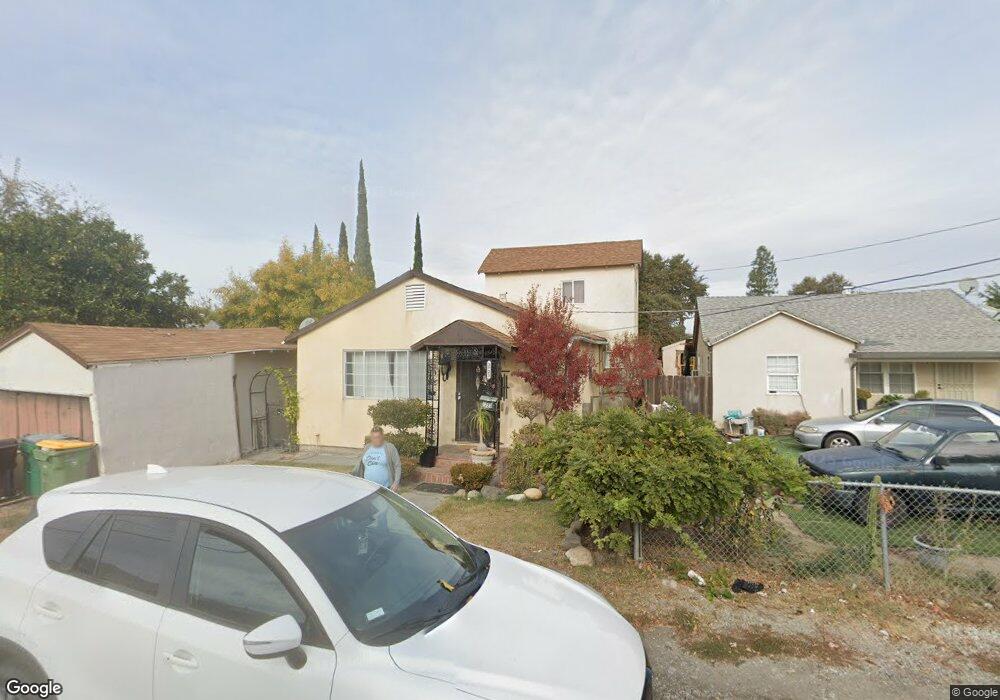
1723 Pinchot St Stockton, CA 95205
Downtown Stockton NeighborhoodEstimated Value: $191,000 - $350,000
2
Beds
1
Bath
978
Sq Ft
$293/Sq Ft
Est. Value
About This Home
This home is located at 1723 Pinchot St, Stockton, CA 95205 and is currently estimated at $286,953, approximately $293 per square foot. 1723 Pinchot St is a home located in San Joaquin County with nearby schools including Grunsky Elementary School, August Elementary School, and Harrison Elementary School.
Ownership History
Date
Name
Owned For
Owner Type
Purchase Details
Closed on
Dec 2, 1997
Sold by
Hanson Iona B and Case #67425
Bought by
Lopez Edward and Lopez Pamela
Current Estimated Value
Home Financials for this Owner
Home Financials are based on the most recent Mortgage that was taken out on this home.
Original Mortgage
$18,290
Outstanding Balance
$3,083
Interest Rate
7.19%
Estimated Equity
$283,870
Create a Home Valuation Report for This Property
The Home Valuation Report is an in-depth analysis detailing your home's value as well as a comparison with similar homes in the area
Home Values in the Area
Average Home Value in this Area
Purchase History
| Date | Buyer | Sale Price | Title Company |
|---|---|---|---|
| Lopez Edward | $29,000 | Alliance Title Company |
Source: Public Records
Mortgage History
| Date | Status | Borrower | Loan Amount |
|---|---|---|---|
| Open | Lopez Edward | $18,290 | |
| Closed | Lopez Edward | $13,500 |
Source: Public Records
Tax History Compared to Growth
Tax History
| Year | Tax Paid | Tax Assessment Tax Assessment Total Assessment is a certain percentage of the fair market value that is determined by local assessors to be the total taxable value of land and additions on the property. | Land | Improvement |
|---|---|---|---|---|
| 2025 | $982 | $84,616 | $19,156 | $65,460 |
| 2024 | $965 | $82,958 | $18,781 | $64,177 |
| 2023 | $942 | $81,332 | $18,413 | $62,919 |
| 2022 | $921 | $79,738 | $18,052 | $61,686 |
| 2021 | $884 | $78,176 | $17,699 | $60,477 |
| 2020 | $900 | $77,375 | $17,518 | $59,857 |
| 2019 | $894 | $75,859 | $17,175 | $58,684 |
| 2018 | $876 | $74,373 | $16,839 | $57,534 |
| 2017 | $829 | $72,915 | $16,509 | $56,406 |
| 2016 | $842 | $71,485 | $16,185 | $55,300 |
| 2014 | $800 | $69,033 | $15,630 | $53,403 |
Source: Public Records
Map
Nearby Homes
- 1257 Sunnyside Ave
- 1902 E Harding Way
- 1926 E Roosevelt St
- 1620 Sycamore Ave
- 1813 E Anita St
- 1600 Sunnyside Ave
- 1272 N Airport Way
- 1711 E Walnut St
- 1702 Sunnyside Ave
- 1751 Sunnyside Ave
- 1751 Sycamore Ave
- 1845 E Poplar St
- 1037 N Airport Way
- 1155 N Pilgrim St
- 1135 N Pilgrim St
- 1372 Bradford St
- 1804 E Flora St
- 1404 Williams St
- 1916 Vicki Ln
- 644 N Airport Way
- 1200 N Funston Ave
- 1206 N Funston Ave
- 1725 Pinchot St
- 1727 Pinchot St
- 1220 N Funston Ave
- 1736 Pinchot St
- 1722 Pinchot St
- 1741 Pinchot St
- 1230 N Funston Ave
- 1207 N Funston Ave
- 1225 Sycamore Ave
- 1738 Pinchot St
- 1740 Pinchot St
- 1720 E Willow St
- 1233 Sycamore Ave
- 1209 Sycamore Ave
- 1201 Sycamore Ave
- 1625 Pinchot St
- 1640 Pinchot St
- 1219 N Funston Ave