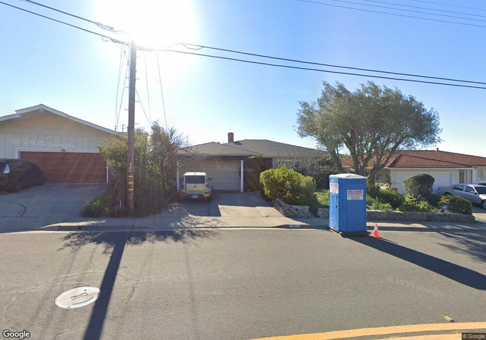
1723 Vistagrand Dr San Leandro, CA 94577
Bay-O-Vista NeighborhoodEstimated Value: $1,137,000 - $1,343,000
3
Beds
3
Baths
2,259
Sq Ft
$550/Sq Ft
Est. Value
About This Home
This home is located at 1723 Vistagrand Dr, San Leandro, CA 94577 and is currently estimated at $1,243,251, approximately $550 per square foot. 1723 Vistagrand Dr is a home located in Alameda County with nearby schools including Roosevelt Elementary School, Bancroft Middle School, and San Leandro High School.
Ownership History
Date
Name
Owned For
Owner Type
Purchase Details
Closed on
May 21, 2019
Sold by
Adelson Michael D and Adelson Amy G
Bought by
Adelson Michael D and Adelson Amy G
Current Estimated Value
Home Financials for this Owner
Home Financials are based on the most recent Mortgage that was taken out on this home.
Original Mortgage
$484,000
Outstanding Balance
$423,797
Interest Rate
4%
Mortgage Type
New Conventional
Estimated Equity
$819,455
Purchase Details
Closed on
Oct 14, 2014
Sold by
Adelson Michael D and Adelson Amy G
Bought by
The Michael & Amy Adelson Living Trust
Purchase Details
Closed on
May 24, 1996
Sold by
Edgar Wayne M and Edgar Lolita M
Bought by
Adelson Michael D and Adelson Amy G
Home Financials for this Owner
Home Financials are based on the most recent Mortgage that was taken out on this home.
Original Mortgage
$225,000
Interest Rate
8.3%
Create a Home Valuation Report for This Property
The Home Valuation Report is an in-depth analysis detailing your home's value as well as a comparison with similar homes in the area
Home Values in the Area
Average Home Value in this Area
Purchase History
| Date | Buyer | Sale Price | Title Company |
|---|---|---|---|
| Adelson Michael D | -- | Placer Title Company | |
| Adelson Michael D | -- | Placer Title Company | |
| The Michael & Amy Adelson Living Trust | -- | None Available | |
| Adelson Michael D | $300,000 | Placer Title Company |
Source: Public Records
Mortgage History
| Date | Status | Borrower | Loan Amount |
|---|---|---|---|
| Open | Adelson Michael D | $484,000 | |
| Previous Owner | Adelson Michael D | $225,000 |
Source: Public Records
Tax History Compared to Growth
Tax History
| Year | Tax Paid | Tax Assessment Tax Assessment Total Assessment is a certain percentage of the fair market value that is determined by local assessors to be the total taxable value of land and additions on the property. | Land | Improvement |
|---|---|---|---|---|
| 2025 | $6,718 | $481,576 | $130,287 | $358,289 |
| 2024 | $6,718 | $471,997 | $127,732 | $351,265 |
| 2023 | $6,652 | $469,607 | $125,228 | $344,379 |
| 2022 | $6,467 | $453,400 | $122,773 | $337,627 |
| 2021 | $6,253 | $444,373 | $120,366 | $331,007 |
| 2020 | $6,080 | $446,747 | $119,132 | $327,615 |
| 2019 | $5,904 | $437,990 | $116,797 | $321,193 |
| 2018 | $5,744 | $429,405 | $114,508 | $314,897 |
| 2017 | $5,643 | $420,986 | $112,263 | $308,723 |
| 2016 | $5,353 | $412,733 | $110,062 | $302,671 |
| 2015 | $5,259 | $406,535 | $108,409 | $298,126 |
| 2014 | $5,214 | $398,573 | $106,286 | $292,287 |
Source: Public Records
Map
Nearby Homes
- 14683 Midland Rd
- 2290 Upland Rd
- 1939 Placer Dr
- 2724 Benedict Dr
- 1293 Vistagrand Dr
- 0 Saturn Dr
- 2230 Sol St
- 14972 Lark St
- 2132 Longview Dr
- 14625 Bancroft Ave
- 14955 Lark St
- 2153 Lakeview Dr
- 1876 Benedict Dr
- 14850 Donna St
- 14101 E 14th St Unit 306
- 1253 139th Ave
- 1426 153rd Ave
- 15683 Liberty St
- 1468 Grand Ave Unit 9
- 1468 Grand Ave Unit 39
- 1737 Vistagrand Dr
- 1705 Vistagrand Dr
- 1749 Vistagrand Dr
- 2820 Darius Way
- 2816 Darius Way
- 2800 Darius Way
- 2828 Darius Way
- 1750 Vistagrand Dr
- 1689 Vistagrand Dr
- 1755 Vistagrand Dr
- 2780 Darius Way
- 2862 Darius Way
- 0 Darius Way Unit 40521325
- 0 Darius Way Unit 41085298
- 0 Darius Way Unit 41050979
- 1673 Vistagrand Dr
- 1761 Vistagrand Dr
- 2768 Darius Way
- 2873 Marineview Dr
- 2895 Marineview Dr