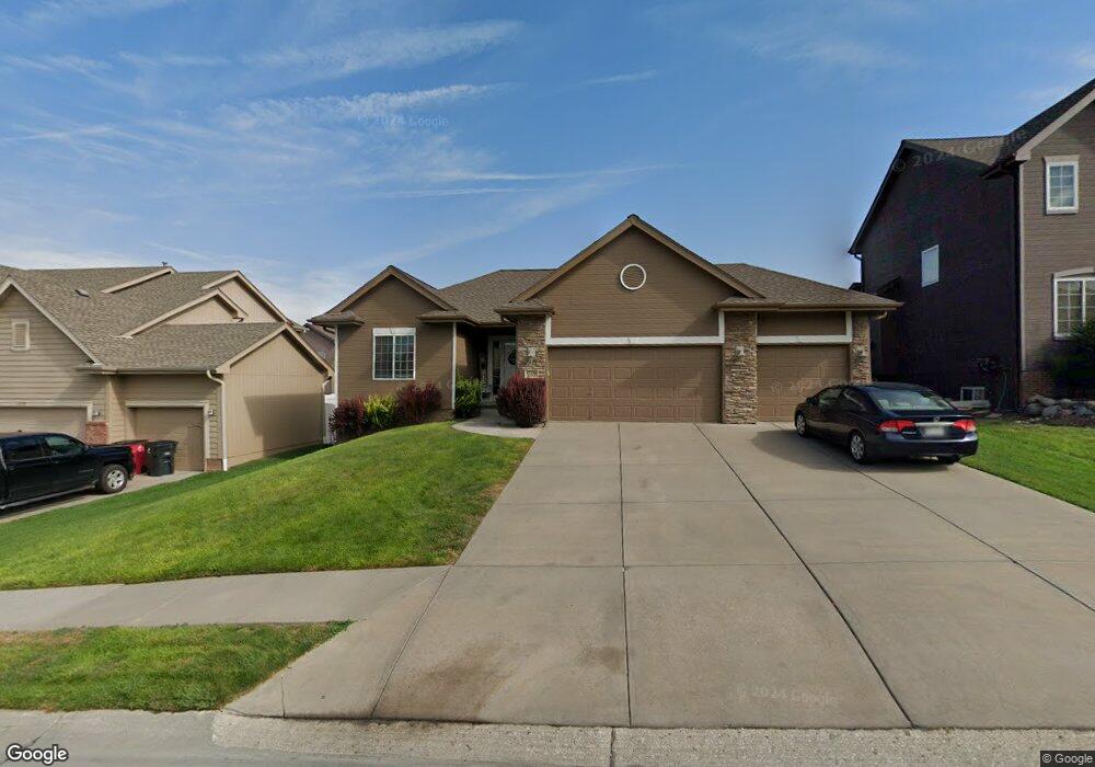
17234 Banner Dr Omaha, NE 68136
Southwest Omaha NeighborhoodEstimated Value: $332,553 - $386,000
3
Beds
2
Baths
1,357
Sq Ft
$266/Sq Ft
Est. Value
About This Home
This home is located at 17234 Banner Dr, Omaha, NE 68136 and is currently estimated at $361,388, approximately $266 per square foot. 17234 Banner Dr is a home located in Sarpy County with nearby schools including Palisades Elementary School, Gretna Middle School, and Gretna High School.
Ownership History
Date
Name
Owned For
Owner Type
Purchase Details
Closed on
Jun 28, 2011
Sold by
Avila Leinen Risa Rae
Bought by
Leinen Brian Lawrence
Current Estimated Value
Purchase Details
Closed on
Nov 9, 2006
Sold by
Timberline Homes Inc
Bought by
Leinen Brian L and Avila Risa R
Home Financials for this Owner
Home Financials are based on the most recent Mortgage that was taken out on this home.
Original Mortgage
$28,050
Outstanding Balance
$3,205
Interest Rate
8.37%
Estimated Equity
$358,183
Purchase Details
Closed on
Jul 31, 2006
Sold by
Palisades Development Llc
Bought by
Timberline Homes Inc
Home Financials for this Owner
Home Financials are based on the most recent Mortgage that was taken out on this home.
Original Mortgage
$149,700
Interest Rate
6.66%
Create a Home Valuation Report for This Property
The Home Valuation Report is an in-depth analysis detailing your home's value as well as a comparison with similar homes in the area
Home Values in the Area
Average Home Value in this Area
Purchase History
| Date | Buyer | Sale Price | Title Company |
|---|---|---|---|
| Leinen Brian Lawrence | -- | None Available | |
| Leinen Brian L | $188,000 | Btc | |
| Timberline Homes Inc | $25,000 | Btc |
Source: Public Records
Mortgage History
| Date | Status | Borrower | Loan Amount |
|---|---|---|---|
| Open | Leinen Brian L | $28,050 | |
| Previous Owner | Timberline Homes Inc | $149,700 |
Source: Public Records
Tax History Compared to Growth
Tax History
| Year | Tax Paid | Tax Assessment Tax Assessment Total Assessment is a certain percentage of the fair market value that is determined by local assessors to be the total taxable value of land and additions on the property. | Land | Improvement |
|---|---|---|---|---|
| 2025 | $5,347 | $287,983 | $60,000 | $227,983 |
| 2024 | $5,768 | $276,915 | $50,000 | $226,915 |
| 2023 | $5,768 | $249,624 | $45,000 | $204,624 |
| 2022 | $5,038 | $214,404 | $40,000 | $174,404 |
| 2021 | $4,788 | $207,100 | $40,000 | $167,100 |
| 2020 | $4,541 | $197,342 | $34,000 | $163,342 |
| 2019 | $4,471 | $194,758 | $34,000 | $160,758 |
| 2018 | $4,476 | $185,476 | $30,000 | $155,476 |
| 2017 | $4,470 | $177,524 | $30,000 | $147,524 |
| 2016 | $4,367 | $169,446 | $30,000 | $139,446 |
| 2015 | $4,250 | $165,903 | $30,000 | $135,903 |
| 2014 | $4,126 | $157,214 | $23,000 | $134,214 |
| 2012 | -- | $160,516 | $23,000 | $137,516 |
Source: Public Records
Map
Nearby Homes
- 17221 Musket St
- 17110 Palisades Dr
- TBD Redwood St
- Lot 143 Garden Oaks
- 17609 Musket St
- 17025 Centennial Rd
- 17107 Chutney Dr
- 17125 Colony Dr
- 9711 S 176th St
- 16812 Colony Cir
- TBD Lot 297
- TBD Augsuta Cir
- Lot 51 Cheyenne Ridge
- 9902 S 173rd Cir
- 9307 S 177th St
- 9930 S 172nd Cir
- 9805 S 176th St
- 17130 Cypress St
- 17703 Palisades Dr
- 17758 Greenfield St
- 17234 Banner
- 17230 Banner St
- 17238 Banner St
- 17238 Banner Dr
- 17230 Banner Dr
- 17229 Musket St
- 17226 Banner St
- 17233 Musket St
- 17226 Banner Dr
- 17225 Musket St
- 17242 Banner Dr
- 17242 Banner St
- 17237 Musket St
- 17237 Banner St
- 17241 Banner St
- 17222 Banner St
- 17222 Banner Dr
- 17245 Banner Dr
- 17229 Banner St
- 17246 Banner Dr