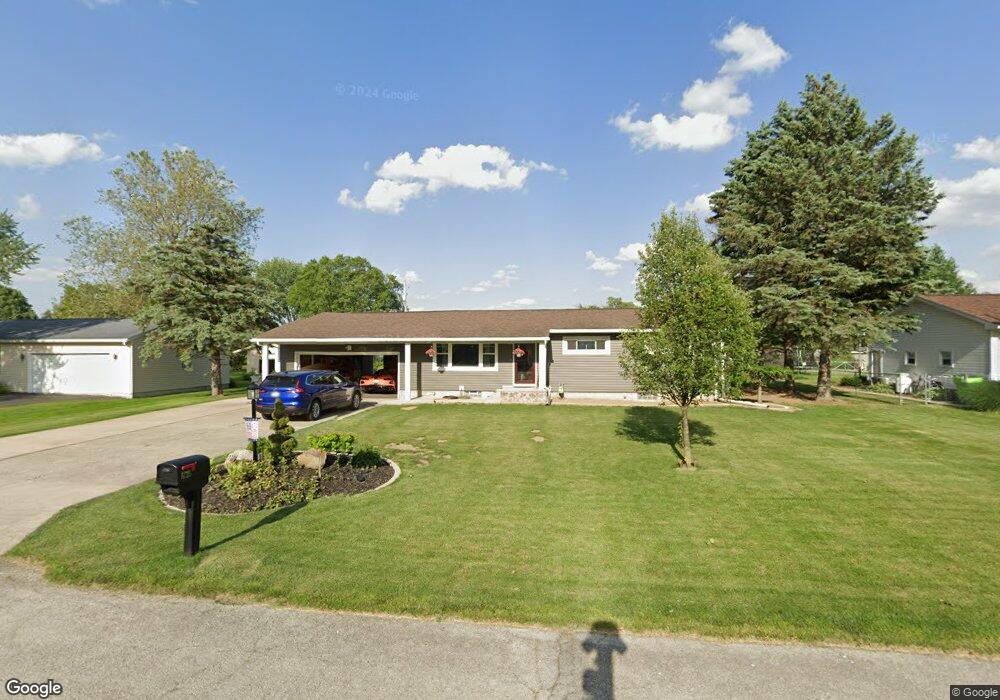
1725 Maple Ln Fremont, OH 43420
Estimated Value: $201,000 - $225,000
3
Beds
2
Baths
1,232
Sq Ft
$176/Sq Ft
Est. Value
About This Home
This home is located at 1725 Maple Ln, Fremont, OH 43420 and is currently estimated at $216,290, approximately $175 per square foot. 1725 Maple Ln is a home located in Sandusky County with nearby schools including Fremont Ross High School, Bishop Hoffman Catholic School - This is St Joe's School now, and St. Joseph School.
Ownership History
Date
Name
Owned For
Owner Type
Purchase Details
Closed on
Oct 20, 2008
Sold by
Hoffman Laurie
Bought by
Hoffman Daniel
Current Estimated Value
Purchase Details
Closed on
Jul 26, 1996
Sold by
Borden Brent R
Bought by
Hoffman Daniel M
Home Financials for this Owner
Home Financials are based on the most recent Mortgage that was taken out on this home.
Original Mortgage
$64,000
Interest Rate
8.43%
Mortgage Type
New Conventional
Create a Home Valuation Report for This Property
The Home Valuation Report is an in-depth analysis detailing your home's value as well as a comparison with similar homes in the area
Home Values in the Area
Average Home Value in this Area
Purchase History
| Date | Buyer | Sale Price | Title Company |
|---|---|---|---|
| Hoffman Daniel | -- | Attorney | |
| Hoffman Daniel M | $89,000 | -- |
Source: Public Records
Mortgage History
| Date | Status | Borrower | Loan Amount |
|---|---|---|---|
| Previous Owner | Hoffman Daniel M | $64,000 |
Source: Public Records
Tax History Compared to Growth
Tax History
| Year | Tax Paid | Tax Assessment Tax Assessment Total Assessment is a certain percentage of the fair market value that is determined by local assessors to be the total taxable value of land and additions on the property. | Land | Improvement |
|---|---|---|---|---|
| 2024 | $2,656 | $66,090 | $12,920 | $53,170 |
| 2023 | $2,656 | $46,200 | $9,030 | $37,170 |
| 2022 | $1,990 | $46,200 | $9,030 | $37,170 |
| 2021 | $2,048 | $46,200 | $9,030 | $37,170 |
| 2020 | $1,844 | $40,710 | $9,030 | $31,680 |
| 2019 | $1,842 | $40,710 | $9,030 | $31,680 |
| 2018 | $1,849 | $40,710 | $9,030 | $31,680 |
| 2017 | $1,610 | $36,580 | $9,030 | $27,550 |
| 2016 | $1,396 | $36,020 | $9,030 | $26,990 |
| 2015 | $1,363 | $36,020 | $9,030 | $26,990 |
| 2014 | $1,368 | $34,620 | $8,650 | $25,970 |
| 2013 | $1,238 | $32,000 | $8,650 | $23,350 |
Source: Public Records
Map
Nearby Homes
- 1818 Finley Dr
- 135 Briarwood Cir
- 350 Conner Dr
- 1832 Myrtle St
- 1970 Morrison Rd
- 64 River Run Dr Unit J
- 10 Meadowbrook Ln
- 10 Meadowbrook Dr
- 1420 Center St
- 933 E Cole Rd
- 18 Katlyn Dr
- 1013 Whittlesey St
- 905 Twinn St
- 1485 Autumn Woods Dr
- 625 Bush Place
- 1028 June St
- 815 South St
- 1719 Buckland Ave
- 616 S Wood St
- 619 Hayes Ave