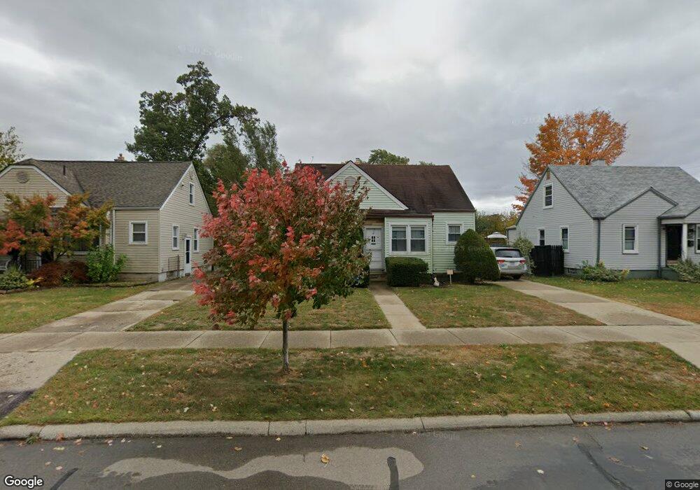
1725 Pearson St Ferndale, MI 48220
Estimated Value: $243,983 - $308,000
3
Beds
2
Baths
968
Sq Ft
$289/Sq Ft
Est. Value
About This Home
This home is located at 1725 Pearson St, Ferndale, MI 48220 and is currently estimated at $279,746, approximately $288 per square foot. 1725 Pearson St is a home located in Oakland County with nearby schools including Ferndale Upper Elementary Campus, Ferndale Lower Elementary Campus, and Ferndale Middle School.
Ownership History
Date
Name
Owned For
Owner Type
Purchase Details
Closed on
Mar 27, 2025
Sold by
Price Frances C
Bought by
1725 Pearson House Trust and Price
Current Estimated Value
Purchase Details
Closed on
Aug 21, 2022
Sold by
Price Frances C
Bought by
Price Frances C and Price Russell
Purchase Details
Closed on
Sep 10, 2003
Sold by
Price John M and Estate Of Cleo I Lybarger
Bought by
Price John M
Create a Home Valuation Report for This Property
The Home Valuation Report is an in-depth analysis detailing your home's value as well as a comparison with similar homes in the area
Home Values in the Area
Average Home Value in this Area
Purchase History
| Date | Buyer | Sale Price | Title Company |
|---|---|---|---|
| 1725 Pearson House Trust | -- | None Listed On Document | |
| 1725 Pearson House Trust | -- | None Listed On Document | |
| Price Frances C | -- | None Listed On Document | |
| Price John M | -- | Alpha Title Agency Inc |
Source: Public Records
Tax History
| Year | Tax Paid | Tax Assessment Tax Assessment Total Assessment is a certain percentage of the fair market value that is determined by local assessors to be the total taxable value of land and additions on the property. | Land | Improvement |
|---|---|---|---|---|
| 2025 | $2,947 | $121,170 | $0 | $0 |
| 2024 | $2,838 | $116,660 | $0 | $0 |
| 2023 | $2,746 | $108,170 | $0 | $0 |
| 2022 | $2,749 | $97,960 | $0 | $0 |
| 2021 | $2,765 | $88,900 | $0 | $0 |
| 2020 | $2,627 | $81,960 | $0 | $0 |
| 2019 | $2,666 | $75,480 | $0 | $0 |
| 2018 | $2,674 | $66,860 | $0 | $0 |
| 2017 | $2,640 | $65,820 | $0 | $0 |
| 2016 | $2,607 | $61,830 | $0 | $0 |
| 2015 | -- | $57,690 | $0 | $0 |
| 2014 | -- | $51,670 | $0 | $0 |
| 2011 | -- | $52,190 | $0 | $0 |
Source: Public Records
Map
Nearby Homes
- 21433 Bethlawn Blvd
- 21395 Westview Ave
- 21356 Westview Ave
- 21392 Bethlawn Blvd
- 21341 Reimanville Ave
- 8610 Saratoga St
- 21415 Woodside Ave
- 1636 W Troy St
- 8104 Cloverdale Ave
- 10040 Albany St
- 10101 Albany St
- 10111 Albany St
- 23041 Roanoke Ave
- 1169 W Marshall St
- 21036 Westview Ave
- 21078 Mitchelldale Ave
- 21056 Woodside Ave
- 10111 Troy St
- 21025 Glen Lodge Rd
- 1915 Central St
- 1705 Pearson St
- 1737 Pearson St
- 1716 W Hazelhurst St
- 1697 Pearson St
- 1726 W Hazelhurst St
- 1706 W Hazelhurst St
- 1736 W Hazelhurst St
- 1696 W Hazelhurst St
- 1687 Pearson St
- 1716 Pearson St
- 1726 Pearson St
- 1706 Pearson St
- 1677 Pearson St Unit Bldg-Unit
- 1677 Pearson St
- 1696 Pearson St
- 1678 W Hazelhurst St
- 1686 Pearson St
- 8515 Capital St
- 1668 W Hazelhurst St
- 1667 Pearson St
Your Personal Tour Guide
Ask me questions while you tour the home.