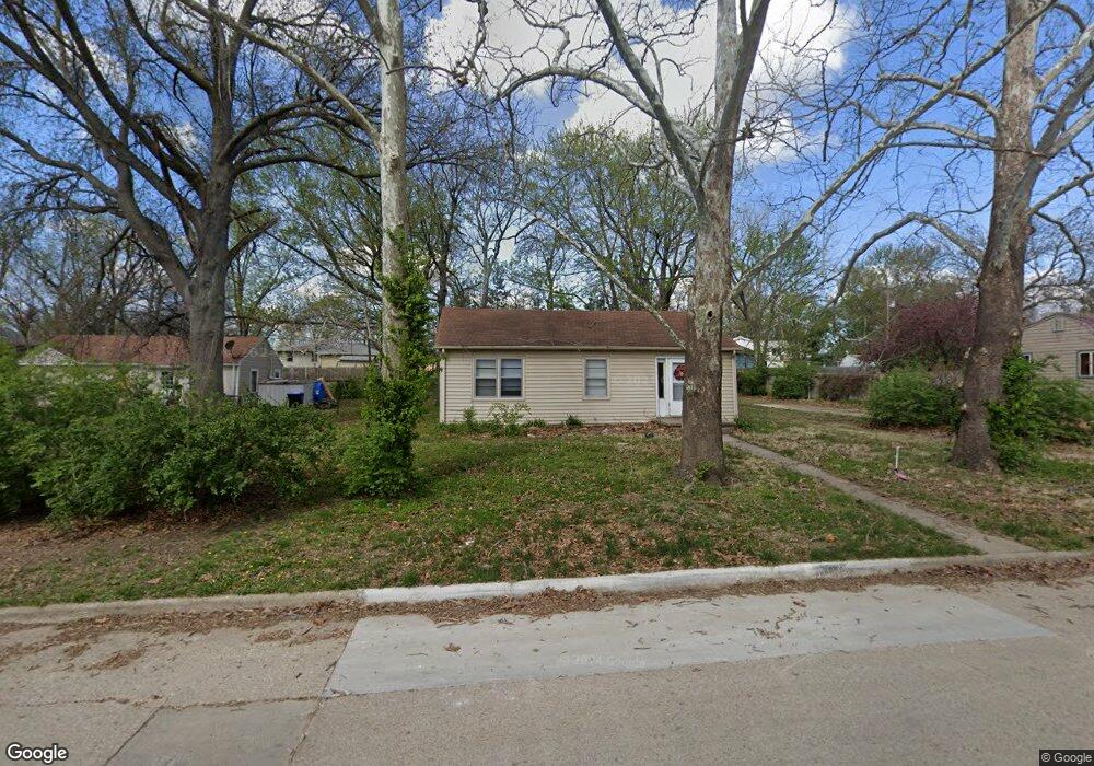
1725 SW Sims Ave Topeka, KS 66604
West Topeka NeighborhoodEstimated Value: $90,000 - $124,413
3
Beds
1
Bath
876
Sq Ft
$118/Sq Ft
Est. Value
About This Home
This home is located at 1725 SW Sims Ave, Topeka, KS 66604 and is currently estimated at $103,103, approximately $117 per square foot. 1725 SW Sims Ave is a home located in Shawnee County with nearby schools including McCarter Elementary School, Marjorie French Middle School, and Topeka West High School.
Ownership History
Date
Name
Owned For
Owner Type
Purchase Details
Closed on
May 5, 2011
Sold by
Federal Home Loan Mortgage Corporation
Bought by
Vanhouse Daniel W
Current Estimated Value
Purchase Details
Closed on
Jan 13, 2011
Sold by
Gray Trevor L and Gray Ashley K
Bought by
Federal Home Loan Mortgage Corp
Purchase Details
Closed on
Oct 4, 2007
Sold by
Gray Trevor L and Gray Ashley K
Bought by
Gray Trevor L and Gray Ashley K
Home Financials for this Owner
Home Financials are based on the most recent Mortgage that was taken out on this home.
Original Mortgage
$110,600
Interest Rate
6.47%
Mortgage Type
Future Advance Clause Open End Mortgage
Create a Home Valuation Report for This Property
The Home Valuation Report is an in-depth analysis detailing your home's value as well as a comparison with similar homes in the area
Home Values in the Area
Average Home Value in this Area
Purchase History
| Date | Buyer | Sale Price | Title Company |
|---|---|---|---|
| Vanhouse Daniel W | $35,000 | Servicelink | |
| Federal Home Loan Mortgage Corp | $58,775 | Continental Title | |
| Gray Trevor L | -- | Kansas Secured Title |
Source: Public Records
Mortgage History
| Date | Status | Borrower | Loan Amount |
|---|---|---|---|
| Previous Owner | Gray Trevor L | $110,600 |
Source: Public Records
Tax History Compared to Growth
Tax History
| Year | Tax Paid | Tax Assessment Tax Assessment Total Assessment is a certain percentage of the fair market value that is determined by local assessors to be the total taxable value of land and additions on the property. | Land | Improvement |
|---|---|---|---|---|
| 2025 | $1,197 | $9,379 | -- | -- |
| 2023 | $1,197 | $8,594 | $0 | $0 |
| 2022 | $1,063 | $7,472 | $0 | $0 |
| 2021 | $994 | $6,497 | $0 | $0 |
| 2020 | $1,030 | $6,795 | $0 | $0 |
| 2019 | $1,015 | $6,662 | $0 | $0 |
| 2018 | $985 | $6,467 | $0 | $0 |
| 2017 | $957 | $6,279 | $0 | $0 |
| 2014 | $1,036 | $6,704 | $0 | $0 |
Source: Public Records
Map
Nearby Homes
- 1728 SW Fairlawn Rd
- 1944 SW Quivira Dr
- 2124 SW Meadow Ln
- 4221 SW 17th St
- 4230 SW 19th St
- 1421 SW Mcalister Ave
- 1274 SW Indian Trail Ct
- 4200 SW Stratford Rd
- 5518 SW Avalon Ln
- 1906 SW Village Dr
- 4401 SW Connemara Ln
- 4405 SW Connemara Ln
- 5618 SW 14th St
- 3900 SW Holly Ln
- 2401 SW Crest Dr
- 5802 SW Sterling Ln
- 1306 SW Glendale Dr
- 3636 SW Stratford Rd
- 5452 SW 12th Terrace Unit 3
- 2401 SW James St
- 1721 SW Sims Ave
- 1729 SW Sims Ave
- 1720 SW Prairie Rd
- 1719 SW Sims Ave
- 1728 SW Prairie Rd
- 1724 SW Prairie Rd
- 1726 SW Sims Ave
- 4775 SW 17th Terrace
- 4840 SW 18th St
- 1730 SW Prairie Rd
- 5000 SW 17th Terrace
- 1715 SW Sims Ave
- 1801 SW Sims Ave
- 1800 SW Prairie Rd
- 4771 SW 17th Terrace
- 1802 SW Sims Ave
- 5004 SW 17th Terrace
- 4836 SW 18th St
- 4836 SW 18th St Unit HUD 181-202951
- 4805 SW 17th St