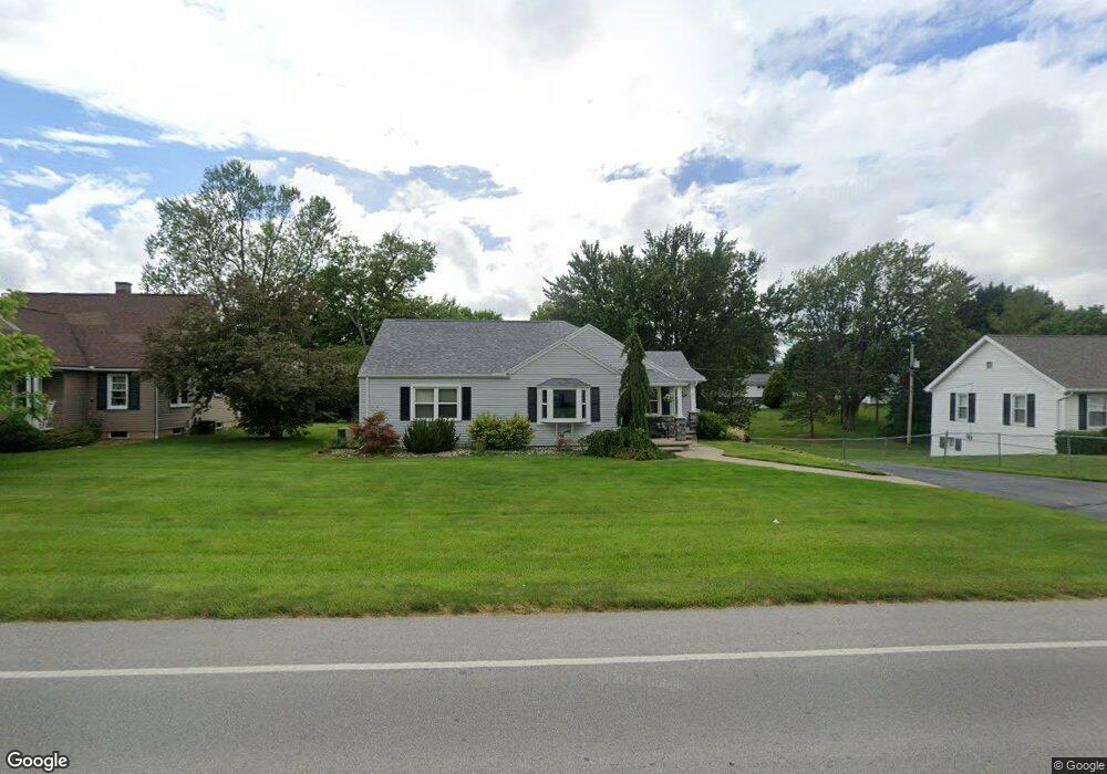
1726 Tiffin Rd Fremont, OH 43420
Estimated Value: $225,000 - $250,000
3
Beds
3
Baths
1,644
Sq Ft
$146/Sq Ft
Est. Value
About This Home
This home is located at 1726 Tiffin Rd, Fremont, OH 43420 and is currently estimated at $239,979, approximately $145 per square foot. 1726 Tiffin Rd is a home located in Sandusky County with nearby schools including Fremont Ross High School, St. Joseph School, and St. Ann Catholic School.
Ownership History
Date
Name
Owned For
Owner Type
Purchase Details
Closed on
Oct 29, 1998
Sold by
Heminger Gerald A
Bought by
Greiner Rickie S and Greiner Debra J
Current Estimated Value
Home Financials for this Owner
Home Financials are based on the most recent Mortgage that was taken out on this home.
Original Mortgage
$103,000
Outstanding Balance
$25,397
Interest Rate
8.05%
Mortgage Type
New Conventional
Estimated Equity
$214,582
Purchase Details
Closed on
Oct 13, 1995
Sold by
Gebauer Jerry L
Bought by
Heminger Gerald A
Home Financials for this Owner
Home Financials are based on the most recent Mortgage that was taken out on this home.
Original Mortgage
$78,000
Interest Rate
7.8%
Mortgage Type
New Conventional
Create a Home Valuation Report for This Property
The Home Valuation Report is an in-depth analysis detailing your home's value as well as a comparison with similar homes in the area
Home Values in the Area
Average Home Value in this Area
Purchase History
| Date | Buyer | Sale Price | Title Company |
|---|---|---|---|
| Greiner Rickie S | $129,000 | -- | |
| Heminger Gerald A | $103,000 | -- |
Source: Public Records
Mortgage History
| Date | Status | Borrower | Loan Amount |
|---|---|---|---|
| Open | Greiner Rickie S | $103,000 | |
| Previous Owner | Heminger Gerald A | $78,000 |
Source: Public Records
Tax History Compared to Growth
Tax History
| Year | Tax Paid | Tax Assessment Tax Assessment Total Assessment is a certain percentage of the fair market value that is determined by local assessors to be the total taxable value of land and additions on the property. | Land | Improvement |
|---|---|---|---|---|
| 2024 | $2,716 | $69,480 | $11,270 | $58,210 |
| 2023 | $2,716 | $48,590 | $7,880 | $40,710 |
| 2022 | $2,032 | $48,590 | $7,880 | $40,710 |
| 2021 | $2,093 | $48,590 | $7,880 | $40,710 |
| 2020 | $2,032 | $46,240 | $7,880 | $38,360 |
| 2019 | $2,030 | $46,240 | $7,880 | $38,360 |
| 2018 | $1,973 | $46,240 | $7,880 | $38,360 |
| 2017 | $1,766 | $41,240 | $7,880 | $33,360 |
| 2016 | $1,543 | $41,240 | $7,880 | $33,360 |
| 2015 | $1,518 | $41,240 | $7,880 | $33,360 |
| 2014 | $1,708 | $44,450 | $7,840 | $36,610 |
| 2013 | $1,672 | $44,450 | $7,840 | $36,610 |
Source: Public Records
Map
Nearby Homes
- 10 Meadowbrook Dr
- 10 Meadowbrook Ln
- 64 River Run Dr Unit J
- 1420 Center St
- 135 Briarwood Cir
- 350 Conner Dr
- 1818 Finley Dr
- 1970 Morrison Rd
- 1832 Myrtle St
- 1485 Autumn Woods Dr
- 1719 Buckland Ave
- 1013 Whittlesey St
- 905 Twinn St
- 933 E Cole Rd
- 18 Katlyn Dr
- 1028 June St
- 2484 Buckland Ave
- 625 Bush Place
- 815 South St
- 616 S Wood St
- 1732 Tiffin Rd
- 1720 Tiffin Rd
- 1738 Tiffin Rd
- 1712 Tiffin Rd
- 1445 Chieftain Cir
- 1725 Tiffin Rd
- 1733 Tiffin Rd
- 1721 Tiffin Rd
- 1741 Tiffin Rd
- 1713 Tiffin Rd
- 1435 Chieftain Cir
- 1704 Tiffin Rd
- 1451 Chieftain Cir
- 1747 Tiffin Rd
- 1709 Tiffin Rd
- 1428 W Cole Rd
- 1703 Tiffin Rd
- 1432 Chieftain Cir
- 1457 Chieftain Cir
- 1648 Tiffin Rd