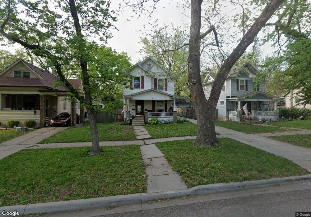
1726 W 1st Ave Topeka, KS 66606
Greater Auburndale NeighborhoodEstimated Value: $149,000 - $211,000
4
Beds
2
Baths
1,568
Sq Ft
$109/Sq Ft
Est. Value
About This Home
This home is located at 1726 W 1st Ave, Topeka, KS 66606 and is currently estimated at $171,679, approximately $109 per square foot. 1726 W 1st Ave is a home located in Shawnee County with nearby schools including Rosenwald Elementary School, Martin Park Elementary School, and Meadows Elementary School.
Ownership History
Date
Name
Owned For
Owner Type
Purchase Details
Closed on
Jan 22, 2014
Sold by
Engstrom Josiah J and Engstrom Andrea D
Bought by
Zipperle Cory S and Zipperle Shelly A
Current Estimated Value
Home Financials for this Owner
Home Financials are based on the most recent Mortgage that was taken out on this home.
Original Mortgage
$89,680
Outstanding Balance
$67,911
Interest Rate
4.47%
Mortgage Type
New Conventional
Estimated Equity
$103,768
Purchase Details
Closed on
Nov 10, 2010
Sold by
Hare Teresa Ann and Hare Stephen Rutherford
Bought by
Engstrom Josiah J and Engstrom Andrea D
Home Financials for this Owner
Home Financials are based on the most recent Mortgage that was taken out on this home.
Original Mortgage
$82,389
Interest Rate
4.17%
Mortgage Type
FHA
Create a Home Valuation Report for This Property
The Home Valuation Report is an in-depth analysis detailing your home's value as well as a comparison with similar homes in the area
Home Values in the Area
Average Home Value in this Area
Purchase History
| Date | Buyer | Sale Price | Title Company |
|---|---|---|---|
| Zipperle Cory S | -- | First American Title | |
| Engstrom Josiah J | -- | First American Title |
Source: Public Records
Mortgage History
| Date | Status | Borrower | Loan Amount |
|---|---|---|---|
| Open | Zipperle Cory S | $89,680 | |
| Previous Owner | Engstrom Josiah J | $82,389 |
Source: Public Records
Tax History Compared to Growth
Tax History
| Year | Tax Paid | Tax Assessment Tax Assessment Total Assessment is a certain percentage of the fair market value that is determined by local assessors to be the total taxable value of land and additions on the property. | Land | Improvement |
|---|---|---|---|---|
| 2025 | $2,116 | $15,829 | -- | -- |
| 2023 | $2,116 | $14,363 | $0 | $0 |
| 2022 | $1,839 | $12,490 | $0 | $0 |
| 2021 | $1,692 | $10,860 | $0 | $0 |
| 2020 | $1,592 | $10,343 | $0 | $0 |
| 2019 | $1,569 | $10,140 | $0 | $0 |
| 2018 | $1,524 | $9,845 | $0 | $0 |
| 2017 | $1,527 | $9,845 | $0 | $0 |
| 2014 | $1,608 | $10,255 | $0 | $0 |
Source: Public Records
Map
Nearby Homes
- 0000 SW Elmwood Ave Unit Lots 5,6 Laurel Park
- 312 SW Elmwood Ave
- 1830 SW Willow Ave
- 200 SW Orchard St
- 136 NW Quinton Ave
- 433 SW Lincoln St
- 208 SW MacVicar Ave
- 700 SW Roosevelt St
- 326 SW Quinton Ave
- 734 SW Lindenwood Ave
- 131 SW Clay St
- 511 SW Buchanan St
- 2235 SW Kenilworth Ct
- 808 SW Lindenwood Ave
- 306 SW Clay St
- 223 SW Fillmore St
- 634 SW Lincoln St
- 216 SW Fillmore St
- 731 SW Lincoln St
- 711 SW Buchanan St
- 1730 W 1st Ave
- 1712 W 1st Ave
- 108 NW Elmwood Ave
- 1734 W 1st Ave
- 1710 W 1st Ave
- 114 NW Elmwood Ave
- 1708 W 1st Ave
- 116 NW Elmwood Ave
- 120 NW Elmwood Ave
- 1711 W 1st Ave
- 127 SW Woodlawn Ave
- 135 SW Woodlawn Ave
- 124 NW Elmwood Ave
- 133 SW Woodlawn Ave
- 125 SW Woodlawn Ave
- 131 SW Woodlawn Ave
- 107 NW Elmwood Ave
- 201 SW Woodlawn Ave
- 111 NW Elmwood Ave
- 126 NW Elmwood Ave