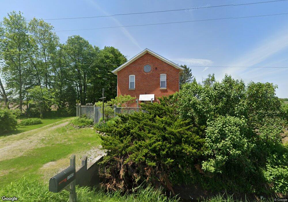
17265 Weston Rd Grand Rapids, OH 43522
Estimated Value: $210,000 - $281,000
1
Bed
1
Bath
2,600
Sq Ft
$90/Sq Ft
Est. Value
About This Home
This home is located at 17265 Weston Rd, Grand Rapids, OH 43522 and is currently estimated at $233,681, approximately $89 per square foot. 17265 Weston Rd is a home located in Wood County with nearby schools including Otsego Elementary School, Otsego Junior High School, and Otsego High School.
Ownership History
Date
Name
Owned For
Owner Type
Purchase Details
Closed on
Jun 23, 1999
Sold by
Horn Scott
Bought by
Svendsen Jens A and Guldbeck Mille
Current Estimated Value
Home Financials for this Owner
Home Financials are based on the most recent Mortgage that was taken out on this home.
Original Mortgage
$112,400
Outstanding Balance
$29,815
Interest Rate
7.12%
Estimated Equity
$203,866
Purchase Details
Closed on
Apr 3, 1996
Sold by
Churchill David
Bought by
Horn Scott H
Home Financials for this Owner
Home Financials are based on the most recent Mortgage that was taken out on this home.
Original Mortgage
$35,000
Interest Rate
7.36%
Mortgage Type
New Conventional
Purchase Details
Closed on
Jul 8, 1987
Bought by
Churchill David
Create a Home Valuation Report for This Property
The Home Valuation Report is an in-depth analysis detailing your home's value as well as a comparison with similar homes in the area
Home Values in the Area
Average Home Value in this Area
Purchase History
| Date | Buyer | Sale Price | Title Company |
|---|---|---|---|
| Svendsen Jens A | $124,900 | -- | |
| Horn Scott H | $45,000 | -- | |
| Churchill David | $17,900 | -- |
Source: Public Records
Mortgage History
| Date | Status | Borrower | Loan Amount |
|---|---|---|---|
| Open | Svendsen Jens A | $112,400 | |
| Previous Owner | Horn Scott H | $35,000 |
Source: Public Records
Tax History Compared to Growth
Tax History
| Year | Tax Paid | Tax Assessment Tax Assessment Total Assessment is a certain percentage of the fair market value that is determined by local assessors to be the total taxable value of land and additions on the property. | Land | Improvement |
|---|---|---|---|---|
| 2024 | $2,307 | $52,675 | $7,875 | $44,800 |
| 2023 | $2,307 | $52,680 | $7,880 | $44,800 |
| 2021 | $2,327 | $48,060 | $7,880 | $40,180 |
| 2020 | $2,332 | $48,060 | $7,880 | $40,180 |
| 2019 | $2,001 | $40,010 | $7,880 | $32,130 |
| 2018 | $1,995 | $40,010 | $7,880 | $32,130 |
| 2017 | $1,886 | $40,010 | $7,880 | $32,130 |
| 2016 | $1,752 | $36,820 | $7,350 | $29,470 |
| 2015 | $1,752 | $36,820 | $7,350 | $29,470 |
| 2014 | $1,726 | $36,820 | $7,350 | $29,470 |
| 2013 | $1,880 | $36,820 | $7,350 | $29,470 |
Source: Public Records
Map
Nearby Homes
- 22888 Wintergreen Rd
- 19330 Tuller Rd
- 0 Kellogg Rd Unit 6125521
- 15255 Van Tassel Rd
- 0 Manore Lot A Rd Unit 6130402
- 0 Manore Lot B Rd Unit 6130403
- 0 Otsego Pike Unit 6136991
- 15722 Range Line Rd
- 17630 Woodburn Ave
- 22327 U S 6
- 0 Scott Rd
- 23763 Front St
- 19393 U S 6
- 23912 E 2nd St
- 16710 Potter Rd
- 0 W River Rd Unit 10000155
- 20553 Euler Rd
- 24432 W 3rd St
- 18735 Main St
- 0 Wall St
- 17355 Weston Rd
- 17372 Weston Rd
- 21010 Long Judson Rd
- 17484 Weston Rd
- 21050 Long Judson Rd
- 21100 Long Judson Rd
- 20985 Long Judson Rd
- 17550 Weston Rd
- 21305 Long Judson Rd
- 17672 Weston Rd
- 20580 Long Judson Rd
- 21415 Long Judson Rd
- 17060 Armbruster Rd
- 0 Armbruster Rd
- 20460 Long Judson Rd
- 17780 Armbruster Rd
- 16601 Weston Rd
- 17852 Armbruster Rd
- 20745 Kellogg Rd
- 20362 Long Judson Rd