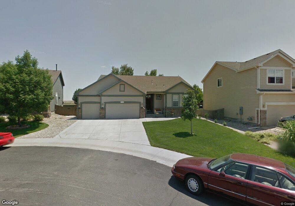
1727 Green Wing Dr Johnstown, CO 80534
Estimated Value: $560,886 - $661,000
5
Beds
3
Baths
2,190
Sq Ft
$275/Sq Ft
Est. Value
About This Home
This home is located at 1727 Green Wing Dr, Johnstown, CO 80534 and is currently estimated at $602,472, approximately $275 per square foot. 1727 Green Wing Dr is a home located in Weld County with nearby schools including Pioneer Ridge Elementary School, Milliken Middle School, and Roosevelt High School.
Ownership History
Date
Name
Owned For
Owner Type
Purchase Details
Closed on
Dec 1, 2022
Sold by
Bell Debra J
Bought by
Bell Debra J and Bell Gregory J
Current Estimated Value
Purchase Details
Closed on
Aug 22, 2003
Sold by
The Ryland Group Inc
Bought by
Bell Douglas P and Bell Debra J
Home Financials for this Owner
Home Financials are based on the most recent Mortgage that was taken out on this home.
Original Mortgage
$93,000
Interest Rate
5.51%
Mortgage Type
Unknown
Create a Home Valuation Report for This Property
The Home Valuation Report is an in-depth analysis detailing your home's value as well as a comparison with similar homes in the area
Home Values in the Area
Average Home Value in this Area
Purchase History
| Date | Buyer | Sale Price | Title Company |
|---|---|---|---|
| Bell Debra J | -- | -- | |
| Bell Douglas P | $264,032 | Ryland Title Company |
Source: Public Records
Mortgage History
| Date | Status | Borrower | Loan Amount |
|---|---|---|---|
| Previous Owner | Bell Douglas P | $93,000 |
Source: Public Records
Tax History Compared to Growth
Tax History
| Year | Tax Paid | Tax Assessment Tax Assessment Total Assessment is a certain percentage of the fair market value that is determined by local assessors to be the total taxable value of land and additions on the property. | Land | Improvement |
|---|---|---|---|---|
| 2025 | $2,807 | $40,830 | $9,380 | $31,450 |
| 2024 | $2,807 | $40,830 | $9,380 | $31,450 |
| 2023 | $2,636 | $39,240 | $5,750 | $33,490 |
| 2022 | $2,221 | $27,660 | $5,840 | $21,820 |
| 2021 | $2,394 | $28,460 | $6,010 | $22,450 |
| 2020 | $2,229 | $27,560 | $5,580 | $21,980 |
| 2019 | $1,744 | $27,560 | $5,580 | $21,980 |
| 2018 | $1,497 | $24,710 | $4,680 | $20,030 |
| 2017 | $1,522 | $24,710 | $4,680 | $20,030 |
| 2016 | $2,007 | $23,090 | $4,300 | $18,790 |
| 2015 | $2,035 | $23,090 | $4,300 | $18,790 |
| 2014 | $1,702 | $19,930 | $3,580 | $16,350 |
Source: Public Records
Map
Nearby Homes
- 1739 Canvasback Dr
- 1538 Mallard Dr
- 1519 Mallard Dr
- 2128 Redhead Dr
- 370 Saxony Rd
- 34 Saxony Rd
- 230 Saxony Rd
- 2507 Rouen Ln
- 139 Muscovey Ln
- 254 Bittern Dr
- 207 Bittern Dr
- 103 Muscovey Ln
- 2724 White Wing Rd
- 944 Harvard St
- 934 Harvard St
- 2708 Aylesbury Way
- 924 Harvard St
- 2683 Pochard Ct
- 2726 Aylesbury Way
- 879 Harvard St
- 1733 Green Wing Dr
- 1721 Green Wing Dr
- 1751 Wood Duck Dr
- 1715 Green Wing Dr
- 1805 Wood Duck Dr
- 1734 Green Wing Dr
- 1716 Green Wing Dr
- 1728 Green Wing Dr
- 1722 Green Wing Dr
- 1806 Wood Duck Dr
- 1811 Wood Duck Dr
- 1734 Wood Duck Dr
- 1727 Wood Duck Dr
- 1812 Wood Duck Dr
- 1728 Wood Duck Dr
- 1817 Wood Duck Dr
- 1806 Green Wing Dr
- 1721 Wood Duck Dr
- 1818 Wood Duck Dr
- 1722 Wood Duck Dr