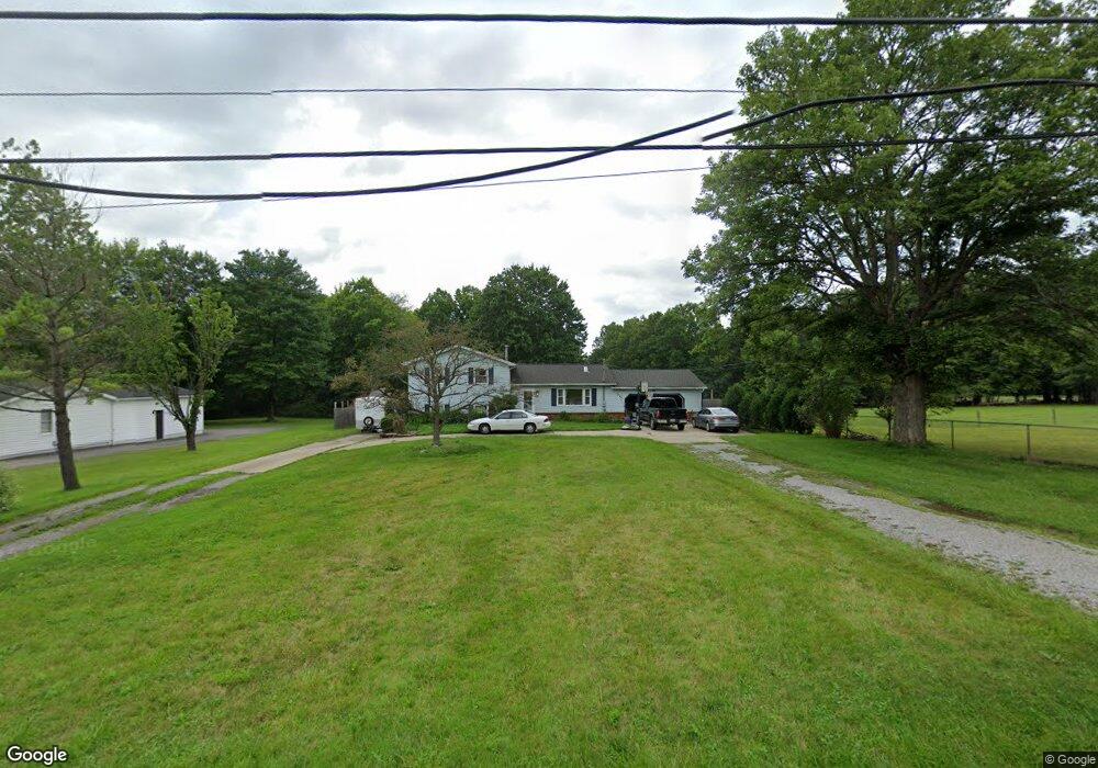
1728 Brookfield Rd Hubbard, OH 44425
Estimated Value: $178,000 - $270,000
3
Beds
2
Baths
1,696
Sq Ft
$141/Sq Ft
Est. Value
About This Home
This home is located at 1728 Brookfield Rd, Hubbard, OH 44425 and is currently estimated at $238,767, approximately $140 per square foot. 1728 Brookfield Rd is a home located in Trumbull County with nearby schools including Hubbard Elementary School, Hubbard Middle School, and Hubbard High School.
Ownership History
Date
Name
Owned For
Owner Type
Purchase Details
Closed on
Jul 22, 2014
Sold by
Novelli Smith Rebecca E
Bought by
Smith Jonathan M
Current Estimated Value
Purchase Details
Closed on
Feb 1, 2006
Sold by
Dach Gerard F
Bought by
Smith Jonathan M and Smith Rebecca E
Home Financials for this Owner
Home Financials are based on the most recent Mortgage that was taken out on this home.
Original Mortgage
$99,439
Outstanding Balance
$56,542
Interest Rate
6.37%
Mortgage Type
FHA
Estimated Equity
$182,225
Purchase Details
Closed on
Jan 27, 2006
Sold by
Dach Gerard F
Bought by
Smith Jonathan M and Smith Rebecca E
Home Financials for this Owner
Home Financials are based on the most recent Mortgage that was taken out on this home.
Original Mortgage
$99,439
Outstanding Balance
$56,542
Interest Rate
6.37%
Mortgage Type
FHA
Estimated Equity
$182,225
Purchase Details
Closed on
Jan 1, 1990
Bought by
Gerard F Dach
Create a Home Valuation Report for This Property
The Home Valuation Report is an in-depth analysis detailing your home's value as well as a comparison with similar homes in the area
Home Values in the Area
Average Home Value in this Area
Purchase History
| Date | Buyer | Sale Price | Title Company |
|---|---|---|---|
| Smith Jonathan M | -- | None Available | |
| Smith Jonathan M | $101,000 | None Available | |
| Smith Jonathan M | $101,000 | None Available | |
| Gerard F Dach | -- | -- |
Source: Public Records
Mortgage History
| Date | Status | Borrower | Loan Amount |
|---|---|---|---|
| Open | Smith Jonathan M | $99,439 | |
| Closed | Smith Jonathan M | $99,439 |
Source: Public Records
Tax History Compared to Growth
Tax History
| Year | Tax Paid | Tax Assessment Tax Assessment Total Assessment is a certain percentage of the fair market value that is determined by local assessors to be the total taxable value of land and additions on the property. | Land | Improvement |
|---|---|---|---|---|
| 2024 | $4,263 | $63,010 | $6,340 | $56,670 |
| 2023 | $4,263 | $63,010 | $6,340 | $56,670 |
| 2022 | $3,959 | $51,380 | $5,810 | $45,570 |
| 2021 | $3,972 | $51,380 | $5,810 | $45,570 |
| 2020 | $3,985 | $51,380 | $5,810 | $45,570 |
| 2019 | $3,736 | $45,010 | $5,390 | $39,620 |
| 2018 | $3,646 | $45,010 | $5,390 | $39,620 |
| 2017 | $3,638 | $45,010 | $5,390 | $39,620 |
| 2016 | $3,069 | $38,150 | $5,390 | $32,760 |
| 2015 | $3,077 | $38,150 | $5,390 | $32,760 |
| 2014 | $3,031 | $38,150 | $5,390 | $32,760 |
| 2013 | $2,371 | $38,150 | $5,390 | $32,760 |
Source: Public Records
Map
Nearby Homes
- 7111 Pine Grove Dr
- 1911 Hubbard Thomas Rd
- 6855 Stewart Sharon Rd
- 1354 Stevenson Rd
- 1952 Hubbard Masury Rd
- 7737 Elm St
- 132 Drummond Ave
- 7847 Chestnut St
- 7822 2nd St
- 5910 Chestnut Ridge Rd
- 764 Jones St
- 7370 Brookwood Dr
- 784 Elmwood Dr
- 1017 Broadway St
- 462 Elizabeth St
- 395 Elizabeth St
- 138 Moore St
- 5683 Chestnut Ridge Rd
- 5950 Mount Everett Rd
- 248 Myron St
- 1750 Brookfield Rd
- 1727 Brookfield Rd
- 1707 Brookfield Rd
- 6944 White Oak Dr
- 1764 Brookfield Rd
- 1755 Brookfield Rd
- 1691 Brookfield Rd
- 6971 White Oak Dr
- 6964 White Oak Dr
- 1769 Brookfield Rd
- 1758 Brookfield Rd
- 1680 Brookfield Rd
- 6963 Pine Grove Dr
- 6978 Pine Grove Dr
- 1671 Brookfield Rd
- 6987 White Oak Dr
- 1796 Brookfield Rd
- 6996 Pine Grove Dr
- 6970 Pine Grove Dr
- 6985 Pine Grove Dr