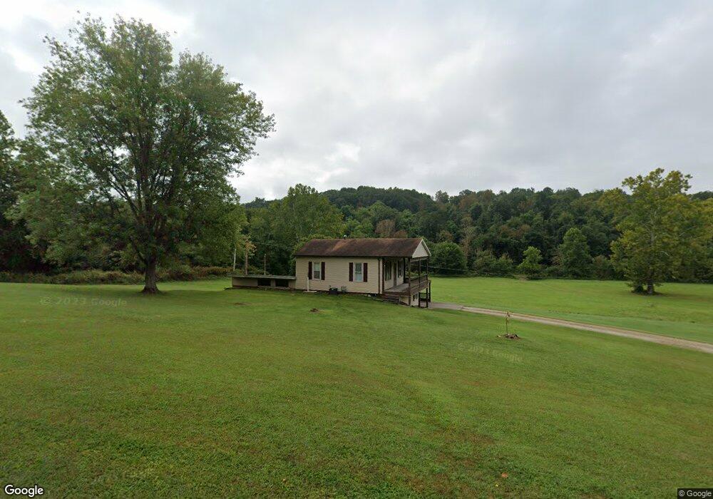
1728 Mill Branch Rd Belpre, OH 45714
Estimated Value: $189,000 - $253,000
3
Beds
2
Baths
1,153
Sq Ft
$190/Sq Ft
Est. Value
About This Home
This home is located at 1728 Mill Branch Rd, Belpre, OH 45714 and is currently estimated at $219,000, approximately $189 per square foot. 1728 Mill Branch Rd is a home located in Washington County with nearby schools including Belpre Elementary School and Belpre High School.
Ownership History
Date
Name
Owned For
Owner Type
Purchase Details
Closed on
Dec 27, 2024
Sold by
Quality Business Investmments Llc
Bought by
Mid Ohio Re Llc
Current Estimated Value
Purchase Details
Closed on
Dec 17, 2024
Sold by
Alloway Mary Lou and Gregg Linda L
Bought by
Quality Business Investments Llc
Purchase Details
Closed on
Sep 2, 2014
Sold by
Estate Of Carl W Alloway
Bought by
Alloway Mary Lou
Create a Home Valuation Report for This Property
The Home Valuation Report is an in-depth analysis detailing your home's value as well as a comparison with similar homes in the area
Home Values in the Area
Average Home Value in this Area
Purchase History
| Date | Buyer | Sale Price | Title Company |
|---|---|---|---|
| Mid Ohio Re Llc | $180,000 | Varsity Title Services Llc | |
| Quality Business Investments Llc | $176,000 | Varsity Title3 | |
| Quality Business Investments Llc | $176,000 | Varsity Title3 | |
| Alloway Mary Lou | -- | None Available |
Source: Public Records
Tax History
| Year | Tax Paid | Tax Assessment Tax Assessment Total Assessment is a certain percentage of the fair market value that is determined by local assessors to be the total taxable value of land and additions on the property. | Land | Improvement |
|---|---|---|---|---|
| 2024 | $2,618 | $42,570 | $14,750 | $27,820 |
| 2023 | $1,309 | $42,610 | $14,790 | $27,820 |
| 2022 | $1,344 | $42,610 | $14,790 | $27,820 |
| 2021 | $1,297 | $39,400 | $12,330 | $27,070 |
| 2020 | $1,222 | $39,400 | $12,330 | $27,070 |
| 2019 | $1,216 | $39,400 | $12,330 | $27,070 |
| 2018 | $1,163 | $37,080 | $11,210 | $25,870 |
| 2017 | $936 | $37,080 | $11,210 | $25,870 |
| 2016 | $1,860 | $37,080 | $11,210 | $25,870 |
| 2015 | $686 | $29,360 | $10,770 | $18,590 |
| 2014 | $1,475 | $29,360 | $10,770 | $18,590 |
| 2013 | $690 | $29,360 | $10,770 | $18,590 |
Source: Public Records
Map
Nearby Homes
- 155 Ridgewood Blvd
- 1310 Oxbow Rd
- 1948 State Route 339
- 2526 Valley View Dr
- 1103 Farson St
- 240 Hollywood Dr
- 2811 Washington Blvd
- 56 Carson Ln
- 2313 Washington Blvd
- 120 Carson Ln
- 111 T322
- 1809 Pennsylvania Ave
- 1806 Pennsylvania Ave
- 906 Westview Dr
- 0 Carson Ln
- 976 Braun Rd
- 631 Short Brook Rd
- 350 Blennerhassett Heights
- 1047 Lakewood Cir
- 82 Highland Lake Cir
- 1733 Mill Branch Rd
- 1707 Mill Branch Rd
- 1838 Mill Branch Rd
- 55 & 77 Dugan Rd
- 1581 Mill Branch Rd Unit T289
- 77 Dugan Rd Unit M221804
- 1936 Mill Branch Rd
- 1936 T289
- 1946 Mill Branch Rd
- 155 Dugan Rd
- 1515 Mill Branch Rd
- 335 Ridgewood Blvd
- 225 Dugan Rd
- 255 Ridgewood Blvd
- 341 Ridgewood Blvd
- 235 Ridgewood Blvd
- 345 Ridgewood Blvd
- 1503 Mill Branch Rd
- 2032 Mill Branch Rd
- 515 Ridgewood Blvd Unit VALLE
Your Personal Tour Guide
Ask me questions while you tour the home.