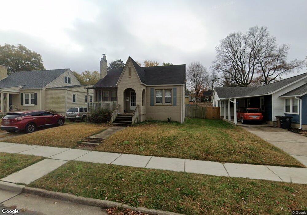
1729 Bessie St Cape Girardeau, MO 63701
Estimated Value: $160,611 - $184,000
2
Beds
1
Bath
1,273
Sq Ft
$136/Sq Ft
Est. Value
About This Home
This home is located at 1729 Bessie St, Cape Girardeau, MO 63701 and is currently estimated at $173,653, approximately $136 per square foot. 1729 Bessie St is a home with nearby schools including Franklin Elementary School, Central Middle School, and Central Junior High School.
Ownership History
Date
Name
Owned For
Owner Type
Purchase Details
Closed on
Jul 29, 2005
Sold by
Johnson Justin P and Johnson Amanda A
Bought by
Childs Tyris D and Childs Kathleen M
Current Estimated Value
Home Financials for this Owner
Home Financials are based on the most recent Mortgage that was taken out on this home.
Original Mortgage
$116,820
Outstanding Balance
$61,170
Interest Rate
5.61%
Mortgage Type
New Conventional
Estimated Equity
$112,483
Create a Home Valuation Report for This Property
The Home Valuation Report is an in-depth analysis detailing your home's value as well as a comparison with similar homes in the area
Home Values in the Area
Average Home Value in this Area
Purchase History
| Date | Buyer | Sale Price | Title Company |
|---|---|---|---|
| Childs Tyris D | -- | None Available |
Source: Public Records
Mortgage History
| Date | Status | Borrower | Loan Amount |
|---|---|---|---|
| Open | Childs Tyris D | $116,820 |
Source: Public Records
Tax History Compared to Growth
Tax History
| Year | Tax Paid | Tax Assessment Tax Assessment Total Assessment is a certain percentage of the fair market value that is determined by local assessors to be the total taxable value of land and additions on the property. | Land | Improvement |
|---|---|---|---|---|
| 2025 | $8 | $15,810 | $1,480 | $14,330 |
| 2024 | $8 | $15,050 | $1,410 | $13,640 |
| 2023 | $782 | $15,050 | $1,410 | $13,640 |
| 2022 | $721 | $13,870 | $1,300 | $12,570 |
| 2021 | $721 | $13,870 | $1,300 | $12,570 |
| 2020 | $723 | $13,870 | $1,300 | $12,570 |
| 2019 | $722 | $13,870 | $0 | $0 |
| 2018 | $721 | $13,870 | $0 | $0 |
| 2017 | $723 | $13,870 | $0 | $0 |
| 2016 | $720 | $13,870 | $0 | $0 |
| 2015 | $720 | $13,870 | $0 | $0 |
| 2014 | $724 | $13,870 | $0 | $0 |
Source: Public Records
Map
Nearby Homes
- 1738 Luce St
- 701 Penny Ave
- 1522 Independence St
- 1455 Whitener St
- 1419 Themis St
- 1401 Bessie St
- 12 N West End Blvd
- 381 N Park Ave
- 374 N Park Ave
- 242 Orange Bowl Dr
- 208 Louis St
- 820 Perry Ave
- 1742 Dunklin St
- 63 N Hanover St
- 303 Orange Bowl Dr
- 123 S Park Ave
- 1219 Merriwether St
- 1958 Dunklin St
- 1610 Bloomfield Rd
- 409 Louis St