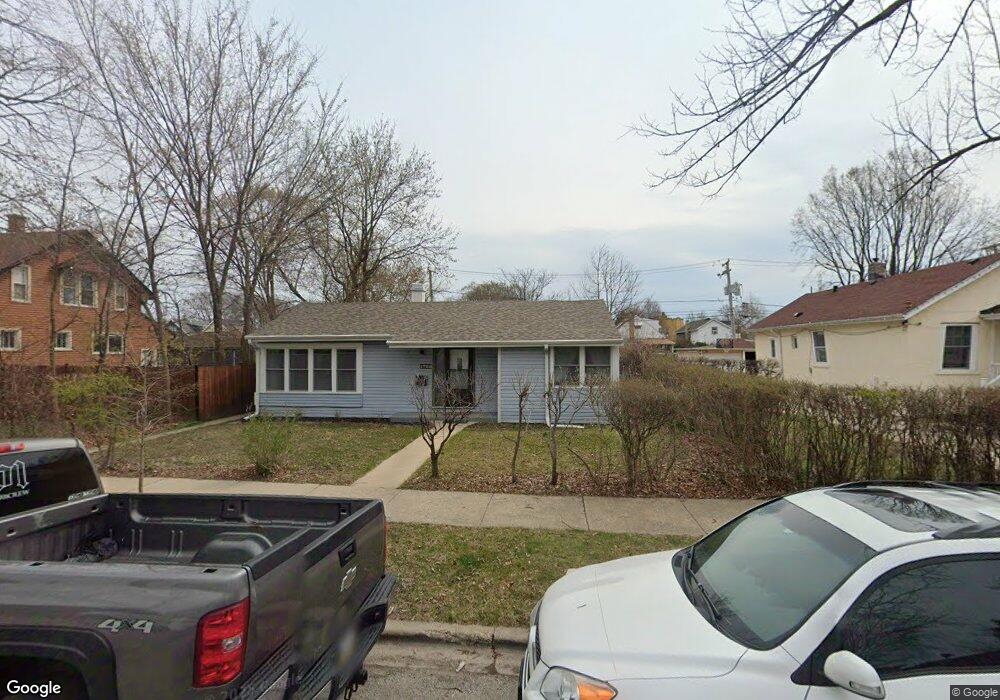
1729 Brown Ave Evanston, IL 60201
West Evanston NeighborhoodEstimated Value: $305,000 - $400,000
3
Beds
1
Bath
1,145
Sq Ft
$306/Sq Ft
Est. Value
About This Home
This home is located at 1729 Brown Ave, Evanston, IL 60201 and is currently estimated at $350,217, approximately $305 per square foot. 1729 Brown Ave is a home located in Cook County with nearby schools including Willard Elementary School, Haven Middle School, and Evanston Township High School.
Ownership History
Date
Name
Owned For
Owner Type
Purchase Details
Closed on
Jan 23, 2023
Sold by
Fainity Group Llc
Bought by
Patterson Katelin and Familara Kevin
Current Estimated Value
Home Financials for this Owner
Home Financials are based on the most recent Mortgage that was taken out on this home.
Original Mortgage
$256,500
Outstanding Balance
$248,610
Interest Rate
6.63%
Mortgage Type
New Conventional
Estimated Equity
$101,607
Purchase Details
Closed on
Jan 25, 2022
Sold by
Boney Derrick C
Bought by
Ali Farrukh
Purchase Details
Closed on
Jan 13, 2022
Sold by
Boney Derrick C
Bought by
Ali Farrukh
Create a Home Valuation Report for This Property
The Home Valuation Report is an in-depth analysis detailing your home's value as well as a comparison with similar homes in the area
Home Values in the Area
Average Home Value in this Area
Purchase History
| Date | Buyer | Sale Price | Title Company |
|---|---|---|---|
| Patterson Katelin | $285,000 | Fidelity National Title | |
| Ali Farrukh | -- | -- | |
| Ali Farrukh | -- | -- | |
| Ali Farrukh | -- | -- |
Source: Public Records
Mortgage History
| Date | Status | Borrower | Loan Amount |
|---|---|---|---|
| Open | Patterson Katelin | $256,500 |
Source: Public Records
Tax History Compared to Growth
Tax History
| Year | Tax Paid | Tax Assessment Tax Assessment Total Assessment is a certain percentage of the fair market value that is determined by local assessors to be the total taxable value of land and additions on the property. | Land | Improvement |
|---|---|---|---|---|
| 2024 | $3,218 | $13,293 | $3,600 | $9,693 |
| 2023 | $2,690 | $13,293 | $3,600 | $9,693 |
| 2022 | $2,690 | $13,293 | $3,600 | $9,693 |
| 2021 | $1,948 | $9,005 | $3,300 | $5,705 |
| 2020 | $1,952 | $9,005 | $3,300 | $5,705 |
| 2019 | $1,964 | $10,096 | $3,300 | $6,796 |
| 2018 | $2,421 | $10,556 | $2,700 | $7,856 |
| 2017 | $2,366 | $10,556 | $2,700 | $7,856 |
| 2016 | $2,356 | $10,556 | $2,700 | $7,856 |
| 2015 | $1,938 | $8,540 | $2,325 | $6,215 |
| 2014 | $1,927 | $8,540 | $2,325 | $6,215 |
| 2013 | $1,875 | $8,540 | $2,325 | $6,215 |
Source: Public Records
Map
Nearby Homes
- 1801 Brown Ave
- 1739 Dodge Ave
- 1813 Dodge Ave
- 1832 Hovland Ct
- 1801 Lyons St
- 1718 Hovland Ct
- 1621 Church St
- 1808 Laurel Ave
- 2011 Grey Ave
- 2005 Darrow Ave
- 1633 Mcdaniel Ave
- 2101 Pioneer Rd
- 1723 Greenwood St
- 1918 Noyes St
- 2026 Green Bay Rd
- 2118 Jackson Ave
- 2440 Simpson St
- 1228 Emerson St Unit 304
- 2017 Jackson Ave
- 1600 Greenwood St