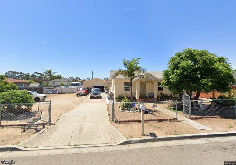
1729 Dixie St Oceanside, CA 92054
Loma Alta NeighborhoodEstimated Value: $827,000 - $1,043,000
2
Beds
1
Bath
1,088
Sq Ft
$839/Sq Ft
Est. Value
About This Home
This home is located at 1729 Dixie St, Oceanside, CA 92054 and is currently estimated at $912,291, approximately $838 per square foot. 1729 Dixie St is a home located in San Diego County with nearby schools including Mission Elementary School, Oceanside High School, and St. Mary Star Of The Sea Elementary School.
Ownership History
Date
Name
Owned For
Owner Type
Purchase Details
Closed on
Dec 2, 1997
Sold by
Federal Home Loan Mortgage Corporation
Bought by
Martinez Uriel E
Current Estimated Value
Purchase Details
Closed on
Dec 1, 1997
Sold by
Eisendrath Robert C
Bought by
Martinez Urie E
Purchase Details
Closed on
Aug 20, 1997
Sold by
Fleet Bank Na
Bought by
Federal Home Loan Mortgage Corporation
Purchase Details
Closed on
Aug 19, 1997
Sold by
Oscar Muniz
Bought by
Fleet Bank Na
Purchase Details
Closed on
Aug 12, 1997
Sold by
Oscar Muniz and Eisendrath Robert C
Bought by
Eisendrath Robert C
Create a Home Valuation Report for This Property
The Home Valuation Report is an in-depth analysis detailing your home's value as well as a comparison with similar homes in the area
Home Values in the Area
Average Home Value in this Area
Purchase History
| Date | Buyer | Sale Price | Title Company |
|---|---|---|---|
| Martinez Uriel E | $60,000 | Chicago Title Co | |
| Martinez Urie E | $22,000 | Chicago Title Co | |
| Federal Home Loan Mortgage Corporation | -- | First Southwestern Title Co | |
| Fleet Bank Na | $65,700 | First Southwestern Title Co | |
| Eisendrath Robert C | $35,000 | Northern Counties Title Inc |
Source: Public Records
Tax History
| Year | Tax Paid | Tax Assessment Tax Assessment Total Assessment is a certain percentage of the fair market value that is determined by local assessors to be the total taxable value of land and additions on the property. | Land | Improvement |
|---|---|---|---|---|
| 2025 | $1,436 | $133,521 | $100,963 | $32,558 |
| 2024 | $1,436 | $130,904 | $98,984 | $31,920 |
| 2023 | $1,391 | $128,339 | $97,044 | $31,295 |
| 2022 | $1,368 | $125,824 | $95,142 | $30,682 |
| 2021 | $1,372 | $123,358 | $93,277 | $30,081 |
| 2020 | $1,330 | $122,094 | $92,321 | $29,773 |
| 2019 | $1,291 | $119,701 | $90,511 | $29,190 |
| 2018 | $1,276 | $117,355 | $88,737 | $28,618 |
| 2017 | $70 | $115,055 | $86,998 | $28,057 |
| 2016 | $1,209 | $112,800 | $85,293 | $27,507 |
| 2015 | $1,173 | $111,106 | $84,012 | $27,094 |
| 2014 | $1,129 | $108,931 | $82,367 | $26,564 |
Source: Public Records
Map
Nearby Homes
- 2309 Saratoga St
- 168 Carey Rd
- 1432 Buena St
- 509 Rockledge St
- 1328 Buena St
- 426 Grant St
- 415 Stoney Point Way Unit 106
- 1330 Bush St
- 503 505 N Nevada St
- 722 &718 N Freeman St
- 506 Canyon Dr Unit 6
- 520 Grant St
- 420 Stoney Point Way Unit 113
- 430 Stoney Point Way Unit 124
- 2721 Lomita St
- 415 S Weitzel St
- 0 Amick St Unit 146-100-23-00, 21, 1
- 1100 Civic Center Dr Unit C25
- 1109 Hibiscus Way
- 421 N Weitzel St
- 1727 Dixie St
- 1733 Dixie St
- 1732 Maxson St
- Dixie Street Dixie Lot (Apn 148-272-44) Unit Lot 44
- Dixie Street Dixie Lot (Apn 148-272-44)
- 1740 Maxson St
- 1768 Dixie St
- 1772 Dixie St
- 1776 Dixie St
- 1764 Dixie St
- 1780 Dixie St
- 1744 Maxson St
- 1760 Dixie St
- 1756 Dixie St
- 1715 Dixie St
- 1784 Dixie St
- Dixie 0 Lots
- 1748 Maxson St
- 1710 Maxson St
- 1788 Dixie St
Your Personal Tour Guide
Ask me questions while you tour the home.