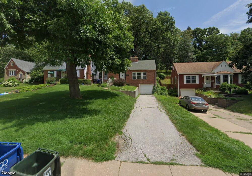
1729 Jersey Ridge Rd Davenport, IA 52803
East End NeighborhoodEstimated Value: $156,000 - $169,000
2
Beds
1
Bath
1,080
Sq Ft
$151/Sq Ft
Est. Value
About This Home
This home is located at 1729 Jersey Ridge Rd, Davenport, IA 52803 and is currently estimated at $163,046, approximately $150 per square foot. 1729 Jersey Ridge Rd is a home located in Scott County with nearby schools including McKinley Elementary School, Casey County Middle School, and Hopkinsville Middle School.
Ownership History
Date
Name
Owned For
Owner Type
Purchase Details
Closed on
Nov 2, 2004
Sold by
Coyle Michael J and Coyle Carrie E
Bought by
Briesco Thomas J Bri
Current Estimated Value
Home Financials for this Owner
Home Financials are based on the most recent Mortgage that was taken out on this home.
Original Mortgage
$82,962
Interest Rate
5.91%
Mortgage Type
New Conventional
Create a Home Valuation Report for This Property
The Home Valuation Report is an in-depth analysis detailing your home's value as well as a comparison with similar homes in the area
Home Values in the Area
Average Home Value in this Area
Purchase History
| Date | Buyer | Sale Price | Title Company |
|---|---|---|---|
| Briesco Thomas J Bri | $76,000 | None Available |
Source: Public Records
Mortgage History
| Date | Status | Borrower | Loan Amount |
|---|---|---|---|
| Previous Owner | Briesco Thomas J Bri | $82,962 |
Source: Public Records
Tax History Compared to Growth
Tax History
| Year | Tax Paid | Tax Assessment Tax Assessment Total Assessment is a certain percentage of the fair market value that is determined by local assessors to be the total taxable value of land and additions on the property. | Land | Improvement |
|---|---|---|---|---|
| 2025 | $2,636 | $155,410 | $28,840 | $126,570 |
| 2024 | $2,772 | $147,500 | $28,840 | $118,660 |
| 2023 | $3,353 | $147,500 | $28,840 | $118,660 |
| 2022 | $3,170 | $133,820 | $27,400 | $106,420 |
| 2021 | $2,872 | $133,820 | $27,400 | $106,420 |
| 2020 | $3,136 | $133,820 | $27,400 | $106,420 |
| 2019 | $2,911 | $124,570 | $27,400 | $97,170 |
| 2018 | $2,634 | $124,570 | $27,400 | $97,170 |
| 2017 | $2,622 | $119,940 | $27,400 | $92,540 |
| 2016 | $2,526 | $115,320 | $0 | $0 |
| 2015 | $2,526 | $110,480 | $0 | $0 |
| 2014 | $2,454 | $110,480 | $0 | $0 |
| 2013 | $2,412 | $0 | $0 | $0 |
| 2012 | -- | $106,130 | $30,260 | $75,870 |
Source: Public Records
Map
Nearby Homes
- 1734 Ridgewood Ave
- 1704 Jersey Ridge Rd
- 1515 Jersey Ridge Rd
- 2316 East St
- 1803 Belle Ave
- 1815 Belle Ave
- 2316 E Pleasant St
- 1504 Christie St
- 10 Kenwood Ave
- 2704 E High St
- 19 Kenwood Ave
- 1 Kenwood Ave
- 2618 Elm St
- 2131 Lorton Ave
- 2811 E 18th St
- 2810 Middle Rd
- 9 Parkwood Dr
- 2103 E Lombard St
- 2905 Middle Rd
- 2429 E Central Park Ave
- 1725 Jersey Ridge Rd
- 1735 Jersey Ridge Rd
- 1719 Jersey Ridge Rd
- 1803 Jersey Ridge Rd
- 1715 Jersey Ridge Rd
- 1807 Jersey Ridge Rd
- 1709 Jersey Ridge Rd
- 1718 Ridgewood Ave
- 1722 Ridgewood Ave
- 1817 Jersey Ridge Rd
- 1732 Jersey Ridge Rd
- 1714 Ridgewood Ave
- 1730 Ridgewood Ave
- 1740 Jersey Ridge Rd
- 1703 Jersey Ridge Rd
- 1742 Jersey Ridge Rd
- 1720 Jersey Ridge Rd
- 2428 East St
- 1820 Jersey Ridge Rd
- 1714 Jersey Ridge Rd