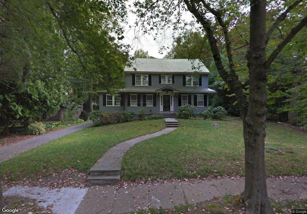
173 Berkeley St West Newton, MA 02465
West Newton NeighborhoodEstimated Value: $1,853,000 - $2,337,000
4
Beds
3
Baths
2,645
Sq Ft
$751/Sq Ft
Est. Value
About This Home
This home is located at 173 Berkeley St, West Newton, MA 02465 and is currently estimated at $1,985,111, approximately $750 per square foot. 173 Berkeley St is a home located in Middlesex County with nearby schools including Peirce Elementary School, F.A. Day Middle School, and Newton North High School.
Ownership History
Date
Name
Owned For
Owner Type
Purchase Details
Closed on
Jan 9, 2007
Sold by
Mchale Elaine C and Conn Russell F
Bought by
Breckenridge Lee P and Margo Robert A
Current Estimated Value
Home Financials for this Owner
Home Financials are based on the most recent Mortgage that was taken out on this home.
Original Mortgage
$633,000
Interest Rate
6.24%
Mortgage Type
Purchase Money Mortgage
Purchase Details
Closed on
Feb 5, 1988
Sold by
Shea Ralph A
Bought by
Conn Russell F
Create a Home Valuation Report for This Property
The Home Valuation Report is an in-depth analysis detailing your home's value as well as a comparison with similar homes in the area
Home Values in the Area
Average Home Value in this Area
Purchase History
| Date | Buyer | Sale Price | Title Company |
|---|---|---|---|
| Breckenridge Lee P | $983,000 | -- | |
| Conn Russell F | $400,000 | -- |
Source: Public Records
Mortgage History
| Date | Status | Borrower | Loan Amount |
|---|---|---|---|
| Open | Conn Russell F | $496,000 | |
| Closed | Breckenridge Lee P | $633,000 | |
| Previous Owner | Conn Russell F | $310,000 | |
| Previous Owner | Conn Russell F | $150,000 |
Source: Public Records
Tax History Compared to Growth
Tax History
| Year | Tax Paid | Tax Assessment Tax Assessment Total Assessment is a certain percentage of the fair market value that is determined by local assessors to be the total taxable value of land and additions on the property. | Land | Improvement |
|---|---|---|---|---|
| 2025 | $14,558 | $1,485,500 | $1,239,900 | $245,600 |
| 2024 | $14,076 | $1,442,200 | $1,203,800 | $238,400 |
| 2023 | $13,472 | $1,323,400 | $944,700 | $378,700 |
| 2022 | $12,891 | $1,225,400 | $874,700 | $350,700 |
| 2021 | $12,439 | $1,156,000 | $825,200 | $330,800 |
| 2020 | $12,069 | $1,156,000 | $825,200 | $330,800 |
| 2019 | $11,728 | $1,122,300 | $801,200 | $321,100 |
| 2018 | $11,277 | $1,042,200 | $722,200 | $320,000 |
| 2017 | $10,933 | $983,200 | $681,300 | $301,900 |
| 2016 | $10,454 | $918,600 | $636,700 | $281,900 |
| 2015 | $9,967 | $858,500 | $595,000 | $263,500 |
Source: Public Records
Map
Nearby Homes
- 18 Sewall St
- 10 Ruane Rd
- 68 Mignon Rd
- 1488 Washington St Unit 1488
- 12 Inis Cir
- 0 Duncan Rd Unit 72925240
- 279 Chestnut St
- 17 Gilbert St
- 1639 Washington St
- 51 Bourne St
- 79 Chestnut St Unit 2
- 39 Valentine Park
- 222 Prince St
- 429 Cherry St Unit 11
- 66 Webster St
- 10 Crescent St Unit 2
- 17 Crescent St
- 4 Hosmer Cir
- 13 Weir St
- 1754 Washington St
- 165 Berkeley St
- 165 Berkeley St
- 130 Temple St
- 122 Temple St
- 15 Sterling St
- 23 Sterling St
- 114 Temple St
- 155 Berkeley St
- 31 Sterling St
- 14 Sterling St
- 14 Sterling St
- 14 Sterling St Unit 2
- 133 Temple St
- 149 Berkeley St
- 121 Temple St
- 104 Temple St
- 39 Sterling St
- 137 Temple St
- 18 Sterling St
- 111 Temple St