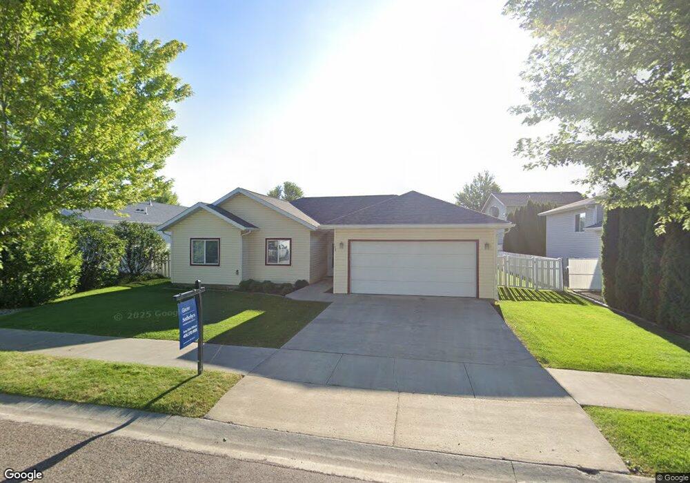
173 Empire Loop Kalispell, MT 59901
Estimated Value: $484,000 - $526,000
3
Beds
2
Baths
1,494
Sq Ft
$333/Sq Ft
Est. Value
About This Home
This home is located at 173 Empire Loop, Kalispell, MT 59901 and is currently estimated at $497,071, approximately $332 per square foot. 173 Empire Loop is a home located in Flathead County with nearby schools including Edgerton School, Kalispell Middle School, and Glacier High School.
Ownership History
Date
Name
Owned For
Owner Type
Purchase Details
Closed on
Aug 27, 2025
Sold by
Walker Family Trust and Walker Denise G
Bought by
Oneill Susan and Oneill Kevin
Current Estimated Value
Purchase Details
Closed on
Oct 4, 2021
Sold by
Walker Denise G
Bought by
Walker Denise G and Walker Family Trust
Purchase Details
Closed on
Mar 9, 2021
Sold by
Rice Marilyn S
Bought by
Walker Denise G
Home Financials for this Owner
Home Financials are based on the most recent Mortgage that was taken out on this home.
Original Mortgage
$287,200
Interest Rate
2.7%
Mortgage Type
New Conventional
Purchase Details
Closed on
Oct 12, 2016
Sold by
Ford Lorri G
Bought by
Carr Dorothy
Create a Home Valuation Report for This Property
The Home Valuation Report is an in-depth analysis detailing your home's value as well as a comparison with similar homes in the area
Purchase History
| Date | Buyer | Sale Price | Title Company |
|---|---|---|---|
| Oneill Susan | -- | Fidelity National Title Compan | |
| Walker Denise G | -- | None Available | |
| Walker Denise G | -- | Premier Title | |
| Carr Dorothy | -- | Insured Titles |
Source: Public Records
Mortgage History
| Date | Status | Borrower | Loan Amount |
|---|---|---|---|
| Previous Owner | Walker Denise G | $287,200 |
Source: Public Records
Tax History
| Year | Tax Paid | Tax Assessment Tax Assessment Total Assessment is a certain percentage of the fair market value that is determined by local assessors to be the total taxable value of land and additions on the property. | Land | Improvement |
|---|---|---|---|---|
| 2025 | $2,484 | $478,900 | $0 | $0 |
| 2024 | $3,550 | $455,900 | $0 | $0 |
| 2023 | $3,800 | $455,900 | $0 | $0 |
| 2022 | $3,155 | $280,000 | $0 | $0 |
| 2021 | $3,013 | $280,000 | $0 | $0 |
| 2020 | $1,698 | $228,900 | $0 | $0 |
| 2019 | $1,042 | $228,900 | $0 | $0 |
| 2018 | $779 | $203,100 | $0 | $0 |
| 2017 | $2,599 | $203,100 | $0 | $0 |
| 2016 | $21 | $175,400 | $0 | $0 |
| 2015 | $2,090 | $175,400 | $0 | $0 |
| 2014 | $2,005 | $100,541 | $0 | $0 |
Source: Public Records
Map
Nearby Homes
- 174 Empire Loop
- 140 Barron Way
- 119 Barron Way
- 108 Hearst Dr
- 90 Empire Loop
- 63 Empire Loop
- 38 Vanderbilt Dr
- 507 Northridge Dr
- 188 N Riding Rd
- 249 Three Mile Dr
- 17 Empire Loop
- 408 Needlegrass Ln
- 417 Needlegrass Ln
- 1280 Quarter Horse Ln
- 28 Vista Loop
- 223 Northland Dr
- 287 Kara Dr
- 120 Garland St
- 240 Kara Dr
- 433 Needlegrass Ln
- 171 Empire Loop
- 175 Empire Loop
- 131 Empire Loop
- 129 Empire Loop
- 129 Empire Loop
- 167 Empire Loop
- 177 Empire Loop
- 176 Empire Loop
- 178 Empire Loop
- 180 Empire Loop
- 127 Empire Loop
- 172 Empire Loop
- 165 Empire Loop
- 182 Empire Loop
- 170 Empire Loop
- 130 Empire Loop
- 184 Empire Loop
- 128 Empire Loop
- 126 Empire Loop
- 132 Empire Loop
Your Personal Tour Guide
Ask me questions while you tour the home.