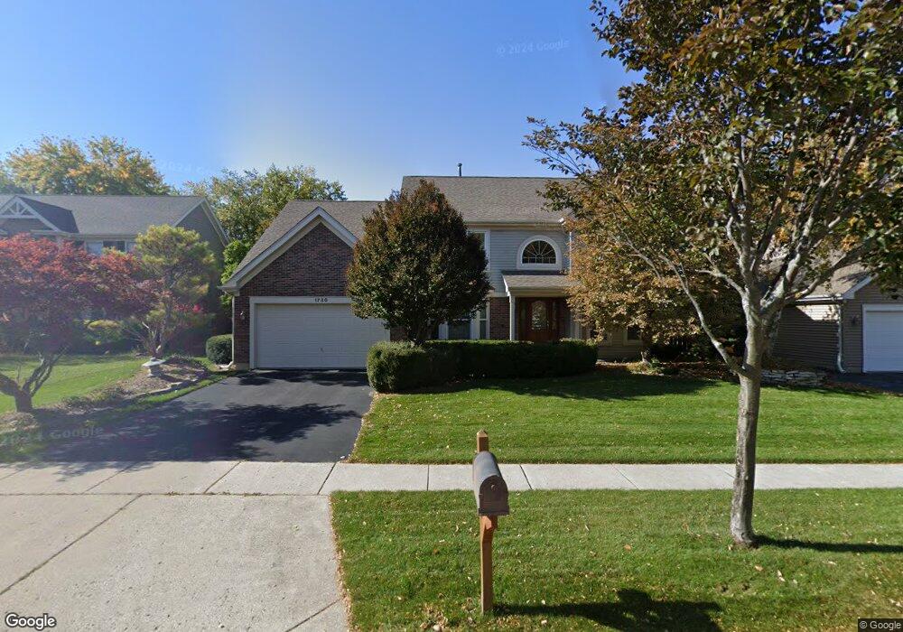
1730 Arbordale Ln Algonquin, IL 60102
Estimated Value: $438,160 - $484,000
4
Beds
--
Bath
2,622
Sq Ft
$178/Sq Ft
Est. Value
About This Home
This home is located at 1730 Arbordale Ln, Algonquin, IL 60102 and is currently estimated at $466,790, approximately $178 per square foot. 1730 Arbordale Ln is a home located in Kane County with nearby schools including Westfield Community School, United Junior High School, and Harry D Jacobs High School.
Ownership History
Date
Name
Owned For
Owner Type
Purchase Details
Closed on
Jan 23, 2025
Sold by
Ainsworth Michael M
Bought by
Michael M Ainsworth Trust and Ainsworth
Current Estimated Value
Purchase Details
Closed on
Dec 12, 2022
Sold by
Ainsworth Beverly A
Bought by
Ainsworth Michael M
Purchase Details
Closed on
Oct 24, 1998
Sold by
Ainsworth Michael M and Hanover Beverly A
Bought by
Ainsworth Michael M and Ainsworth Beverly
Home Financials for this Owner
Home Financials are based on the most recent Mortgage that was taken out on this home.
Original Mortgage
$140,000
Interest Rate
6.78%
Create a Home Valuation Report for This Property
The Home Valuation Report is an in-depth analysis detailing your home's value as well as a comparison with similar homes in the area
Home Values in the Area
Average Home Value in this Area
Purchase History
| Date | Buyer | Sale Price | Title Company |
|---|---|---|---|
| Michael M Ainsworth Trust | -- | None Listed On Document | |
| Ainsworth Michael M | -- | None Listed On Document | |
| Ainsworth Michael M | -- | Chicago Title Insurance Co |
Source: Public Records
Mortgage History
| Date | Status | Borrower | Loan Amount |
|---|---|---|---|
| Previous Owner | Ainsworth Michael M | $140,000 |
Source: Public Records
Tax History Compared to Growth
Tax History
| Year | Tax Paid | Tax Assessment Tax Assessment Total Assessment is a certain percentage of the fair market value that is determined by local assessors to be the total taxable value of land and additions on the property. | Land | Improvement |
|---|---|---|---|---|
| 2024 | $9,144 | $136,274 | $25,730 | $110,544 |
| 2023 | $8,677 | $122,615 | $23,151 | $99,464 |
| 2022 | $8,621 | $114,154 | $23,151 | $91,003 |
| 2021 | $8,621 | $107,784 | $21,859 | $85,925 |
| 2020 | $8,175 | $105,361 | $21,368 | $83,993 |
| 2019 | $7,904 | $100,020 | $20,285 | $79,735 |
| 2018 | $8,359 | $96,662 | $19,883 | $76,779 |
| 2017 | $8,026 | $90,423 | $18,600 | $71,823 |
| 2016 | $7,914 | $84,378 | $18,009 | $66,369 |
| 2015 | -- | $77,385 | $17,040 | $60,345 |
| 2014 | -- | $69,000 | $16,569 | $52,431 |
| 2013 | -- | $71,527 | $17,076 | $54,451 |
Source: Public Records
Map
Nearby Homes
- 1900 Waverly Ln
- 1971 Peach Tree Ln
- 30 Arbordale Ct Unit 4284
- 2101 Peach Tree Ln Unit 4094
- 2043 Peach Tree Ln Unit 4122
- 000 County Line Rd
- 2161 Burnham Ct
- 2060 Dorchester Ave
- Adams Plan at Algonquin Meadows - Single Family
- Sequoia Plan at Algonquin Meadows - Single Family
- Bryce Plan at Algonquin Meadows - Single Family
- Rainier Plan at Algonquin Meadows - Single Family
- Santa Rosa Plan at Algonquin Meadows - Single Family
- Biscayne Plan at Algonquin Meadows - Single Family
- Marianne Plan at Algonquin Meadows - Traditional Townhomes
- Darcy Plan at Algonquin Meadows - Traditional Townhomes
- Charlotte Plan at Algonquin Meadows - Traditional Townhomes
- Amherst Plan at Algonquin Meadows - Urban Townhomes
- Chatham Plan at Algonquin Meadows - Urban Townhomes
- Chelsea Plan at Algonquin Meadows - Urban Townhomes
- 1720 Arbordale Ln
- 1740 Arbordale Ln
- 9 Driftwood Ct Unit 6
- 1750 Arbordale Ln
- 1710 Arbordale Ln Unit 4
- 2021 Cloverdale Ln
- 7 Driftwood Ct
- 1731 Arbordale Ln
- 1800 Arbordale Ln
- 1741 Arbordale Ln
- 2031 Cloverdale Ln
- 1721 Arbordale Ln
- 11 Driftwood Ct
- 1751 Arbordale Ln
- 5 Driftwood Ct
- 1711 Arbordale Ln
- 1810 Arbordale Ln
- 1801 Arbordale Ln
- 2041 Cloverdale Ln
- 1820 Arbordale Ln