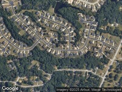
1730 Carissa Dr Conyers, GA 30094
Estimated Value: $447,784 - $501,000
4
Beds
3
Baths
3,230
Sq Ft
$146/Sq Ft
Est. Value
About This Home
This home is located at 1730 Carissa Dr, Conyers, GA 30094 and is currently estimated at $472,446, approximately $146 per square foot. 1730 Carissa Dr is a home located in Rockdale County with nearby schools including Shoal Creek Elementary School, Edwards Middle School, and Heritage High School.
Ownership History
Date
Name
Owned For
Owner Type
Purchase Details
Closed on
Feb 23, 2006
Sold by
Horzin Hmbldrs Inc
Bought by
Thomas Paulette E
Current Estimated Value
Home Financials for this Owner
Home Financials are based on the most recent Mortgage that was taken out on this home.
Original Mortgage
$27,190
Interest Rate
5.69%
Mortgage Type
New Conventional
Create a Home Valuation Report for This Property
The Home Valuation Report is an in-depth analysis detailing your home's value as well as a comparison with similar homes in the area
Home Values in the Area
Average Home Value in this Area
Purchase History
| Date | Buyer | Sale Price | Title Company |
|---|---|---|---|
| Thomas Paulette E | $271,900 | -- |
Source: Public Records
Mortgage History
| Date | Status | Borrower | Loan Amount |
|---|---|---|---|
| Open | Thomas Paulette E | $262,650 | |
| Closed | Thomas Paulette E | $27,190 | |
| Closed | Thomas Paulette E | $217,520 |
Source: Public Records
Tax History Compared to Growth
Tax History
| Year | Tax Paid | Tax Assessment Tax Assessment Total Assessment is a certain percentage of the fair market value that is determined by local assessors to be the total taxable value of land and additions on the property. | Land | Improvement |
|---|---|---|---|---|
| 2024 | $4,978 | $198,000 | $37,080 | $160,920 |
| 2023 | $2,855 | $121,760 | $24,600 | $97,160 |
| 2022 | $2,483 | $107,280 | $22,978 | $84,302 |
| 2021 | $2,660 | $107,280 | $22,978 | $84,302 |
| 2020 | $2,769 | $107,280 | $23,800 | $83,480 |
| 2019 | $1,900 | $76,760 | $10,640 | $66,120 |
| 2018 | $1,912 | $76,760 | $10,640 | $66,120 |
| 2017 | $1,719 | $69,800 | $10,640 | $59,160 |
| 2016 | $1,587 | $69,800 | $10,640 | $59,160 |
| 2015 | $1,590 | $69,800 | $10,640 | $59,160 |
| 2014 | $1,420 | $69,800 | $10,640 | $59,160 |
| 2013 | -- | $101,960 | $20,000 | $81,960 |
Source: Public Records
Map
Nearby Homes
- 1905 Buford Ct
- 2057 Lost Forest Ln SW
- 1757 Mystery Cir SW Unit 5
- 0 Granade Rd SW Unit 10430610
- 0 Granade Rd SW Unit 10430608
- 0 Granade Rd SW Unit 10430607
- 0 Granade Rd SW Unit 10430605
- 0 Granade Rd SW Unit 10430604
- 2105 Rotunda Ct
- 1760 Carissa Dr
- 1779 Granade Rd SW
- 2310 Lost Forest Ln SW
- 2095 Flat Shoals Rd SW
- 2341 Amberbrook Dr SW
- 2384 Shadowood Dr SW
- 2340 Rolling Acres Dr SW
- 1993 Old Smyrna Rd SW
- 2374 Rolling Acres Dr SW
- 1875 Ebenezer Rd SW
- 1819 Laurel Ridge Dr SW
- 1730 Carissa Dr
- 1900 Buford Ct
- 2205 Anise Ct
- 2201 Anise Ct
- 1904 Buford Ct Unit /79
- 1904 Buford Ct
- 1729 Carissa Dr
- 1731 Carissa Dr
- 1727 Carissa Dr Unit 14
- 1727 Carissa Dr
- 1727 SW Carissa Unit 14
- 0 Anise Ct Unit 8530299
- 0 Anise Ct Unit 8432085
- 0 Anise Ct Unit 7582141
- 0 Anise Ct
- 1912 Buford Ct
- 1724 Carissa Dr
- 1733 Carissa Dr
- 1725 Carissa Dr
- 1735 Carissa Dr
