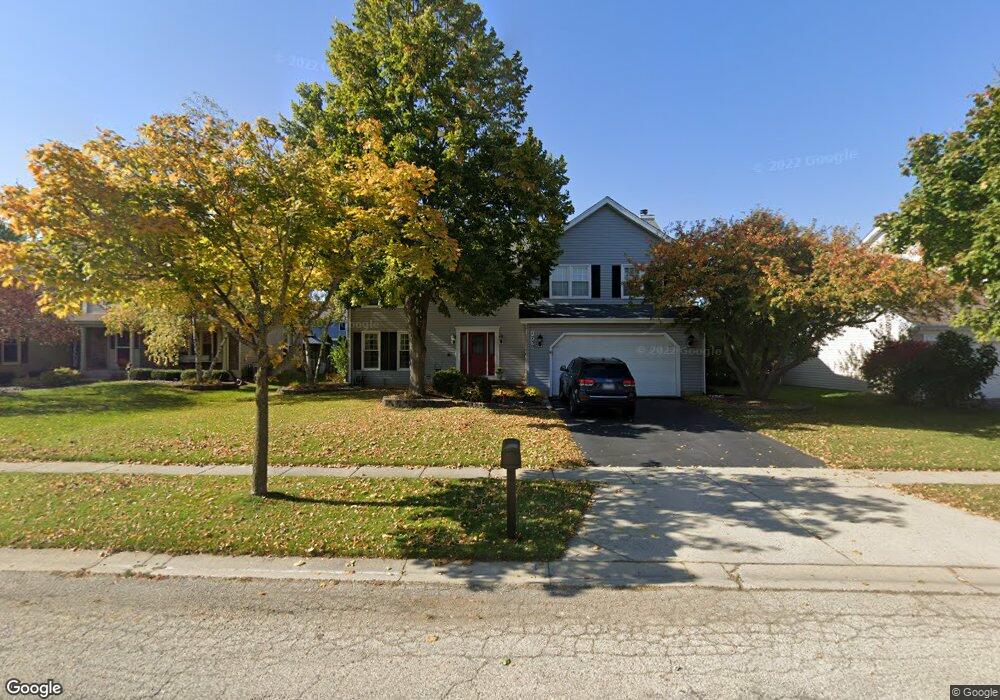
1730 Waverly Ln Algonquin, IL 60102
Estimated Value: $430,023 - $482,000
4
Beds
--
Bath
2,334
Sq Ft
$197/Sq Ft
Est. Value
About This Home
This home is located at 1730 Waverly Ln, Algonquin, IL 60102 and is currently estimated at $459,256, approximately $196 per square foot. 1730 Waverly Ln is a home located in Kane County with nearby schools including Westfield Community School, Harry D Jacobs High School, and St Margaret Mary Catholic School.
Ownership History
Date
Name
Owned For
Owner Type
Purchase Details
Closed on
Oct 10, 2024
Sold by
Deroo Timothy J and Deroo Patricia A
Bought by
Deroo Family Trust and Deroo
Current Estimated Value
Purchase Details
Closed on
Apr 14, 1995
Sold by
Willoughby Farms First Ltd Partnership
Bought by
Deroo Timothy J and Deroo Patricia A
Home Financials for this Owner
Home Financials are based on the most recent Mortgage that was taken out on this home.
Original Mortgage
$157,000
Interest Rate
8.55%
Create a Home Valuation Report for This Property
The Home Valuation Report is an in-depth analysis detailing your home's value as well as a comparison with similar homes in the area
Purchase History
| Date | Buyer | Sale Price | Title Company |
|---|---|---|---|
| Deroo Family Trust | -- | None Listed On Document | |
| Deroo Family Trust | -- | None Listed On Document | |
| Deroo Timothy J | $198,000 | Chicago Title Insurance Co |
Source: Public Records
Mortgage History
| Date | Status | Borrower | Loan Amount |
|---|---|---|---|
| Previous Owner | Deroo Timothy J | $157,000 |
Source: Public Records
Tax History
| Year | Tax Paid | Tax Assessment Tax Assessment Total Assessment is a certain percentage of the fair market value that is determined by local assessors to be the total taxable value of land and additions on the property. | Land | Improvement |
|---|---|---|---|---|
| 2024 | $9,492 | $132,849 | $25,730 | $107,119 |
| 2023 | $9,078 | $119,533 | $23,151 | $96,382 |
| 2022 | $8,368 | $106,127 | $23,151 | $82,976 |
| 2021 | $8,123 | $100,205 | $21,859 | $78,346 |
| 2020 | $7,966 | $97,953 | $21,368 | $76,585 |
| 2019 | $7,724 | $92,988 | $20,285 | $72,703 |
| 2018 | $7,851 | $91,146 | $19,883 | $71,263 |
| 2017 | $7,536 | $85,263 | $18,600 | $66,663 |
| 2016 | $7,316 | $78,457 | $18,009 | $60,448 |
| 2015 | -- | $71,949 | $17,040 | $54,909 |
| 2014 | -- | $65,845 | $16,569 | $49,276 |
| 2013 | -- | $67,860 | $17,076 | $50,784 |
Source: Public Records
Map
Nearby Homes
- 1900 Waverly Ln
- 20 Peach Tree Ct Unit 4153
- 18 Peach Tree Ct Unit 4154
- 2069 Peach Tree Ln Unit 4116
- 2051 Carlisle St
- 2224 Barrett Dr
- 1239 Glenmont St
- 1141 Glenmont St
- 350 Coldsprings St
- 1090 Glenmont St
- 1247 Glenmont St
- 1250 Glenmont St
- 1241 Glenmont St
- 1111 Glenmont St
- 1243 Glenmont St
- 1080 Glenmont St
- 1030 Glenmont St
- 1249 Glenmont St
- 1245 Glenmont St
- 1020 Glenmont St
- 1720 Waverly Ln
- 1740 Waverly Ln
- 1731 Arbordale Ln
- 1800 Waverly Ln
- 1710 Waverly Ln
- 1721 Arbordale Ln
- 1741 Arbordale Ln
- 1741 Waverly Ln
- 1711 Arbordale Ln
- 1731 Waverly Ln
- 1801 Waverly Ln
- 1810 Waverly Ln
- 1751 Arbordale Ln
- 1721 Waverly Ln
- 1941 Cloverdale Ln
- 1811 Waverly Ln
- 1820 Waverly Ln Unit 8
- 1821 Waverly Ln
- 1931 Cloverdale Ln
- 1960 Cloverdale Ln
Your Personal Tour Guide
Ask me questions while you tour the home.