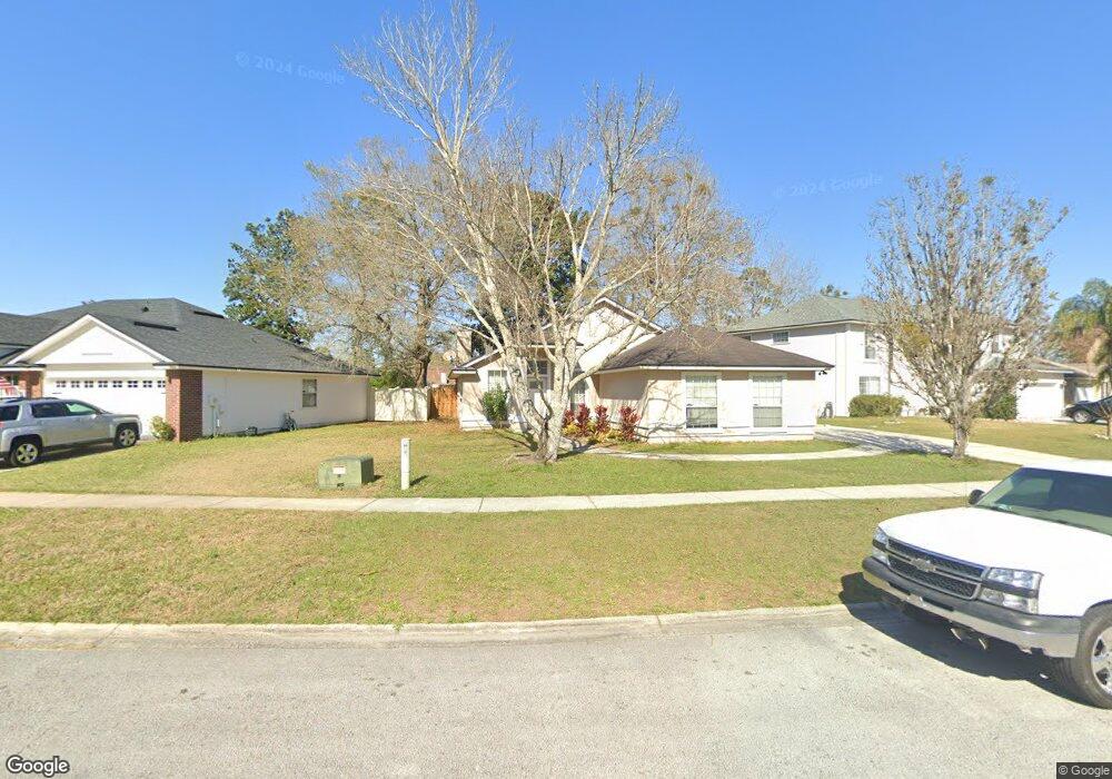
1731 Dockside Dr Unit 2 Fleming Island, FL 32003
Estimated Value: $286,000 - $346,000
4
Beds
2
Baths
1,674
Sq Ft
$194/Sq Ft
Est. Value
About This Home
This home is located at 1731 Dockside Dr Unit 2, Fleming Island, FL 32003 and is currently estimated at $324,137, approximately $193 per square foot. 1731 Dockside Dr Unit 2 is a home located in Clay County with nearby schools including Robert M. Paterson Elementary School, Fleming Island High School, and Green Cove Springs Junior High School.
Ownership History
Date
Name
Owned For
Owner Type
Purchase Details
Closed on
Aug 22, 2003
Sold by
Brown William M and Brown Lisa L
Bought by
Hunt Michelle S
Current Estimated Value
Home Financials for this Owner
Home Financials are based on the most recent Mortgage that was taken out on this home.
Original Mortgage
$131,850
Outstanding Balance
$56,204
Interest Rate
5.41%
Mortgage Type
Purchase Money Mortgage
Estimated Equity
$267,933
Purchase Details
Closed on
Jul 19, 2002
Sold by
D R Horton Inc Jacksonville
Bought by
Brown William M and Brown Lisa L
Home Financials for this Owner
Home Financials are based on the most recent Mortgage that was taken out on this home.
Original Mortgage
$132,914
Interest Rate
6.67%
Mortgage Type
Purchase Money Mortgage
Create a Home Valuation Report for This Property
The Home Valuation Report is an in-depth analysis detailing your home's value as well as a comparison with similar homes in the area
Home Values in the Area
Average Home Value in this Area
Purchase History
| Date | Buyer | Sale Price | Title Company |
|---|---|---|---|
| Hunt Michelle S | $146,500 | First American Title Ins Co | |
| Brown William M | $135,100 | -- |
Source: Public Records
Mortgage History
| Date | Status | Borrower | Loan Amount |
|---|---|---|---|
| Open | Hunt Michelle S | $131,850 | |
| Previous Owner | Brown William M | $132,914 |
Source: Public Records
Tax History
| Year | Tax Paid | Tax Assessment Tax Assessment Total Assessment is a certain percentage of the fair market value that is determined by local assessors to be the total taxable value of land and additions on the property. | Land | Improvement |
|---|---|---|---|---|
| 2025 | $1,790 | $163,478 | -- | -- |
| 2024 | $2,067 | $158,871 | -- | -- |
| 2023 | $2,067 | $154,244 | $0 | $0 |
| 2022 | $1,889 | $149,752 | $0 | $0 |
| 2021 | $1,880 | $145,391 | $0 | $0 |
| 2020 | $1,820 | $143,384 | $0 | $0 |
| 2019 | $1,790 | $140,161 | $0 | $0 |
| 2018 | $1,639 | $137,548 | $0 | $0 |
| 2017 | $1,627 | $134,719 | $0 | $0 |
| 2016 | $1,622 | $131,948 | $0 | $0 |
| 2015 | $1,668 | $131,031 | $0 | $0 |
| 2014 | $1,626 | $129,991 | $0 | $0 |
Source: Public Records
Map
Nearby Homes
- 1223 Stern Way
- 1279 Pirates Cove Ln
- 1301 Portside Dr
- 1608 Dockside Dr
- 1028 Creighton Rd
- 315 Scenic Point Ln
- 1776 Cord Grass Ln
- 1532 Marsh Rabbit Way
- 1316 Holmes Landing Dr
- 1565 Royal Fern Ln
- 1608 River Breeze Dr
- 410 Lucys Ln
- 4661 Raggedy Point Rd
- 2778 Holly Point Rd W
- 1806 Royal Fern Ln
- 1420 Green Turtle Ct
- 4635 Pine Ave
- 1912 Bluebonnet Way
- 1566 Pine Hammock Trail
- 1478 Winston Ln
- 1735 Dockside Dr
- 1725 Dockside Dr Unit 2
- 1721 Dockside Dr
- 1730 Dockside Dr
- 1726 Dockside Dr
- 1739 Dockside Dr
- 1722 Dockside Dr
- 1535 Sea Spray Way Unit 2
- 1734 Dockside Dr
- 1738 Dockside Dr
- 1718 Dockside Dr
- 1502 Starboard Ct
- 1743 Dockside Dr
- 1531 Sea Spray Way
- 1498 Starboard Ct
- 1742 Dockside Dr
- 1714 Dockside Dr
- 167 Dockside Dr
- 1490 Starboard Ct
- 1530 Sea Spray Way
Your Personal Tour Guide
Ask me questions while you tour the home.