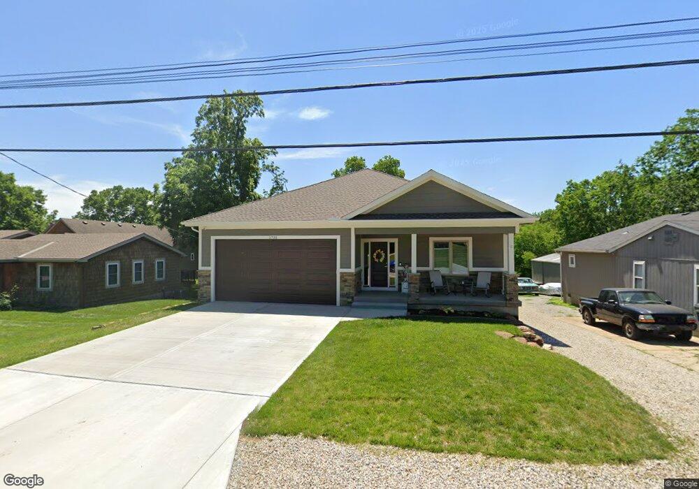
1731 NE Lake Shore Dr Lees Summit, MO 64086
Estimated Value: $587,000 - $915,920
5
Beds
4
Baths
2,712
Sq Ft
$290/Sq Ft
Est. Value
About This Home
This home is located at 1731 NE Lake Shore Dr, Lees Summit, MO 64086 and is currently estimated at $785,980, approximately $289 per square foot. 1731 NE Lake Shore Dr is a home located in Jackson County with nearby schools including Underwood Elementary School, Bernard C. Campbell Middle School, and Lee's Summit North High School.
Ownership History
Date
Name
Owned For
Owner Type
Purchase Details
Closed on
Apr 21, 2023
Sold by
Robert Allen Construction Inc
Bought by
Jones Glenn and Jones Carrie
Current Estimated Value
Home Financials for this Owner
Home Financials are based on the most recent Mortgage that was taken out on this home.
Original Mortgage
$652,726
Outstanding Balance
$632,969
Interest Rate
6.13%
Mortgage Type
New Conventional
Estimated Equity
$153,011
Create a Home Valuation Report for This Property
The Home Valuation Report is an in-depth analysis detailing your home's value as well as a comparison with similar homes in the area
Home Values in the Area
Average Home Value in this Area
Purchase History
| Date | Buyer | Sale Price | Title Company |
|---|---|---|---|
| Jones Glenn | -- | First American Title |
Source: Public Records
Mortgage History
| Date | Status | Borrower | Loan Amount |
|---|---|---|---|
| Open | Jones Glenn | $652,726 |
Source: Public Records
Tax History Compared to Growth
Tax History
| Year | Tax Paid | Tax Assessment Tax Assessment Total Assessment is a certain percentage of the fair market value that is determined by local assessors to be the total taxable value of land and additions on the property. | Land | Improvement |
|---|---|---|---|---|
| 2025 | $10,180 | $187,365 | $30,535 | $156,830 |
| 2024 | $10,106 | $140,980 | $44,766 | $96,214 |
| 2023 | $10,106 | $140,980 | $17,136 | $123,844 |
| 2022 | $2,776 | $34,390 | $20,644 | $13,746 |
| 2021 | $2,834 | $34,390 | $20,644 | $13,746 |
| 2020 | $2,597 | $31,211 | $20,644 | $10,567 |
| 2019 | $2,526 | $31,211 | $20,644 | $10,567 |
| 2018 | $1,873 | $21,476 | $4,397 | $17,079 |
| 2017 | $1,845 | $21,476 | $4,397 | $17,079 |
| 2016 | $1,845 | $20,938 | $4,788 | $16,150 |
| 2014 | $1,925 | $21,413 | $3,724 | $17,689 |
Source: Public Records
Map
Nearby Homes
- 1717 NE Luther Rd
- 1632 NE Stonewood Dr
- 1676 NE Ozark Dr
- 1425 NE Stonewood Dr
- 1424 NE Stonewood Dr
- 1817 NE Burgandy Cir
- 1408 NE Whitestone Dr
- 27008 E Olive Dr
- 27104 E Cedar Grove Dr
- 1400 NE Colbern Rd
- 13507 Woodland Ranch Dr
- 13404 Woodland Ranch Dr
- 13311 Woodland Ranch Dr
- 13511 Woodland Ranch Dr
- 13401 Woodland Ranch Dr
- 1220 NE Hendrix Dr
- 2329 NE Lake Breeze Ln
- The Gunnison IV Plan at Woodland Oaks
- The Modern Gunnison Plan at Woodland Oaks
- The Maplewood III Plan at Woodland Oaks
- 1729 NE Lake Shore Dr
- 1735 NE Lake Shore Dr
- 1725 NE Lake Shore Dr
- 1743 NE Lake Shore Dr
- 1749 NE Lake Shore Dr
- 1739 NE Lake Shore Dr
- 1721 NE Lake Shore Dr
- 12604 S Red Fox St
- 12606 S Burrows St
- 27602 S Red Fox St
- 12703 S Burrows St
- 12607 S Burrows St
- 12617 S Burrows St
- 12711 S Burrows St
- 27606 S Red Fox St
- 27608 S Red Fox St
- 27612 S Red Fox St
- 12603 S Burrows St
- 12711 S Burrows St
- 12611 S Burrows St