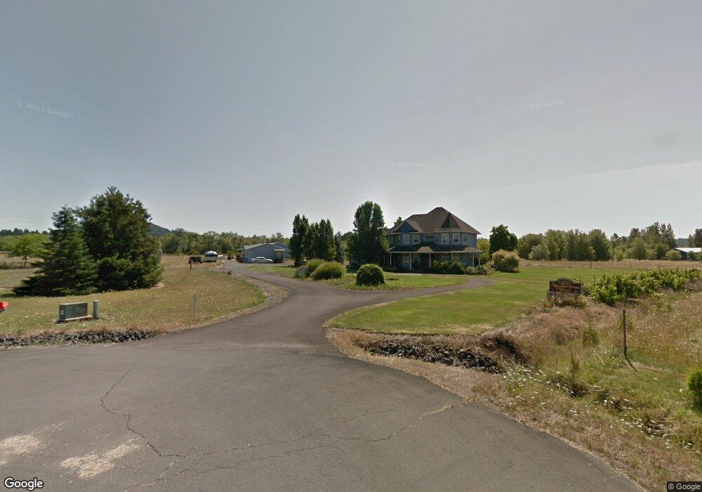
1731 Pheasant Ct Philomath, OR 97370
Estimated Value: $1,282,000 - $1,334,306
5
Beds
5
Baths
4,837
Sq Ft
$270/Sq Ft
Est. Value
About This Home
This home is located at 1731 Pheasant Ct, Philomath, OR 97370 and is currently estimated at $1,308,153, approximately $270 per square foot. 1731 Pheasant Ct is a home located in Benton County with nearby schools including Clemens Primary School, Philomath Elementary School, and Philomath Middle School.
Ownership History
Date
Name
Owned For
Owner Type
Purchase Details
Closed on
Sep 11, 2020
Sold by
Gilson Charles We and Gilson Marcia
Bought by
Gilson Charles W and Gilson Marcia G
Current Estimated Value
Home Financials for this Owner
Home Financials are based on the most recent Mortgage that was taken out on this home.
Original Mortgage
$253,177
Outstanding Balance
$170,406
Interest Rate
2.9%
Mortgage Type
New Conventional
Estimated Equity
$1,137,747
Purchase Details
Closed on
Sep 14, 2015
Sold by
Gilson Charles W and Gilson Marcia G
Bought by
Charles & Marcia Gilson Living Trust
Purchase Details
Closed on
Oct 25, 1989
Bought by
Wells Fargo Home Mortgage Corp
Create a Home Valuation Report for This Property
The Home Valuation Report is an in-depth analysis detailing your home's value as well as a comparison with similar homes in the area
Purchase History
We collect this data history from publicly available records. To have your information removed, we recommend requesting removal directly through your county’s website.
| Date | Buyer | Sale Price | Title Company |
|---|---|---|---|
| Gilson Charles W | -- | Amrock | |
| Gilson Charles W | -- | Amrock | |
| Charles & Marcia Gilson Living Trust | -- | None Available | |
| Wells Fargo Home Mortgage Corp | $27,000 | -- |
Source: Public Records
Mortgage History
We collect this data history from publicly available records. To have your information removed, we recommend requesting removal directly through your county’s website.
| Date | Status | Borrower | Loan Amount |
|---|---|---|---|
| Open | Gilson Charles W | $253,177 |
Source: Public Records
Tax History
| Year | Tax Paid | Tax Assessment Tax Assessment Total Assessment is a certain percentage of the fair market value that is determined by local assessors to be the total taxable value of land and additions on the property. | Land | Improvement |
|---|---|---|---|---|
| 2025 | $12,267 | $813,890 | -- | -- |
| 2024 | $12,267 | $790,184 | -- | -- |
| 2023 | $11,651 | $767,169 | $0 | $0 |
| 2022 | $11,663 | $744,824 | $0 | $0 |
| 2021 | $10,676 | $723,130 | $0 | $0 |
| 2020 | $10,850 | $702,068 | $0 | $0 |
| 2019 | $8,739 | $625,563 | $0 | $0 |
| 2018 | $8,902 | $607,343 | $0 | $0 |
| 2017 | $8,197 | $579,811 | $0 | $0 |
Source: Public Records
Map
Nearby Homes
- 2013 W Hills Rd
- 1753 Wooded Knolls Dr
- 2192 Dawnwood Dr
- 2035 Primrose Loop
- 716 Grouse Place
- 714 Grouse Place
- 769 N 9th St
- 355 N 13th St
- 791 Quail Glenn Dr
- 990 Pippa Ln
- 1717 Main St
- 2148 Main St
- 502 N 8th St Unit 17 St
- 2752 Newton St
- 556 Starlight Way
- 1506 Applegate St
- 317 Vincent St
- 609 Coastal View Dr (Lan
- 815 Applegate St Unit Lot 1
- 815 Applegate St Unit 1 St
- 1741 Pheasant Ct
- 1726 Pheasant Ct
- 1667 Wooded Knolls Dr
- 0 Wooded Knolls Dr
- 1669 Wooded Knolls Dr
- 2093 West Hills Rd
- 2021 W Hills Rd
- 1873 Wooded Knolls Dr
- 1877 W Hills Rd
- 1834 Unassigned Dr
- 2011 West Hills Rd
- 2009 West Hills Rd
- 2009 West Hills Rd
- 1945 West Hills Rd
- 1911 West Hills Rd
- 1736 Wooded Knolls Dr
- 1805 West Hills Rd
- 1618 Bailey St
- 1933 Wooded Knolls Dr
- 1834 Egan Dr
Your Personal Tour Guide
Ask me questions while you tour the home.