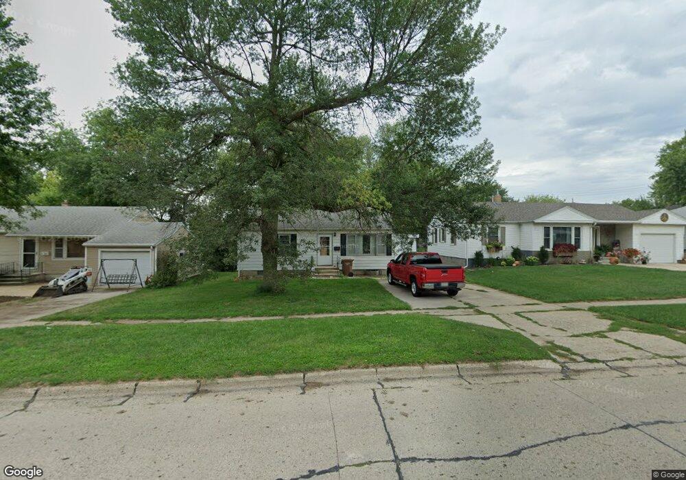
1731 Quint Ave Carroll, IA 51401
Estimated Value: $114,000 - $162,000
2
Beds
2
Baths
816
Sq Ft
$164/Sq Ft
Est. Value
About This Home
This home is located at 1731 Quint Ave, Carroll, IA 51401 and is currently estimated at $133,453, approximately $163 per square foot. 1731 Quint Ave is a home located in Carroll County with nearby schools including Fairview Elementary School, Adams Elementary School, and Carroll Middle School.
Ownership History
Date
Name
Owned For
Owner Type
Purchase Details
Closed on
May 24, 2010
Sold by
Ball Pamela E
Bought by
Holdeman Michael P
Current Estimated Value
Home Financials for this Owner
Home Financials are based on the most recent Mortgage that was taken out on this home.
Original Mortgage
$66,000
Outstanding Balance
$44,432
Interest Rate
5.14%
Mortgage Type
New Conventional
Estimated Equity
$89,021
Purchase Details
Closed on
Dec 27, 2004
Sold by
Deutsche Bank National Trust Co
Bought by
Bates Robert J and Bates Kimberly J
Home Financials for this Owner
Home Financials are based on the most recent Mortgage that was taken out on this home.
Original Mortgage
$34,000
Interest Rate
6%
Mortgage Type
Adjustable Rate Mortgage/ARM
Create a Home Valuation Report for This Property
The Home Valuation Report is an in-depth analysis detailing your home's value as well as a comparison with similar homes in the area
Home Values in the Area
Average Home Value in this Area
Purchase History
| Date | Buyer | Sale Price | Title Company |
|---|---|---|---|
| Holdeman Michael P | $63,500 | None Available | |
| Bates Robert J | $36,000 | None Available |
Source: Public Records
Mortgage History
| Date | Status | Borrower | Loan Amount |
|---|---|---|---|
| Open | Holdeman Michael P | $66,000 | |
| Previous Owner | Bates Robert J | $34,000 |
Source: Public Records
Tax History Compared to Growth
Tax History
| Year | Tax Paid | Tax Assessment Tax Assessment Total Assessment is a certain percentage of the fair market value that is determined by local assessors to be the total taxable value of land and additions on the property. | Land | Improvement |
|---|---|---|---|---|
| 2025 | $1,190 | $99,530 | $20,370 | $79,160 |
| 2024 | $1,166 | $90,710 | $20,370 | $70,340 |
| 2023 | $1,203 | $90,710 | $20,370 | $70,340 |
| 2022 | $1,138 | $78,520 | $17,460 | $61,060 |
| 2021 | $1,138 | $78,520 | $17,460 | $61,060 |
| 2020 | $1,165 | $78,520 | $17,460 | $61,060 |
| 2019 | $1,178 | $78,520 | $17,460 | $61,060 |
| 2018 | $1,110 | $78,520 | $17,460 | $61,060 |
| 2017 | $1,110 | $77,511 | $15,569 | $61,942 |
| 2016 | $1,036 | $72,440 | $0 | $0 |
| 2015 | $1,036 | $69,220 | $0 | $0 |
| 2014 | $980 | $69,220 | $0 | $0 |
Source: Public Records
Map
Nearby Homes
- 631 W 17th St
- 1608 Salinger Ave
- 1852 Quint Ave
- 1810 Crestview Dr
- 711 W 21st St
- 611 W 21st St
- 1306 Simon Ave
- 1509 Birch St
- 219 Windwood Dr
- 907 Salinger Ave
- 1601 N Main St
- 0 E 10th St Unit 5423085
- 0 E 10th St Unit 6324630
- 0 E 10th St Unit 6319081
- 1515 N Main St
- 1320 N Adams St
- 1015 N Adams St
- 1108 N Main St
- 1102 N Main St
- 0 Deer Creek Ln Unit 6302348
- 1733 Quint Ave
- 1725 Quint Ave
- 1737 Quint Ave
- 1719 Quint Ave
- 1738 Salinger Ave
- 1726 Salinger Ave
- 1741 Quint Ave
- 634 Mccoy Dr
- 1713 Quint Ave
- 1732 Salinger Ave
- 1720 Salinger Ave
- 635 Mccoy Dr
- 1714 Salinger Ave
- 1745 Quint Ave
- 1744 Salinger Ave
- 1709 Quint Ave
- 622 Mccoy Dr
- 1748 Quint Ave
- 1710 Salinger Ave
- 717 W 18th St