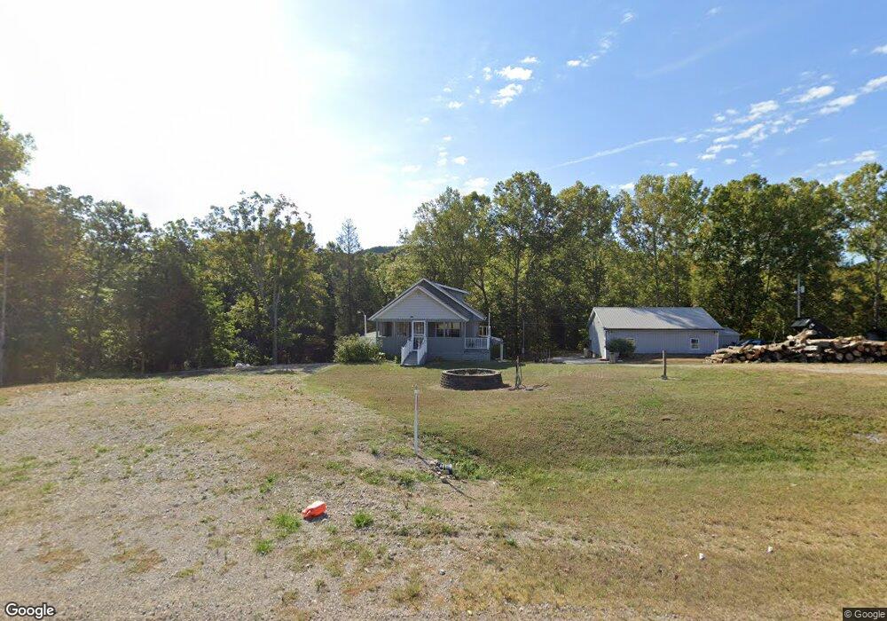
17327 State Route 125 West Union, OH 45693
Estimated Value: $178,369 - $228,000
2
Beds
2
Baths
1,180
Sq Ft
$169/Sq Ft
Est. Value
About This Home
This home is located at 17327 State Route 125, West Union, OH 45693 and is currently estimated at $198,842, approximately $168 per square foot. 17327 State Route 125 is a home located in Adams County with nearby schools including West Union Elementary School and West Union High School.
Ownership History
Date
Name
Owned For
Owner Type
Purchase Details
Closed on
Mar 31, 2017
Sold by
Stapleton Darren and Stapleton Heather A
Bought by
Hayslip Kenneth E
Current Estimated Value
Purchase Details
Closed on
Aug 18, 2016
Sold by
Hayslip Kenneth E
Bought by
Stapleton Darren and Stapleton Heather A
Purchase Details
Closed on
Jan 1, 1990
Bought by
Hayslip Kenneth E
Create a Home Valuation Report for This Property
The Home Valuation Report is an in-depth analysis detailing your home's value as well as a comparison with similar homes in the area
Home Values in the Area
Average Home Value in this Area
Purchase History
| Date | Buyer | Sale Price | Title Company |
|---|---|---|---|
| Hayslip Kenneth E | -- | None Available | |
| Stapleton Darren | -- | None Available | |
| Hayslip Eric | $2,500 | None Available | |
| Hayslip Kenneth E | -- | -- |
Source: Public Records
Tax History Compared to Growth
Tax History
| Year | Tax Paid | Tax Assessment Tax Assessment Total Assessment is a certain percentage of the fair market value that is determined by local assessors to be the total taxable value of land and additions on the property. | Land | Improvement |
|---|---|---|---|---|
| 2024 | $897 | $37,100 | $3,710 | $33,390 |
| 2023 | $927 | $37,100 | $3,710 | $33,390 |
| 2022 | $931 | $33,600 | $2,730 | $30,870 |
| 2021 | $885 | $33,600 | $2,730 | $30,870 |
| 2020 | $905 | $33,600 | $2,730 | $30,870 |
| 2019 | $905 | $33,600 | $2,730 | $30,870 |
| 2018 | $703 | $28,460 | $2,730 | $25,730 |
| 2017 | $691 | $28,460 | $2,730 | $25,730 |
| 2016 | $886 | $34,030 | $3,890 | $30,140 |
| 2015 | $767 | $31,400 | $3,990 | $27,410 |
| 2014 | $767 | $31,400 | $3,990 | $27,410 |
Source: Public Records
Map
Nearby Homes
- 1460 Hamilton Rd
- 1186 Tulip Rd
- 189 Hamilton Rd
- 598 Ohio 348
- 858 Randalls Run Rd
- 2603 Cassel Run Rd
- 1011 Hafer Rd
- 1064 Hafer Rd
- 1805 Waggoner Riffle Rd
- 467 Waggoner Riffle Rd
- 0 Blue Creek Rd
- 4702 Brush Creek Rd
- 3380 Blue Creek Rd
- 7851 Ohio 348
- 2030 Cedar Mills Rd
- 0 Coon Hollow Rd Unit 947967
- 2316 White Oak Rd
- 2314 White Oak Rd
- 8.307 Ac Churn Creek Rd
- 9 Coon Hollow Rd
- 17327 State Route 125
- 17397 State Route 125
- 965 Lynx Dr
- 979 Lynx Dr
- 976 Lynx Dr
- 17453 State Route 125
- 30 Ott Grooms Rd
- 885 Lynx Dr
- 17499 St Rt 125
- 17499 State Route 125
- 17499 Sr 125
- 17177 State Route 125
- 17177 State Route 125
- 898 Lynx Dr
- 17523 State Route 125
- 17141 State Route 125
- 17297 State Route 125
- 850 Lynx Dr
- 90 Ott Grooms Rd
- 828 Lynx Dr