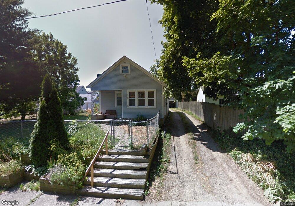
1733 Commonwealth Ave Kalamazoo, MI 49006
Westwood NeighborhoodEstimated Value: $189,000 - $210,000
3
Beds
1
Bath
1,204
Sq Ft
$166/Sq Ft
Est. Value
About This Home
This home is located at 1733 Commonwealth Ave, Kalamazoo, MI 49006 and is currently estimated at $199,823, approximately $165 per square foot. 1733 Commonwealth Ave is a home located in Kalamazoo County with nearby schools including Northglade Montessori School, Hillside Middle School, and Kalamazoo Central High School.
Ownership History
Date
Name
Owned For
Owner Type
Purchase Details
Closed on
Dec 30, 2008
Sold by
Przeslawski Michael and Przeslawski Kristen
Bought by
Hoag Caitlin E
Current Estimated Value
Home Financials for this Owner
Home Financials are based on the most recent Mortgage that was taken out on this home.
Original Mortgage
$65,100
Outstanding Balance
$43,043
Interest Rate
6.06%
Mortgage Type
Purchase Money Mortgage
Estimated Equity
$156,780
Purchase Details
Closed on
Sep 9, 2004
Sold by
Phee Robin M and Phee Thomas G
Bought by
Przeslawski Michael and Przeslawski Kristen
Create a Home Valuation Report for This Property
The Home Valuation Report is an in-depth analysis detailing your home's value as well as a comparison with similar homes in the area
Home Values in the Area
Average Home Value in this Area
Purchase History
| Date | Buyer | Sale Price | Title Company |
|---|---|---|---|
| Hoag Caitlin E | $93,000 | Chicago Title | |
| Przeslawski Michael | $107,000 | Metropolitan |
Source: Public Records
Mortgage History
| Date | Status | Borrower | Loan Amount |
|---|---|---|---|
| Open | Hoag Caitlin E | $65,100 |
Source: Public Records
Tax History Compared to Growth
Tax History
| Year | Tax Paid | Tax Assessment Tax Assessment Total Assessment is a certain percentage of the fair market value that is determined by local assessors to be the total taxable value of land and additions on the property. | Land | Improvement |
|---|---|---|---|---|
| 2025 | $2,689 | $89,500 | $0 | $0 |
| 2024 | $518 | $82,900 | $0 | $0 |
| 2023 | $494 | $72,600 | $0 | $0 |
| 2022 | $2,444 | $65,400 | $0 | $0 |
| 2021 | $2,292 | $58,500 | $0 | $0 |
| 2020 | $2,256 | $53,200 | $0 | $0 |
| 2019 | $2,156 | $48,300 | $0 | $0 |
| 2018 | $2,102 | $43,200 | $0 | $0 |
| 2017 | $0 | $43,200 | $0 | $0 |
| 2016 | -- | $41,600 | $0 | $0 |
| 2015 | -- | $41,200 | $0 | $0 |
| 2014 | -- | $38,800 | $0 | $0 |
Source: Public Records
Map
Nearby Homes
- 1709 Jefferson Ave
- 1605 W North St
- 2010 Commonwealth Ave
- 1455 W North St
- 204 Nelson Ave
- 1416 Forbes St
- 426 Pinehurst Blvd
- 629 Jefferson Place
- 1338 Summit Ave
- 115 Monroe St
- 1332 Summit Ave
- 1108 Warren Place
- 2306 Kenwood St
- 613 Summer St
- 204 Monroe St
- 1209 Grand Ave
- 1206 Summit Ave
- 1117 Cadillac St
- 1121 Douglas Ave
- 150 Carberry Hill Ct Unit C
- 422 N Berkley St
- 417 N Arlington St
- 425 N Arlington St
- 426 N Berkley St
- 415 N Arlington St
- 1728 Commonwealth Ave
- 412 N Berkley St
- 30 N Berkley St
- 0 N Berkley St
- 522524 N Berkley St
- 514516 N Berkley St
- 1744 Commonwealth Ave
- 1738 Commonwealth Ave
- 1732 Commonwealth Ave
- 1722 W Main St
- 1726 Commonwealth Ave Unit 172628
- 425 N Berkley St
- 419 N Berkley St
- 444 N Berkley St
- 426 N Arlington St