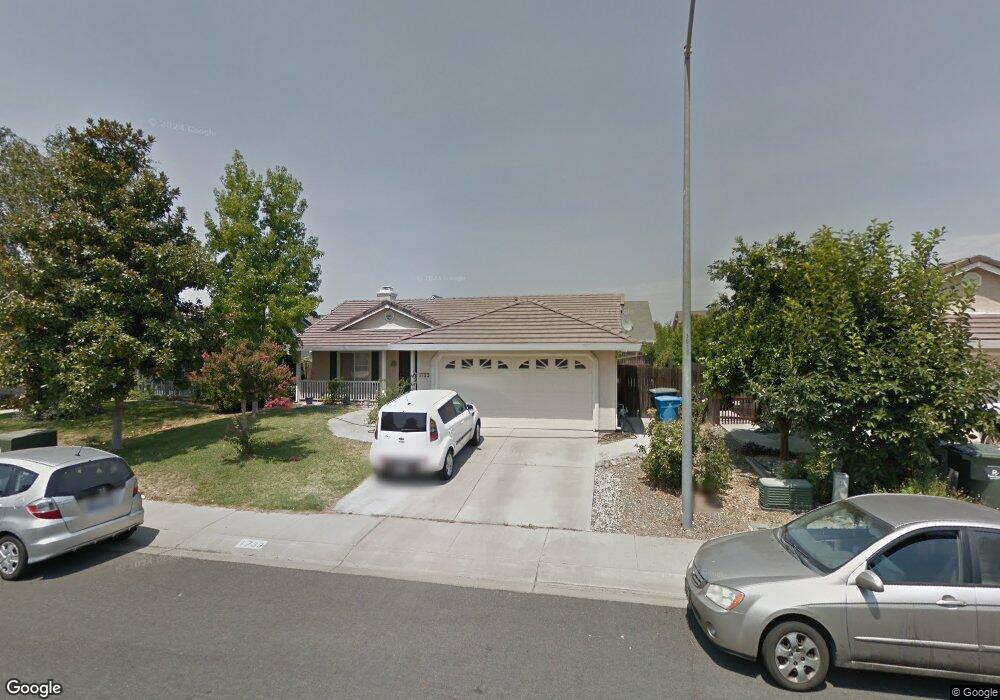
1733 Michelle Dr Yuba City, CA 95993
Estimated Value: $348,000 - $414,000
3
Beds
2
Baths
1,397
Sq Ft
$279/Sq Ft
Est. Value
About This Home
This home is located at 1733 Michelle Dr, Yuba City, CA 95993 and is currently estimated at $389,691, approximately $278 per square foot. 1733 Michelle Dr is a home located in Sutter County with nearby schools including Andros Karperos, River Valley High School, and St. Isidore Catholic School.
Ownership History
Date
Name
Owned For
Owner Type
Purchase Details
Closed on
Dec 5, 2024
Sold by
Bonds Larry and Bonds Wendy L
Bought by
Bonds Larry E and Bonds Wendy L
Current Estimated Value
Purchase Details
Closed on
Sep 22, 2004
Sold by
Basi Raman Jote and Basi Baljinder
Bought by
Bonds Larry
Home Financials for this Owner
Home Financials are based on the most recent Mortgage that was taken out on this home.
Original Mortgage
$196,000
Interest Rate
5.77%
Mortgage Type
Purchase Money Mortgage
Purchase Details
Closed on
May 5, 2004
Sold by
Basi Sadhu Singh and Basi Charan Kaur
Bought by
Basi Raman Jote and Basi Baljinder
Home Financials for this Owner
Home Financials are based on the most recent Mortgage that was taken out on this home.
Original Mortgage
$150,000
Interest Rate
5.38%
Mortgage Type
Seller Take Back
Create a Home Valuation Report for This Property
The Home Valuation Report is an in-depth analysis detailing your home's value as well as a comparison with similar homes in the area
Home Values in the Area
Average Home Value in this Area
Purchase History
| Date | Buyer | Sale Price | Title Company |
|---|---|---|---|
| Bonds Larry E | -- | None Listed On Document | |
| Bonds Family 2024 Trust | -- | None Listed On Document | |
| Bonds Larry E | -- | None Listed On Document | |
| Bonds Larry | $245,000 | North State Title Company | |
| Basi Raman Jote | $180,000 | Placer Title Company |
Source: Public Records
Mortgage History
| Date | Status | Borrower | Loan Amount |
|---|---|---|---|
| Previous Owner | Bonds Larry | $196,000 | |
| Previous Owner | Basi Raman Jote | $150,000 |
Source: Public Records
Tax History Compared to Growth
Tax History
| Year | Tax Paid | Tax Assessment Tax Assessment Total Assessment is a certain percentage of the fair market value that is determined by local assessors to be the total taxable value of land and additions on the property. | Land | Improvement |
|---|---|---|---|---|
| 2025 | $4,263 | $341,491 | $104,533 | $236,958 |
| 2024 | $4,263 | $334,796 | $102,484 | $232,312 |
| 2023 | $4,263 | $328,232 | $100,475 | $227,757 |
| 2022 | $4,123 | $321,797 | $98,505 | $223,292 |
| 2021 | $4,065 | $315,501 | $96,582 | $218,919 |
| 2020 | $3,762 | $288,000 | $85,000 | $203,000 |
| 2019 | $3,566 | $270,000 | $75,000 | $195,000 |
| 2018 | $3,243 | $240,000 | $60,000 | $180,000 |
| 2017 | $3,068 | $225,000 | $60,000 | $165,000 |
| 2016 | $2,910 | $210,000 | $55,000 | $155,000 |
| 2015 | $2,868 | $205,000 | $50,000 | $155,000 |
| 2014 | $2,559 | $175,000 | $40,000 | $135,000 |
Source: Public Records
Map
Nearby Homes
- 170 Nantucket Way
- 152 College Hill Way
- 1665 Michelle Dr
- 138 Nantucket Way
- 238 Anita Way
- 156 Bristol Way
- 1781 Franklin Rd Unit 36
- 1781 Franklin Rd Unit 59
- 1955 Jason Ct
- 1514 Countryside Dr
- 1571 Holly Tree Dr
- 1545 Camino Del Oro
- 430 Neil Dr
- 683 Mark Thomas Dr
- 1344 Kean Ave
- 1330 Kean Ave
- 1421 Richland Rd
- 955 Carson Dr
- 1196 Hunn Rd
- 353 N Lawrence Ave
- 1725 Michelle Dr
- 1720 Barrington Dr Unit 30
- 1720 Barrington Dr
- 1726 Barrington Dr
- 1714 Barrington Dr Unit 1
- 1714 Barrington Dr
- 1717 Michelle Dr
- 1732 Barrington Dr
- 1747 Michelle Dr
- 1708 Barrington Dr
- 1732 Michelle Dr
- 1738 Michelle Dr
- 1720 Michelle Dr
- 1738 Barrington Dr
- 1702 Barrington Dr
- 1707 Michelle Dr
- 1712 Michelle Dr
- 1746 Michelle Dr
- 192 College Hill Way Unit 39
- 192 College Hill Way