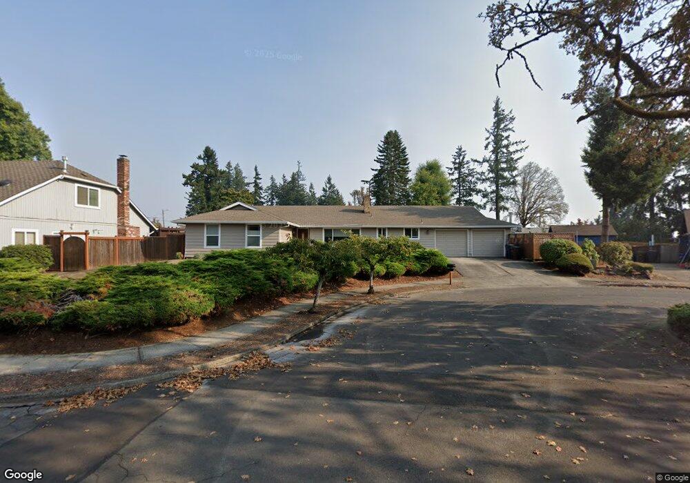
17330 Timothy Way Gladstone, OR 97027
Estimated Value: $562,000 - $629,000
3
Beds
3
Baths
2,196
Sq Ft
$266/Sq Ft
Est. Value
About This Home
This home is located at 17330 Timothy Way, Gladstone, OR 97027 and is currently estimated at $583,912, approximately $265 per square foot. 17330 Timothy Way is a home located in Clackamas County with nearby schools including John Wetten Elementary School, Walter L Kraxberger Middle School, and Gladstone High School.
Ownership History
Date
Name
Owned For
Owner Type
Purchase Details
Closed on
Mar 5, 2020
Sold by
Gilroy Julia I
Bought by
Gilroy Julia I and The Julia I Gilroy Trust
Current Estimated Value
Purchase Details
Closed on
Mar 28, 2006
Sold by
Estate Of Norma J Brown
Bought by
Gilroy Julia I
Home Financials for this Owner
Home Financials are based on the most recent Mortgage that was taken out on this home.
Original Mortgage
$252,000
Outstanding Balance
$142,286
Interest Rate
6.25%
Mortgage Type
Fannie Mae Freddie Mac
Estimated Equity
$441,626
Create a Home Valuation Report for This Property
The Home Valuation Report is an in-depth analysis detailing your home's value as well as a comparison with similar homes in the area
Home Values in the Area
Average Home Value in this Area
Purchase History
| Date | Buyer | Sale Price | Title Company |
|---|---|---|---|
| Gilroy Julia I | -- | None Available | |
| Gilroy Julia I | $315,000 | Transnation Title Agency Or |
Source: Public Records
Mortgage History
| Date | Status | Borrower | Loan Amount |
|---|---|---|---|
| Open | Gilroy Julia I | $252,000 |
Source: Public Records
Tax History Compared to Growth
Tax History
| Year | Tax Paid | Tax Assessment Tax Assessment Total Assessment is a certain percentage of the fair market value that is determined by local assessors to be the total taxable value of land and additions on the property. | Land | Improvement |
|---|---|---|---|---|
| 2025 | $6,755 | $335,271 | -- | -- |
| 2024 | $6,568 | $325,506 | -- | -- |
| 2023 | $6,568 | $316,026 | $0 | $0 |
| 2022 | $6,108 | $306,822 | $0 | $0 |
| 2021 | $5,883 | $297,886 | $0 | $0 |
| 2020 | $5,743 | $289,210 | $0 | $0 |
| 2019 | $5,677 | $280,787 | $0 | $0 |
| 2018 | $5,470 | $272,609 | $0 | $0 |
| 2017 | $5,307 | $264,669 | $0 | $0 |
| 2016 | $5,132 | $256,960 | $0 | $0 |
| 2015 | $4,963 | $249,476 | $0 | $0 |
| 2014 | $4,829 | $242,210 | $0 | $0 |
Source: Public Records
Map
Nearby Homes
- 7655 Ridgewood Dr
- 17542 Kirkwood Rd
- 16981 Stanhelma Dr
- 7693 SE Strawberry Ln
- 17900 Monticello Dr
- 17520 SE 82nd Dr
- 17485 Monticello Dr
- 16981 SE 80th Place
- 16743 SE Knoll Ridge Terrace
- 17125 SE 82nd Dr Unit 62
- 8230 SE Poppy St
- 16510 SE 81st Ave
- 16705 SE Kingsridge Ct
- 575 Collins Crest St
- 16261 SE 79th Ave
- 1065 Columbia Ave
- 16260 SE 79th Ave
- 16251 SE 84th Ave
- 8434 SE Heritage Ct Unit 19
- 18300 Scott Ct
- 17320 Timothy Way
- 17340 Timothy Way
- 8122 Cox Ln
- 17555 Kirkwood St
- 17595 Kirkwood St
- 17310 Timothy Way
- 17335 Timothy Way
- 17345 Timothy Way
- 7610 Charolais Ct
- 8117 Cox Ln
- 17547 Kirkwood St
- 17344 Timothy Way
- 17621 Kirkwood St
- 8133 Cox Ln
- 17350 Timothy Way
- 17300 Timothy Way
- 7590 Springhill Dr
- 7625 Charolais Ct
- 7600 Springhill Dr
- 7608 Charolais Ct