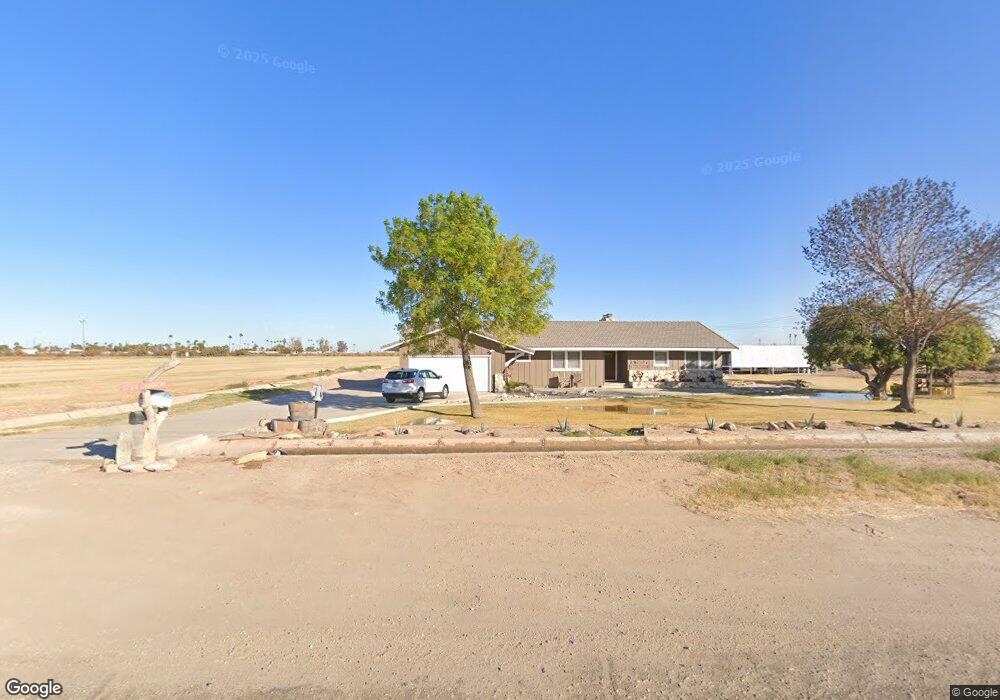
1734 Cannon Rd El Centro, CA 92243
Estimated Value: $374,805 - $577,000
Studio
--
Bath
2,259
Sq Ft
$225/Sq Ft
Est. Value
About This Home
This home is located at 1734 Cannon Rd, El Centro, CA 92243 and is currently estimated at $508,935, approximately $225 per square foot. 1734 Cannon Rd is a home located in Imperial County with nearby schools including Meadows Elementary School, Central Union High School, and Christ Community.
Ownership History
Date
Name
Owned For
Owner Type
Purchase Details
Closed on
Sep 1, 2022
Sold by
Lamoreaux Melvin
Bought by
Lamoreaux Family Trust
Current Estimated Value
Purchase Details
Closed on
Jun 4, 2002
Sold by
Lamoreaux Margo Lea
Bought by
Lamoreaux Melvin and Lamoreaux Margo Lea
Home Financials for this Owner
Home Financials are based on the most recent Mortgage that was taken out on this home.
Original Mortgage
$25,000
Interest Rate
4.75%
Mortgage Type
Credit Line Revolving
Purchase Details
Closed on
Jun 5, 2000
Sold by
Lamoreaux Melvin Leon
Bought by
Lamoreaux Margo Lea
Create a Home Valuation Report for This Property
The Home Valuation Report is an in-depth analysis detailing your home's value as well as a comparison with similar homes in the area
Purchase History
| Date | Buyer | Sale Price | Title Company |
|---|---|---|---|
| Lamoreaux Family Trust | -- | -- | |
| Lamoreaux Melvin | -- | -- | |
| Lamoreaux Margo Lea | -- | -- |
Source: Public Records
Mortgage History
| Date | Status | Borrower | Loan Amount |
|---|---|---|---|
| Previous Owner | Lamoreaux Melvin | $25,000 |
Source: Public Records
Tax History
| Year | Tax Paid | Tax Assessment Tax Assessment Total Assessment is a certain percentage of the fair market value that is determined by local assessors to be the total taxable value of land and additions on the property. | Land | Improvement |
|---|---|---|---|---|
| 2025 | $1,434 | $129,708 | $43,220 | $86,488 |
| 2023 | $1,434 | $124,674 | $41,543 | $83,131 |
| 2022 | $1,389 | $122,230 | $40,729 | $81,501 |
| 2021 | $1,380 | $119,834 | $39,931 | $79,903 |
| 2020 | $1,407 | $118,606 | $39,522 | $79,084 |
| 2019 | $1,396 | $116,282 | $38,748 | $77,534 |
| 2018 | $1,378 | $114,003 | $37,989 | $76,014 |
| 2017 | $1,278 | $111,769 | $37,245 | $74,524 |
| 2014 | $1,183 | $105,820 | $35,263 | $70,557 |
Source: Public Records
Map
Nearby Homes
- 1817 S Dogwood Rd
- 1859 Dogwood Rd
- 1803 S Dogwood Rd
- 3924 S Dogwood Rd
- 1887 S Dogwood Rd
- 1859 S Dogwood Rd
- 1998 S Dogwood Rd
- 0 W Mineo Ave
- 280 E Aurora Dr
- 105 E Ross Ave
- 427 E Ross Ave
- 376 E Heil Ave
- 371 E Ross Ave
- 471 E State St
- 102 Danenberg Dr
- 1004 S 1st St
- 108 W Holt Ave
- 121 Danenberg Dr
- 241 W Danenberg Dr
- 1953 Bowker Rd
- 350 E Dealwood Rd Unit 370
- 297 E Grafton Rd
- 303 E Grafton Rd Unit 305
- 303 E Grafton Rd
- 349 E Grafton Rd
- 355 E Grafton Rd
- 1655 Lollie Ln
- 300 E Ross Rd
- 298 E Ross Rd
- 1654 Lollie Ln
- 295 E Ross Rd
- 304 E Ross Rd
- 375 E Ross Rd Unit 23
- 375 E Ross Rd Unit 611
- 375 E Ross Rd Unit 21
- 270 E Ross Rd
- 266 E Ross Rd
- 1748 Singh Rd
- 260 E Ross Rd
- 240 E Ross Rd
Your Personal Tour Guide
Ask me questions while you tour the home.