Estimated Value: $982,000 - $1,096,000
--
Bed
1
Bath
4,897
Sq Ft
$211/Sq Ft
Est. Value
About This Home
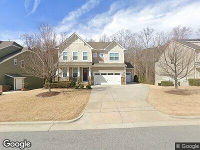
This home is located at 1734 Pershore Dr, Apex, NC 27502 and is currently estimated at $1,035,225, approximately $211 per square foot. 1734 Pershore Dr is a home with nearby schools including Apex Elementary, Apex Middle, and Apex Friendship High School.
Ownership History
Date
Name
Owned For
Owner Type
Purchase Details
Closed on
May 18, 2016
Sold by
Standard Pacific Of The Carolinas Llc
Bought by
Everhart Richard Thomas and Everhart Evon Lynn
Current Estimated Value
Home Financials for this Owner
Home Financials are based on the most recent Mortgage that was taken out on this home.
Original Mortgage
$513,554
Outstanding Balance
$417,747
Interest Rate
3.59%
Mortgage Type
New Conventional
Estimated Equity
$601,317
Create a Home Valuation Report for This Property
The Home Valuation Report is an in-depth analysis detailing your home's value as well as a comparison with similar homes in the area
Home Values in the Area
Average Home Value in this Area
Purchase History
| Date | Buyer | Sale Price | Title Company |
|---|---|---|---|
| Everhart Richard Thomas | $571,000 | None Available |
Source: Public Records
Mortgage History
| Date | Status | Borrower | Loan Amount |
|---|---|---|---|
| Open | Everhart Richard Thomas | $513,554 |
Source: Public Records
Tax History Compared to Growth
Tax History
| Year | Tax Paid | Tax Assessment Tax Assessment Total Assessment is a certain percentage of the fair market value that is determined by local assessors to be the total taxable value of land and additions on the property. | Land | Improvement |
|---|---|---|---|---|
| 2024 | $7,140 | $834,200 | $160,000 | $674,200 |
| 2023 | $6,333 | $575,461 | $90,000 | $485,461 |
| 2022 | $5,944 | $575,461 | $90,000 | $485,461 |
| 2021 | $5,717 | $575,461 | $90,000 | $485,461 |
| 2020 | $5,660 | $575,461 | $90,000 | $485,461 |
| 2019 | $6,059 | $531,768 | $80,000 | $451,768 |
| 2018 | $5,707 | $531,768 | $80,000 | $451,768 |
| 2017 | $5,311 | $531,768 | $80,000 | $451,768 |
| 2016 | $1,257 | $128,176 | $80,000 | $48,176 |
Source: Public Records
Map
Nearby Homes
- 1840 Flint Valley Ln
- 1527 Ingraham Dr
- 2008 Stanwood Dr
- 1848 Poe Farm Ave
- 1701 Bodwin Ln
- 1557 Tice Hurst Ln
- 1888 Sweet Gardenia Way
- 1764 Yellow Bloom Trail
- 1102 Whiston Dr
- 1742 Aspen River Ln
- 1755 Night Sky Trail Unit 141
- 1739 Aspen River Ln
- 1751 Night Sky Trail
- 1759 Barrett Run Trail
- 1755 Barrett Run Trail Unit 213
- 1429 Wragby Ln
- 1680 Mint River Dr
- 345 Anterbury Dr
- 116 Anterbury Dr
- 204 Sugarland Dr
- 1734 Pershore Dr
- 1738 Pershore Dr
- 1730 Pershore Dr
- 1742 Pershore Dr
- 1726 Pershore Dr
- 1735 Pershore Dr
- 1739 Pershore Dr
- 1729 Pershore Dr
- 1743 Pershore Dr
- 1722 Pershore Dr
- 1723 Pershore Dr
- 1890 Flint Valley Ln
- 1886 Flint Valley Ln
- 1718 Pershore Dr
- 1715 Pershore Dr
- 1894 Flint Valley Ln
- 1882 Flint Valley Ln
- 1878 Flint Valley Ln
- 1714 Pershore Dr
- 1900 Flint Valley Ln