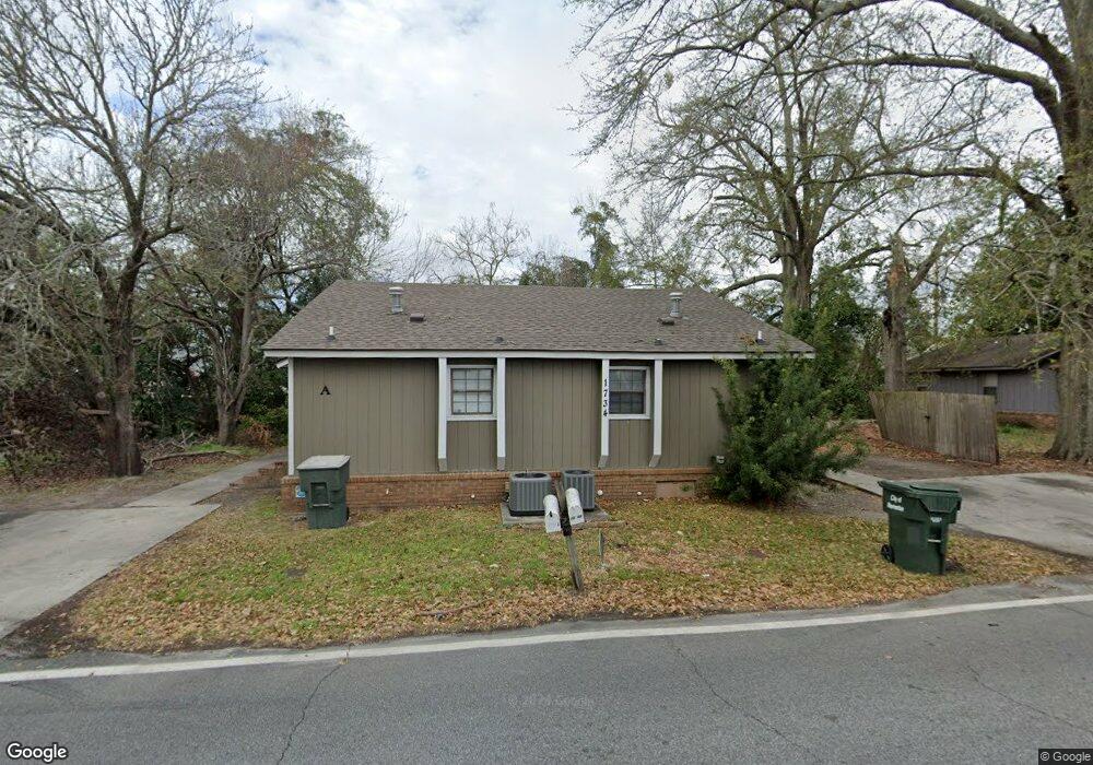
1734 Poplar St Unit A&B Valdosta, GA 31601
Estimated Value: $119,000 - $193,000
2
Beds
2
Baths
1,440
Sq Ft
$101/Sq Ft
Est. Value
About This Home
This home is located at 1734 Poplar St Unit A&B, Valdosta, GA 31601 and is currently estimated at $145,901, approximately $101 per square foot. 1734 Poplar St Unit A&B is a home located in Lowndes County with nearby schools including Westside Elementary School, Hahira Middle School, and Lowndes High School.
Ownership History
Date
Name
Owned For
Owner Type
Purchase Details
Closed on
Aug 14, 2018
Sold by
Mid Town Partners Llc
Bought by
Wpm Properties Llc
Current Estimated Value
Purchase Details
Closed on
Mar 8, 2013
Sold by
Suemar Properties Llc
Bought by
Mid Town Partners Llc
Purchase Details
Closed on
Oct 24, 2011
Sold by
Duke Murray W
Bought by
Suemar Properties Llc
Purchase Details
Closed on
Aug 7, 2006
Sold by
Mid Town Partners Llc
Bought by
Duke Murray W
Purchase Details
Closed on
Aug 1, 2005
Sold by
Dean David M
Bought by
Mid Town Partners Llc
Purchase Details
Closed on
Feb 17, 1986
Bought by
Dean David M
Create a Home Valuation Report for This Property
The Home Valuation Report is an in-depth analysis detailing your home's value as well as a comparison with similar homes in the area
Home Values in the Area
Average Home Value in this Area
Purchase History
| Date | Buyer | Sale Price | Title Company |
|---|---|---|---|
| Wpm Properties Llc | $289,000 | -- | |
| Mid Town Partners Llc | $471,000 | -- | |
| Suemar Properties Llc | -- | -- | |
| Duke Murray W | $500,500 | -- | |
| Mid Town Partners Llc | $62,273 | -- | |
| Dean David M | -- | -- |
Source: Public Records
Tax History Compared to Growth
Tax History
| Year | Tax Paid | Tax Assessment Tax Assessment Total Assessment is a certain percentage of the fair market value that is determined by local assessors to be the total taxable value of land and additions on the property. | Land | Improvement |
|---|---|---|---|---|
| 2024 | $1,815 | $33,724 | $5,604 | $28,120 |
| 2023 | $1,786 | $33,724 | $5,604 | $28,120 |
| 2022 | $958 | $25,254 | $5,604 | $19,650 |
| 2021 | $987 | $25,254 | $5,604 | $19,650 |
| 2020 | $847 | $25,254 | $5,604 | $19,650 |
| 2019 | $854 | $25,254 | $5,604 | $19,650 |
| 2018 | $865 | $25,254 | $5,604 | $19,650 |
| 2017 | $878 | $25,254 | $5,604 | $19,650 |
| 2016 | $880 | $25,254 | $5,604 | $19,650 |
| 2015 | -- | $25,254 | $5,604 | $19,650 |
| 2014 | $855 | $29,830 | $5,604 | $24,226 |
Source: Public Records
Map
Nearby Homes
- 1911 Baytree Place
- 1337 Edgewood Dr
- 1533 Woodard St Unit n/a
- 1331B Edgewood Dr Unit B
- 1331A Edgewood Dr Unit A
- 1792 Wayland Park Dr
- 1811 Canterbury Dr
- 1526 Woodard St
- 1793 Wayland Park Dr
- 1522 Woodard St
- 1205 Mcree Dr
- 1197 Jo Ree St
- 1196 Mcarthur Dr
- 1196 Mcarthur Dr Unit all
- 2106 Jerry Jones Dr
- 817 W Cranford Ave
- 2105 Jerry Jones Dr
- 503 Roberts St
- 1003 Ridgewood Dr
- 931 Ridgewood Dr
- *** Dean Ln Unit 3unit
- 1736 Poplar St
- 1736 Poplar St Unit A&B
- 1531 Myrtle St
- 1532 Myrtle St
- 1732 Poplar St Unit 2
- 1801 Plum St
- 1705 Poplar St
- 726 Poplar St
- 0 Poplar St
- 1530 Myrtle St
- 1735 Poplar St Unit A&B
- 411 Pullman St
- 1725 Poplar St
- 1903 Baytree Place
- 1737 Poplar St Unit A&B
- 1528 Myrtle St
- 1402 Strickland Cir
- 1802 Plum St
- 1600 Victory St