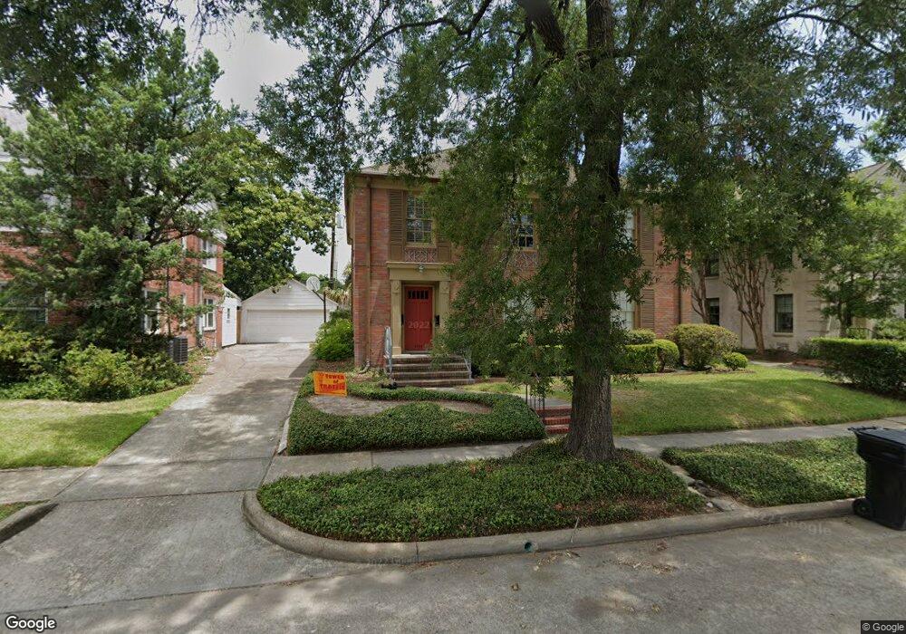
1734 Wroxton Ct Unit 1 Houston, TX 77005
University Place NeighborhoodEstimated Value: $728,000 - $1,002,353
2
Beds
1
Bath
1,338
Sq Ft
$650/Sq Ft
Est. Value
About This Home
This home is located at 1734 Wroxton Ct Unit 1, Houston, TX 77005 and is currently estimated at $869,838, approximately $650 per square foot. 1734 Wroxton Ct Unit 1 is a home located in Harris County with nearby schools including Poe Elementary School, Lanier Middle School, and Lamar High School.
Ownership History
Date
Name
Owned For
Owner Type
Purchase Details
Closed on
Apr 21, 2023
Sold by
Donald & Victoria Verplancken Bypass Tru
Bought by
Fernandez Jose Jessica and Fernandez Fernando
Current Estimated Value
Purchase Details
Closed on
Nov 25, 2019
Sold by
Verplancken Donald J and Verplancken Donald
Bought by
Verplancken Donald J and Verplancken Donald
Purchase Details
Closed on
Dec 31, 1998
Sold by
Verplancken Donald J and Negrelli Victoria A
Bought by
Verplancken Donald J and Verplancken Victoria A
Create a Home Valuation Report for This Property
The Home Valuation Report is an in-depth analysis detailing your home's value as well as a comparison with similar homes in the area
Home Values in the Area
Average Home Value in this Area
Purchase History
| Date | Buyer | Sale Price | Title Company |
|---|---|---|---|
| Fernandez Jose Jessica | -- | Chicago Title | |
| Verplancken Donald J | -- | None Available | |
| Verplancken Donald J | -- | -- |
Source: Public Records
Tax History Compared to Growth
Tax History
| Year | Tax Paid | Tax Assessment Tax Assessment Total Assessment is a certain percentage of the fair market value that is determined by local assessors to be the total taxable value of land and additions on the property. | Land | Improvement |
|---|---|---|---|---|
| 2025 | $14,123 | $675,000 | $657,500 | $17,500 |
| 2024 | $14,123 | $675,000 | $657,500 | $17,500 |
| 2023 | $14,385 | $713,985 | $657,500 | $56,485 |
| 2022 | $15,554 | $706,397 | $657,500 | $48,897 |
| 2021 | $16,238 | $696,716 | $657,500 | $39,216 |
| 2020 | $16,872 | $696,716 | $657,500 | $39,216 |
| 2019 | $17,770 | $702,264 | $657,500 | $44,764 |
| 2018 | $17,737 | $700,963 | $657,500 | $43,463 |
| 2017 | $17,724 | $700,963 | $657,500 | $43,463 |
| 2016 | $17,724 | $700,963 | $657,500 | $43,463 |
| 2015 | $13,232 | $700,963 | $657,500 | $43,463 |
| 2014 | $13,232 | $514,722 | $473,400 | $41,322 |
Source: Public Records
Map
Nearby Homes
- 1723 Albans Rd
- 1700 Sunset Blvd Unit E
- 1832 Albans Rd
- 5309 Cherokee St
- 1801 Sunset Blvd
- 1723 Sunset Blvd
- 1804 Bolsover St
- 5319 Mandell St
- 1723 Milford St
- 1928 Dunstan Rd
- 1741 Banks St
- 1819 Banks St
- 1656 Banks St
- 1531 Milford St
- 2042 Bissonnet St
- 2039 South Blvd
- 2114 Wroxton Rd
- 2016 Milford St
- 2122 Wroxton Rd
- 1624 Vassar St
- 1734 Wroxton Ct
- 1736 Wroxton Ct
- 1730 Wroxton Ct
- 5310 Southampton Estate
- 1740 Wroxton Ct
- 1726 Wroxton Ct
- 1731 Wroxton Ct
- 1737 Wroxton Ct
- 1729 Wroxton Ct
- 1729 Wroxton Ct Unit B
- 1729 Wroxton Ct Unit A
- 5306 Southampton Estate
- 1746 Wroxton Ct
- 1741 Wroxton Ct
- 1725 Wroxton Ct
- 1724 Wroxton Ct
- 5304 Southampton Estate
- 5311 Southampton Estate
- 1747 Wroxton Ct
- 1747 Wroxton Ct Unit 6