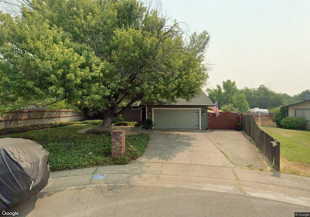
1735 Hawthorne Ct Redding, CA 96002
Mistletoe NeighborhoodEstimated Value: $279,583 - $321,000
3
Beds
2
Baths
1,310
Sq Ft
$230/Sq Ft
Est. Value
About This Home
This home is located at 1735 Hawthorne Ct, Redding, CA 96002 and is currently estimated at $300,646, approximately $229 per square foot. 1735 Hawthorne Ct is a home located in Shasta County with nearby schools including Mistletoe Elementary School, Enterprise High School, and Bethel Christian School.
Ownership History
Date
Name
Owned For
Owner Type
Purchase Details
Closed on
Jul 24, 2000
Sold by
U S Bank National Assn
Bought by
Clements Will and Griswould Clements Jamie
Current Estimated Value
Home Financials for this Owner
Home Financials are based on the most recent Mortgage that was taken out on this home.
Original Mortgage
$61,600
Outstanding Balance
$21,996
Interest Rate
8.2%
Estimated Equity
$278,650
Purchase Details
Closed on
Dec 9, 1999
Sold by
Bartke Cheryl N
Bought by
U S Bank National Assn
Create a Home Valuation Report for This Property
The Home Valuation Report is an in-depth analysis detailing your home's value as well as a comparison with similar homes in the area
Home Values in the Area
Average Home Value in this Area
Purchase History
| Date | Buyer | Sale Price | Title Company |
|---|---|---|---|
| Clements Will | $88,000 | Fidelity National Title Co | |
| U S Bank National Assn | $106,444 | Fidelity National Title Ins |
Source: Public Records
Mortgage History
| Date | Status | Borrower | Loan Amount |
|---|---|---|---|
| Open | Clements Will | $61,600 | |
| Closed | Clements Will | $22,000 |
Source: Public Records
Tax History
| Year | Tax Paid | Tax Assessment Tax Assessment Total Assessment is a certain percentage of the fair market value that is determined by local assessors to be the total taxable value of land and additions on the property. | Land | Improvement |
|---|---|---|---|---|
| 2025 | $1,386 | $132,574 | $45,191 | $87,383 |
| 2024 | $1,365 | $129,975 | $44,305 | $85,670 |
| 2023 | $1,365 | $127,428 | $43,437 | $83,991 |
| 2022 | $1,325 | $124,931 | $42,586 | $82,345 |
| 2021 | $1,279 | $122,482 | $41,751 | $80,731 |
| 2020 | $1,272 | $121,227 | $41,323 | $79,904 |
| 2019 | $1,260 | $118,851 | $40,513 | $78,338 |
| 2018 | $1,244 | $116,521 | $39,719 | $76,802 |
| 2017 | $1,264 | $114,238 | $38,941 | $75,297 |
| 2016 | $1,181 | $111,999 | $38,178 | $73,821 |
| 2015 | $1,170 | $110,318 | $37,605 | $72,713 |
| 2014 | $1,161 | $108,158 | $36,869 | $71,289 |
Source: Public Records
Map
Nearby Homes
- 1750 Hawthorne Ct
- 1018 Pineland Dr
- 1005 Grissom Ct
- 1953 Cameo Ct
- 1285 Lancers Ln
- 1088 Burton Dr
- 785 Mallard St
- 1928 Bechelli Ln
- 1968 Bechelli Ln
- 1479 Atajo Ct
- 2093 Victor Ave
- 1890 Manchester Dr
- 2583 Reservoir Ln
- 2631 Alfreda Way
- 825 Mission Sierra Ct
- 953 Oakmont Dr
- 1701 E Cypress Ave
- 1026 Palisades Ave
- 1865 Dellwood Dr
- 985 River Bend Rd
- 1237 Hawthorne Ave
- 1761 Hawthorne Ct
- 1720 Hawthorne Ct
- 1261 Hawthorne Ave
- 1249 Hawthorne Ave
- 1787 Hawthorne Ct
- 1273 Hawthorne Ave
- 1711 Hawthorne Ct
- 1778 Hawthorne Ct
- 1216 Hawthorne Ave
- 1240 Hawthorne Ave
- 1232 Hawthorne Ave
- 1146 Dusty Ln
- 1248 Hawthorne Ave
- 1201 Hawthorne Ave
- 1208 Hawthorne Ave
- 1224 Hawthorne Ave
- 1186 Dusty Ln
- 1285 Hawthorne Ave
- 1256 Hawthorne Ave
Your Personal Tour Guide
Ask me questions while you tour the home.