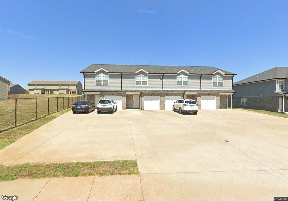
1736 Manning Dr Unit 1 Clarksville, TN 37042
Estimated Value: $689,000 - $809,000
12
Beds
8
Baths
5,436
Sq Ft
$137/Sq Ft
Est. Value
About This Home
This home is located at 1736 Manning Dr Unit 1, Clarksville, TN 37042 and is currently estimated at $746,382, approximately $137 per square foot. 1736 Manning Dr Unit 1 is a home located in Montgomery County with nearby schools including Pisgah Elementary School, West Creek Middle School, and West Creek High School.
Ownership History
Date
Name
Owned For
Owner Type
Purchase Details
Closed on
Jul 31, 2020
Sold by
Bj Properties
Bought by
Larson Carl and Larson Katie Titus
Current Estimated Value
Home Financials for this Owner
Home Financials are based on the most recent Mortgage that was taken out on this home.
Original Mortgage
$462,453
Outstanding Balance
$410,986
Interest Rate
3.1%
Mortgage Type
FHA
Estimated Equity
$335,396
Purchase Details
Closed on
Nov 6, 2017
Bought by
Bj Properties
Home Financials for this Owner
Home Financials are based on the most recent Mortgage that was taken out on this home.
Original Mortgage
$315,000
Interest Rate
3.85%
Mortgage Type
New Conventional
Purchase Details
Closed on
Sep 28, 2016
Sold by
Mace Billy J
Bought by
Gleason Rae Ellen and Gleason Rae Ellen 2000 Trust Trustee
Purchase Details
Closed on
Sep 26, 2016
Sold by
Lee Suk
Bought by
Mace Billy J
Create a Home Valuation Report for This Property
The Home Valuation Report is an in-depth analysis detailing your home's value as well as a comparison with similar homes in the area
Home Values in the Area
Average Home Value in this Area
Purchase History
| Date | Buyer | Sale Price | Title Company |
|---|---|---|---|
| Larson Carl | $505,000 | Tennessee Title Services Llc | |
| Bj Properties | $315,000 | -- | |
| Gleason Rae Ellen | $2,000,000 | -- | |
| Mace Billy J | -- | -- |
Source: Public Records
Mortgage History
| Date | Status | Borrower | Loan Amount |
|---|---|---|---|
| Open | Larson Carl | $462,453 | |
| Previous Owner | Bj Properties | $315,000 |
Source: Public Records
Tax History Compared to Growth
Tax History
| Year | Tax Paid | Tax Assessment Tax Assessment Total Assessment is a certain percentage of the fair market value that is determined by local assessors to be the total taxable value of land and additions on the property. | Land | Improvement |
|---|---|---|---|---|
| 2024 | $10,175 | $341,440 | $0 | $0 |
| 2023 | $10,175 | $148,920 | $0 | $0 |
| 2022 | $6,285 | $148,920 | $0 | $0 |
| 2021 | $6,285 | $148,920 | $0 | $0 |
| 2020 | $2,788 | $69,360 | $0 | $0 |
| 2019 | $452 | $11,250 | $0 | $0 |
| 2018 | $521 | $12,080 | $0 | $0 |
| 2017 | $371 | $12,080 | $0 | $0 |
| 2016 | $371 | $12,080 | $0 | $0 |
| 2015 | $509 | $12,080 | $0 | $0 |
| 2014 | $502 | $12,080 | $0 | $0 |
| 2013 | -- | $11,200 | $0 | $0 |
Source: Public Records
Map
Nearby Homes
- 1709 Manning Dr
- 314 Front Ridge Cir
- 1061 Charles Thomas Dr
- 1897 Sherman Ct
- 1062 Spicer Dr
- 1901 Sherman Ct
- 1824 Jackie Lorraine Dr
- 1812 Jackie Lorraine Dr
- 1926 Jackie Lorraine Dr
- 1880 Jackie Lorraine Dr
- 1845 Jackie Lorraine Dr
- 1873 Jackie Lorraine Dr
- 2 Drift King Estates
- 319 Dugger Dr
- 279 Cardinal Creek 139 Brenda Dr
- 1883 Needmore Rd
- 299 Dugger Dr
- 268 Dugger Dr
- 242 Cardinal Creek
- 238 Dugger Dr
- 1736 Manning Dr Unit 3
- 1736 Manning Dr
- 1732 Manning Dr Unit 1
- 1732 Manning Dr Unit 3
- 1732 Manning Dr Unit 2
- 1732 Manning Dr Unit 4
- 1728 Manning Dr Unit 3
- 1728 Manning Dr
- 1728 Manning Dr
- 1728 Manning Dr Unit 2
- 1728 Manning Dr Unit 4
- 1728 Manning Dr Unit 3
- 1728 Manning Dr Unit 1
- 1733 Manning Dr Unit 1
- 1733 Manning Dr Unit 3
- 1733 Manning Dr
- 1733 Manning Dr Unit 2
- 456 Autumn Creek
- 1724 Manning Dr