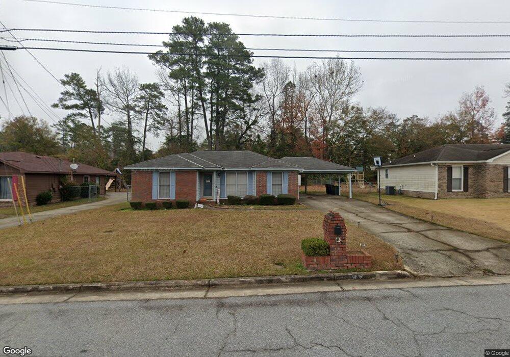
1736 Mazor Dr Columbus, GA 31907
East Columbus NeighborhoodEstimated Value: $70,151 - $184,000
3
Beds
3
Baths
1,459
Sq Ft
$83/Sq Ft
Est. Value
About This Home
This home is located at 1736 Mazor Dr, Columbus, GA 31907 and is currently estimated at $121,788, approximately $83 per square foot. 1736 Mazor Dr is a home located in Muscogee County with nearby schools including Wesley Heights Elementary School, East Columbus Magnet Academy, and Kendrick High School.
Ownership History
Date
Name
Owned For
Owner Type
Purchase Details
Closed on
Mar 27, 2025
Sold by
Smith Lemesio
Bought by
Raya Sherry
Current Estimated Value
Home Financials for this Owner
Home Financials are based on the most recent Mortgage that was taken out on this home.
Original Mortgage
$67,997
Outstanding Balance
$67,707
Interest Rate
6.85%
Mortgage Type
New Conventional
Estimated Equity
$54,081
Create a Home Valuation Report for This Property
The Home Valuation Report is an in-depth analysis detailing your home's value as well as a comparison with similar homes in the area
Home Values in the Area
Average Home Value in this Area
Purchase History
| Date | Buyer | Sale Price | Title Company |
|---|---|---|---|
| Raya Sherry | $70,100 | None Listed On Document | |
| Raya Sherry | $70,100 | None Listed On Document |
Source: Public Records
Mortgage History
| Date | Status | Borrower | Loan Amount |
|---|---|---|---|
| Open | Raya Sherry | $67,997 | |
| Closed | Raya Sherry | $67,997 |
Source: Public Records
Tax History
| Year | Tax Paid | Tax Assessment Tax Assessment Total Assessment is a certain percentage of the fair market value that is determined by local assessors to be the total taxable value of land and additions on the property. | Land | Improvement |
|---|---|---|---|---|
| 2025 | $820 | $54,180 | $8,756 | $45,424 |
| 2024 | $819 | $54,180 | $8,756 | $45,424 |
| 2023 | $130 | $54,180 | $8,756 | $45,424 |
| 2022 | $854 | $43,096 | $8,756 | $34,340 |
| 2021 | $847 | $35,640 | $8,756 | $26,884 |
| 2020 | $848 | $35,640 | $8,756 | $26,884 |
| 2019 | $852 | $35,640 | $8,756 | $26,884 |
| 2018 | $852 | $35,640 | $8,756 | $26,884 |
| 2017 | $856 | $35,640 | $8,756 | $26,884 |
| 2016 | $861 | $34,141 | $7,200 | $26,941 |
| 2015 | $863 | $34,141 | $7,200 | $26,941 |
| 2014 | $864 | $34,141 | $7,200 | $26,941 |
| 2013 | -- | $34,141 | $7,200 | $26,941 |
Source: Public Records
Map
Nearby Homes
- 1925 Woodhollow Dr
- 6293 Dupree Dr
- 2312 Burnside Dr
- 6213 Fitzgerald Dr
- 1524 Mazor Dr
- 6270 Mill Branch Rd
- 6620 Cove Cir
- 1314 Pagoda Dr
- 6370 Lemongrass Dr
- 6362 Lemongrass Dr
- 6366 Lemongrass Dr
- 6311 Morning Dew Dr
- 6303 Morning Dew Dr
- 6302 Morning Dew Dr
- 6307 Morning Dew Dr
- 2708 Courtland Ave
- 2216 Hunter Ct
- 6224 Valencia Dr
- 6061 Luna Dr
- 6021 Luna Dr
- 1742 Mazor Dr
- 1730 Mazor Dr
- 1919 Woodhollow Dr
- 1748 Mazor Dr
- 1724 Mazor Dr
- 1913 Woodhollow Dr
- 1731 Mazor Dr
- 1737 Mazor Dr
- 1907 Woodhollow Dr
- 6344 Dupree Dr
- 1718 Mazor Dr
- 2001 Courtland Ave
- 1717 Mazor Dr
- 1901 Woodhollow Dr
- 2011 Courtland Ave
- 6331 Browning Dr
- 1712 Mazor Dr
- 6338 Dupree Dr
- 6349 Dupree Dr
- 6343 Dupree Dr