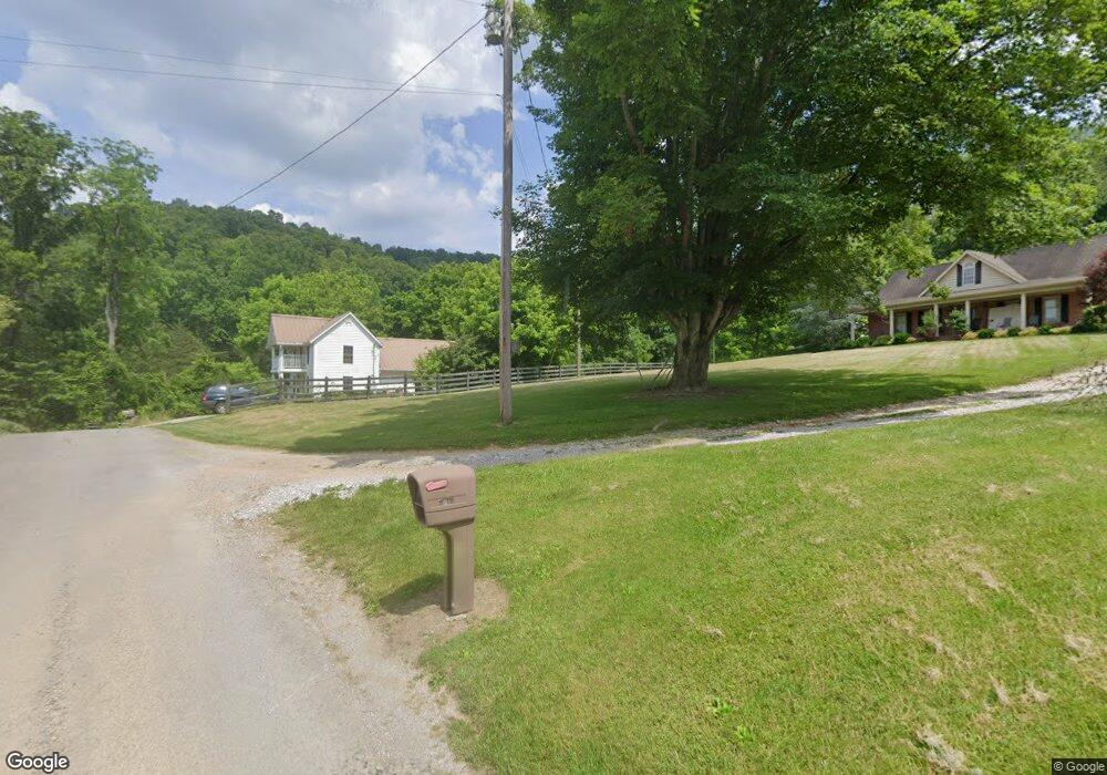
1736 Merritt Rd Washburn, TN 37888
Estimated Value: $150,000 - $344,000
--
Bed
1
Bath
1,766
Sq Ft
$131/Sq Ft
Est. Value
About This Home
This home is located at 1736 Merritt Rd, Washburn, TN 37888 and is currently estimated at $231,785, approximately $131 per square foot. 1736 Merritt Rd is a home located in Grainger County with nearby schools including Washburn School.
Ownership History
Date
Name
Owned For
Owner Type
Purchase Details
Closed on
Jul 14, 2016
Sold by
Dotson Rodney T
Bought by
Crandall Alan R and Crandall Charlotte
Current Estimated Value
Home Financials for this Owner
Home Financials are based on the most recent Mortgage that was taken out on this home.
Original Mortgage
$90,385
Outstanding Balance
$71,913
Interest Rate
3.56%
Mortgage Type
New Conventional
Estimated Equity
$159,872
Purchase Details
Closed on
Oct 2, 1999
Sold by
Dotson Rodney T and Dotson Susan
Bought by
Dotson Rodney T
Purchase Details
Closed on
Feb 7, 1986
Bought by
Cook R Glen
Purchase Details
Closed on
Jan 1, 1902
Create a Home Valuation Report for This Property
The Home Valuation Report is an in-depth analysis detailing your home's value as well as a comparison with similar homes in the area
Home Values in the Area
Average Home Value in this Area
Purchase History
| Date | Buyer | Sale Price | Title Company |
|---|---|---|---|
| Crandall Alan R | $87,900 | -- | |
| Dotson Rodney T | -- | -- | |
| Cook R Glen | $75,000 | -- | |
| -- | -- | -- |
Source: Public Records
Mortgage History
| Date | Status | Borrower | Loan Amount |
|---|---|---|---|
| Open | Crandall Alan R | $90,385 |
Source: Public Records
Tax History Compared to Growth
Tax History
| Year | Tax Paid | Tax Assessment Tax Assessment Total Assessment is a certain percentage of the fair market value that is determined by local assessors to be the total taxable value of land and additions on the property. | Land | Improvement |
|---|---|---|---|---|
| 2025 | $509 | $21,675 | $0 | $0 |
| 2024 | $509 | $21,675 | $4,250 | $17,425 |
| 2023 | $509 | $21,675 | $4,250 | $17,425 |
| 2022 | $498 | $21,675 | $4,250 | $17,425 |
| 2021 | $498 | $21,675 | $4,250 | $17,425 |
| 2020 | $510 | $21,675 | $4,250 | $17,425 |
| 2019 | $510 | $18,200 | $3,725 | $14,475 |
| 2018 | $440 | $18,200 | $3,725 | $14,475 |
| 2017 | $423 | $18,200 | $3,725 | $14,475 |
| 2016 | $423 | $17,475 | $3,725 | $13,750 |
| 2015 | $402 | $17,475 | $3,725 | $13,750 |
| 2014 | $402 | $16,094 | $0 | $0 |
Source: Public Records
Map
Nearby Homes
- 3427 Tater Valley Rd
- 291 Twin Ln
- 138 Sylvia Way
- 125 Dale Rd
- 126 Dale Rd
- 891 New Harvest Rd
- 400 Cabbage Cemetery Rd
- 9100 Highway 131
- 833 Shirley Rd
- 1140 Tater Valley Rd
- Lot 15 Black Fox Harbor Rd
- 1644 Round Barn Rd
- 7875 Tennessee 131
- Lot 880 Fellowship Ln
- 1386 Walker Ford Rd
- 1641 Walker Ford Rd
- 0 Baltimore Rd Unit 1299663
- 0 Baltimore Rd Unit LotWP001 23416397
- 914 Bluff Rd
- 399 High Ridge Ct
- 1736 Merritt Rd
- 1758 Merritt Rd
- 1395 Merritt Rd
- 0 Baker Hollow Unit 613459
- 0 Baker Hollow Unit 687843
- 42.83 Merritt Rd
- 1425 Merritt Rd
- 1394 Merritt Rd
- 814 Baker Hollow Rd
- 21.03 Acre Merritt Rd
- 1232 Tater Valley Rd
- 4001 Tater Valley Rd
- 1596 Merritt Rd
- 31 Ac Liberty Hill Rd
- 4134 Tater Valley Rd
- 480 Edmondson Rd
- 480 Edmondson Rd
- 3655 Tater Valley Rd
- 4170 Tater Valley Rd
- 3601 Tater Valley Rd
