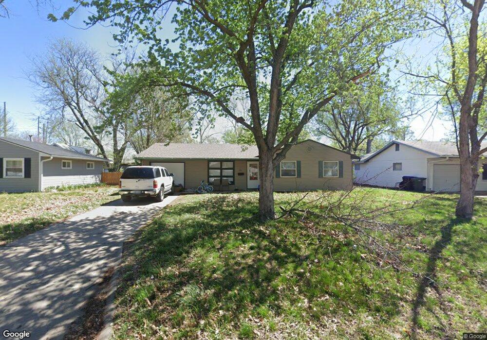
1736 SW Amhurst Rd Topeka, KS 66604
West Topeka NeighborhoodEstimated Value: $120,000 - $153,000
3
Beds
1
Bath
996
Sq Ft
$136/Sq Ft
Est. Value
About This Home
This home is located at 1736 SW Amhurst Rd, Topeka, KS 66604 and is currently estimated at $135,550, approximately $136 per square foot. 1736 SW Amhurst Rd is a home located in Shawnee County with nearby schools including McCarter Elementary School, Marjorie French Middle School, and Topeka West High School.
Ownership History
Date
Name
Owned For
Owner Type
Purchase Details
Closed on
Jun 24, 2010
Sold by
1736 Amhurst Land Trust
Bought by
Cana Investments Llc
Current Estimated Value
Home Financials for this Owner
Home Financials are based on the most recent Mortgage that was taken out on this home.
Original Mortgage
$67,200
Outstanding Balance
$44,593
Interest Rate
4.77%
Mortgage Type
Future Advance Clause Open End Mortgage
Estimated Equity
$90,957
Purchase Details
Closed on
Jan 2, 2010
Sold by
Holthaus Vickie A and Holthaus Allan L
Bought by
1736 Amhurst Land Trust
Purchase Details
Closed on
Oct 20, 2008
Sold by
Cana Investments Llc
Bought by
Holthaus Vickie A
Purchase Details
Closed on
Apr 19, 2008
Sold by
Stowers James Lloyd
Bought by
Cana Investment Llc
Create a Home Valuation Report for This Property
The Home Valuation Report is an in-depth analysis detailing your home's value as well as a comparison with similar homes in the area
Home Values in the Area
Average Home Value in this Area
Purchase History
| Date | Buyer | Sale Price | Title Company |
|---|---|---|---|
| Cana Investments Llc | -- | Lawyers Title Of Topeka Inc | |
| 1736 Amhurst Land Trust | -- | None Available | |
| Holthaus Vickie A | -- | None Available | |
| Cana Investment Llc | -- | None Available |
Source: Public Records
Mortgage History
| Date | Status | Borrower | Loan Amount |
|---|---|---|---|
| Open | Cana Investments Llc | $67,200 |
Source: Public Records
Tax History Compared to Growth
Tax History
| Year | Tax Paid | Tax Assessment Tax Assessment Total Assessment is a certain percentage of the fair market value that is determined by local assessors to be the total taxable value of land and additions on the property. | Land | Improvement |
|---|---|---|---|---|
| 2025 | $1,688 | $12,746 | -- | -- |
| 2023 | $1,688 | $11,678 | $0 | $0 |
| 2022 | $1,478 | $10,155 | $0 | $0 |
| 2021 | $1,367 | $8,830 | $0 | $0 |
| 2020 | $1,352 | $8,830 | $0 | $0 |
| 2019 | $1,333 | $8,656 | $0 | $0 |
| 2018 | $1,294 | $8,404 | $0 | $0 |
| 2017 | $1,297 | $8,404 | $0 | $0 |
| 2014 | $1,438 | $9,196 | $0 | $0 |
Source: Public Records
Map
Nearby Homes
- 1728 SW Fairlawn Rd
- 1906 SW Village Dr
- 2124 SW Meadow Ln
- 5518 SW Avalon Ln
- 1944 SW Quivira Dr
- 5618 SW 14th St
- 5802 SW Sterling Ln
- 1306 SW Glendale Dr
- 1609 SW Burnett Rd
- 5452 SW 12th Terrace Unit 3
- 5324 SW 24th St
- 2401 SW Crest Dr
- 1274 SW Indian Trail Ct
- 4221 SW 17th St
- 4230 SW 19th St
- 1421 SW Mcalister Ave
- 0000 SW 22nd Terrace
- 5859 SW 22nd Terrace Unit 3
- 5861 SW 22nd Terrace Unit 1
- 4200 SW Stratford Rd
- 1740 SW Amhurst Rd
- 1732 SW Amhurst Rd
- 1737 SW Fairlawn Rd
- 1741 SW Fairlawn Rd
- 1733 SW Fairlawn Rd
- 1744 SW Amhurst Rd
- 1728 SW Amhurst Rd
- 1745 SW Fairlawn Rd
- 1729 SW Fairlawn Rd
- 1737 SW Amhurst Rd
- 1733 SW Amhurst Rd
- 1741 SW Amhurst Rd
- 1724 SW Amhurst Rd
- 1729 SW Amhurst Rd
- 1747 SW Amhurst Rd
- 1725 SW Fairlawn Rd
- 1725 SW Amhurst Rd
- 1718 SW Amhurst Rd
- 1811 SW Fairlawn Rd
- 1719 SW Fairlawn Rd