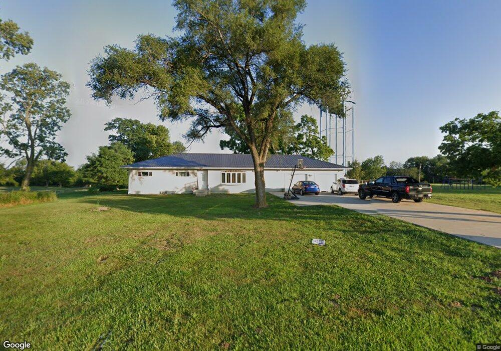
1737 Cattail Rd Chillicothe, OH 45601
Estimated Value: $166,000 - $244,000
--
Bed
1
Bath
1,392
Sq Ft
$146/Sq Ft
Est. Value
About This Home
This home is located at 1737 Cattail Rd, Chillicothe, OH 45601 and is currently estimated at $203,667, approximately $146 per square foot. 1737 Cattail Rd is a home located in Ross County with nearby schools including Unioto Elementary School, Unioto Middle School, and Unioto High School.
Ownership History
Date
Name
Owned For
Owner Type
Purchase Details
Closed on
Dec 19, 2020
Sold by
Watterson Brenda Sue and The Stiving Principal Protecti
Bought by
Netter Brian J and Netter Emily G
Current Estimated Value
Purchase Details
Closed on
Jan 23, 2014
Sold by
Mcwhorter Wallace O and Mcwhorter Thomas O
Bought by
Netter Brian J and Netter Emily
Home Financials for this Owner
Home Financials are based on the most recent Mortgage that was taken out on this home.
Original Mortgage
$90,000
Interest Rate
4.42%
Mortgage Type
Future Advance Clause Open End Mortgage
Create a Home Valuation Report for This Property
The Home Valuation Report is an in-depth analysis detailing your home's value as well as a comparison with similar homes in the area
Home Values in the Area
Average Home Value in this Area
Purchase History
| Date | Buyer | Sale Price | Title Company |
|---|---|---|---|
| Netter Brian J | $1,000 | None Available | |
| Netter Brian J | $49,000 | Attorney |
Source: Public Records
Mortgage History
| Date | Status | Borrower | Loan Amount |
|---|---|---|---|
| Previous Owner | Netter Brian J | $90,000 |
Source: Public Records
Tax History Compared to Growth
Tax History
| Year | Tax Paid | Tax Assessment Tax Assessment Total Assessment is a certain percentage of the fair market value that is determined by local assessors to be the total taxable value of land and additions on the property. | Land | Improvement |
|---|---|---|---|---|
| 2024 | $2,162 | $61,180 | $5,870 | $55,310 |
| 2023 | $2,162 | $61,180 | $5,870 | $55,310 |
| 2022 | $2,210 | $61,180 | $5,870 | $55,310 |
| 2021 | $1,521 | $39,420 | $4,550 | $34,870 |
| 2020 | $1,529 | $39,420 | $4,550 | $34,870 |
| 2019 | $1,529 | $39,420 | $4,550 | $34,870 |
| 2018 | $931 | $23,510 | $4,220 | $19,290 |
| 2017 | $913 | $23,030 | $4,220 | $18,810 |
| 2016 | $890 | $23,030 | $4,220 | $18,810 |
| 2015 | $840 | $21,490 | $4,220 | $17,270 |
| 2014 | $473 | $21,490 | $4,220 | $17,270 |
| 2013 | $475 | $21,490 | $4,220 | $17,270 |
Source: Public Records
Map
Nearby Homes
- 10217 County Road 550
- 11303 County Road 550
- 435 Mount Carmel Rd
- 2391 Simmons Rd
- 559 Golfview Dr
- 365 Golfview Dr
- 12690 Pleasant Valley Rd
- 265 Brookside Dr
- 54 Moccasin Dr
- 25 Woodland Way
- 420 Steiner Rd
- 2153 Egypt Pike
- 1667 Stone Rd Unit Lot 59
- 500 Old Elm Rd
- 313 Goodale Dr
- 18 Sarah Ct
- 13223 Pleasant Valley Rd
- 1036 Clinton Rd
- 45 Custer Dr
- 2083 Anderson Station Rd
- 1783 Cattail Rd
- 1651 Cattail Rd
- 1865 Cattail Rd
- 1785 Cattail Rd
- 000 Cattail Rd
- 0 Cattail Rd
- 1871 Cattail Rd
- 1931 Cattail Rd
- 1589 Cattail Rd
- 1991 Cattail Rd
- 1591 Cattail Rd
- 1473 Cattail Rd
- 2033 Cattail Rd
- 2039 Cattail Rd
- 2039 Cattail Rd
- 2047 Cattail Rd
- 526 Clearview Rd
- 526 Clearview Rd
- 1492 Cattail Rd
- 511 Clearview Rd