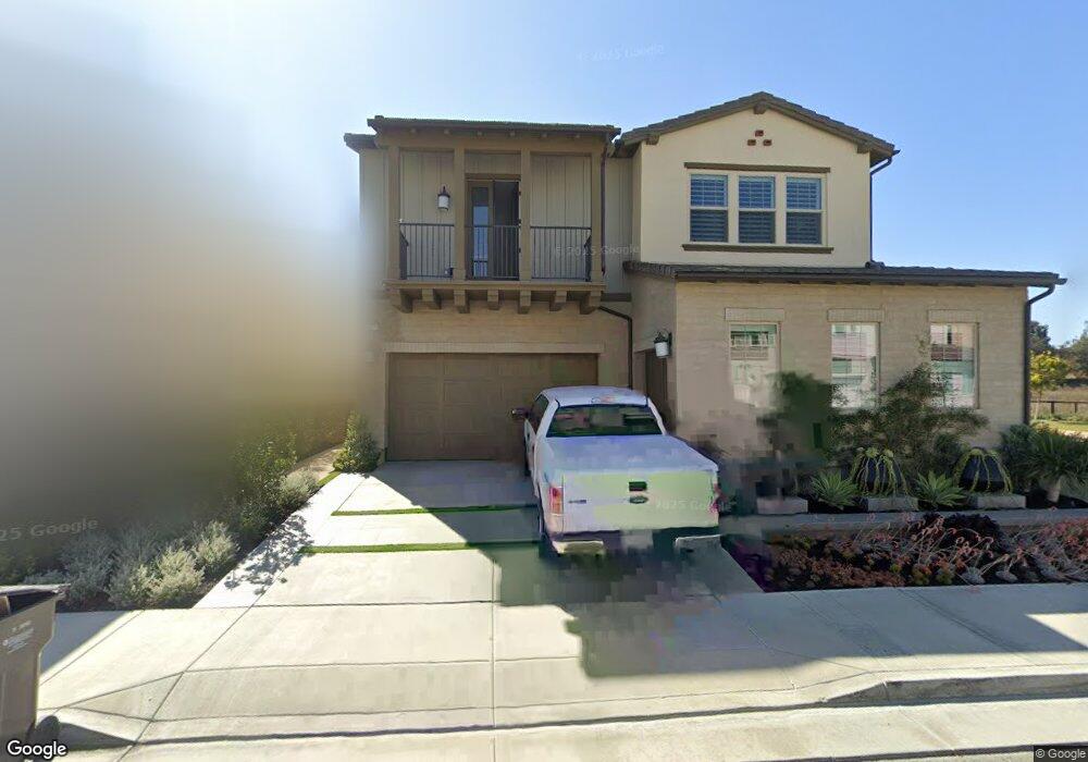
17371 Eucalyptus Ln Huntington Beach, CA 92649
Estimated Value: $2,612,000 - $3,572,000
5
Beds
6
Baths
3,746
Sq Ft
$836/Sq Ft
Est. Value
About This Home
This home is located at 17371 Eucalyptus Ln, Huntington Beach, CA 92649 and is currently estimated at $3,132,476, approximately $836 per square foot. 17371 Eucalyptus Ln is a home with nearby schools including Hope View Elementary School, Mesa View Middle School, and Huntington Beach High School.
Ownership History
Date
Name
Owned For
Owner Type
Purchase Details
Closed on
Dec 24, 2019
Sold by
Shea Homes Limited Partnership
Bought by
Timoti Wayne H and Timoti Brenda J
Current Estimated Value
Home Financials for this Owner
Home Financials are based on the most recent Mortgage that was taken out on this home.
Original Mortgage
$675,000
Interest Rate
3%
Mortgage Type
New Conventional
Create a Home Valuation Report for This Property
The Home Valuation Report is an in-depth analysis detailing your home's value as well as a comparison with similar homes in the area
Home Values in the Area
Average Home Value in this Area
Purchase History
| Date | Buyer | Sale Price | Title Company |
|---|---|---|---|
| Timoti Wayne H | $1,890,500 | First American Title Company |
Source: Public Records
Mortgage History
| Date | Status | Borrower | Loan Amount |
|---|---|---|---|
| Previous Owner | Timoti Wayne H | $675,000 |
Source: Public Records
Tax History Compared to Growth
Tax History
| Year | Tax Paid | Tax Assessment Tax Assessment Total Assessment is a certain percentage of the fair market value that is determined by local assessors to be the total taxable value of land and additions on the property. | Land | Improvement |
|---|---|---|---|---|
| 2025 | $22,971 | $2,110,089 | $2,027,396 | $82,693 |
| 2024 | $22,971 | $2,068,715 | $1,987,643 | $81,072 |
| 2023 | $22,460 | $2,028,152 | $1,948,669 | $79,483 |
| 2022 | $22,144 | $1,988,385 | $1,910,460 | $77,925 |
| 2021 | $21,086 | $1,890,500 | $1,873,000 | $17,500 |
| 2020 | $2,245 | $172,142 | $172,142 | $0 |
| 2019 | $2,211 | $168,767 | $168,767 | $0 |
| 2018 | $1,976 | $148,301 | $148,301 | $0 |
| 2017 | $1,945 | $145,394 | $145,394 | $0 |
| 2016 | $1,873 | $142,544 | $142,544 | $0 |
Source: Public Records
Map
Nearby Homes
- 5262 Glenroy Dr
- 17202 Corbina Ln Unit 108
- 5241 Glenroy Dr
- 17191 Corbina Ln Unit 110
- 17322 Wareham Ln
- 17472 Oakbluffs Ln
- 17291 Wareham Ln
- 17272 Tidalridge Ln
- 17042 Twain Ln
- 17532 Montbury Cir
- 17372 Forbes Ln
- 17212 Lynn Ln
- 4746 Oceanridge Dr
- 4822 Tiara Dr Unit 104
- 4711 Winthrop Dr
- 16832 Roosevelt Ln
- 17182 Hillside Cir
- 4651 Los Patos Ave
- 4682 Warner Ave Unit B102
- 5812 Raphael Dr
- 17391 Eucalyptus Ln
- 17372 Eucalyptus Ln
- 17362 Eucalyptus Ln
- 17342 Eucalyptus Ln
- 5262 Goldenrod Cir
- 5252 Goldenrod Cir
- 17371 Burrows Ln
- 5242 Goldenrod Cir
- 17381 Burrows Ln
- 17351 Burrows Ln
- 5272 Goldenrod Cir
- 5222 Goldenrod Cir
- 17332 Eucalyptus Ln
- 5212 Goldenrod Cir
- 17331 Burrows Ln
- 5202 Goldenrod Cir
- 17322 Eucalyptus Ln
- 5192 Goldenrod Cir
- 17321 Burrows Ln
- 5302 Goldenrod Cir