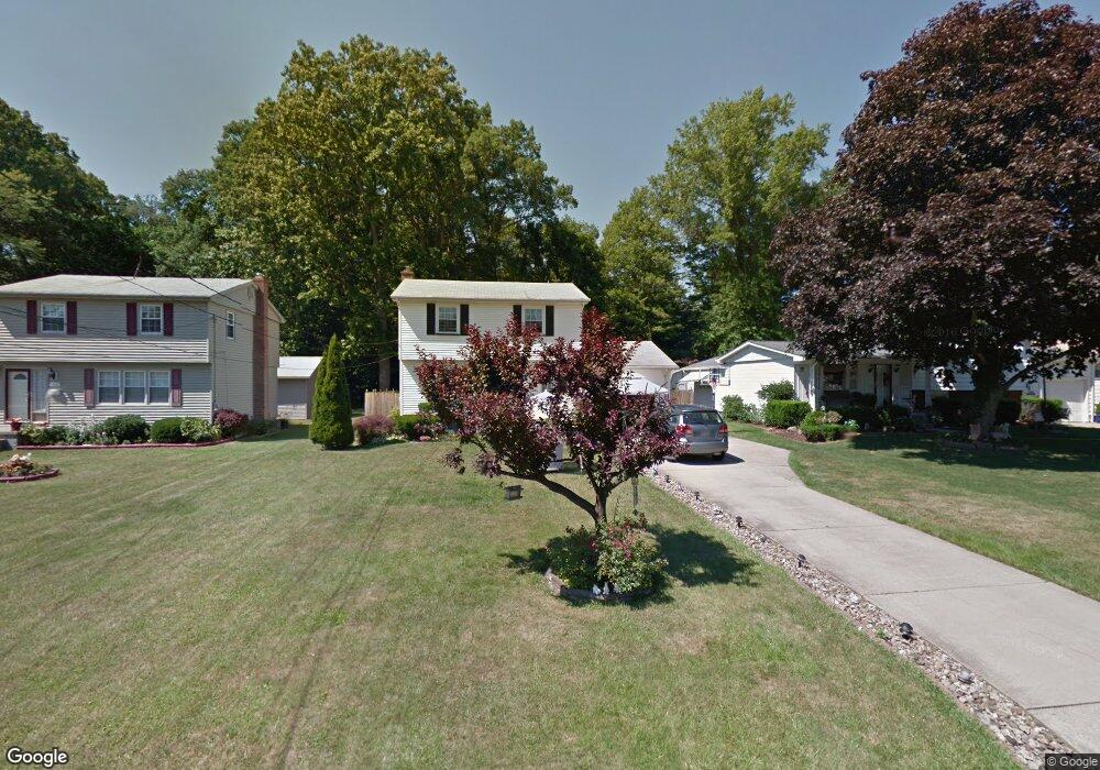
1738 Basil Ave Youngstown, OH 44514
Estimated Value: $160,000 - $211,000
3
Beds
2
Baths
1,636
Sq Ft
$112/Sq Ft
Est. Value
About This Home
This home is located at 1738 Basil Ave, Youngstown, OH 44514 and is currently estimated at $182,494, approximately $111 per square foot. 1738 Basil Ave is a home located in Mahoning County with nearby schools including Darwin L. Gilmore Elementary School, Paul C. Bunn Elementary School, and Bayside Intermediate School.
Ownership History
Date
Name
Owned For
Owner Type
Purchase Details
Closed on
Jun 16, 1995
Sold by
Stickel James C
Bought by
Dunkel Karl and Dunkel Mira W
Current Estimated Value
Home Financials for this Owner
Home Financials are based on the most recent Mortgage that was taken out on this home.
Original Mortgage
$49,500
Interest Rate
7.84%
Mortgage Type
New Conventional
Purchase Details
Closed on
Sep 16, 1993
Bought by
Stickel James C and Stickel Maureen
Create a Home Valuation Report for This Property
The Home Valuation Report is an in-depth analysis detailing your home's value as well as a comparison with similar homes in the area
Home Values in the Area
Average Home Value in this Area
Purchase History
| Date | Buyer | Sale Price | Title Company |
|---|---|---|---|
| Dunkel Karl | $66,000 | -- | |
| Stickel James C | -- | -- |
Source: Public Records
Mortgage History
| Date | Status | Borrower | Loan Amount |
|---|---|---|---|
| Closed | Dunkel Karl | $49,500 |
Source: Public Records
Tax History Compared to Growth
Tax History
| Year | Tax Paid | Tax Assessment Tax Assessment Total Assessment is a certain percentage of the fair market value that is determined by local assessors to be the total taxable value of land and additions on the property. | Land | Improvement |
|---|---|---|---|---|
| 2024 | $2,667 | $47,700 | $5,670 | $42,030 |
| 2023 | $2,649 | $47,700 | $5,670 | $42,030 |
| 2022 | $2,219 | $30,140 | $5,510 | $24,630 |
| 2021 | $2,219 | $30,140 | $5,510 | $24,630 |
| 2020 | $2,230 | $30,140 | $5,510 | $24,630 |
| 2019 | $2,190 | $25,980 | $4,750 | $21,230 |
| 2018 | $2,214 | $25,980 | $4,750 | $21,230 |
| 2017 | $1,977 | $25,980 | $4,750 | $21,230 |
| 2016 | $1,853 | $24,320 | $5,810 | $18,510 |
| 2015 | $1,820 | $24,320 | $5,810 | $18,510 |
| 2014 | $1,809 | $24,320 | $5,810 | $18,510 |
| 2013 | $1,787 | $24,320 | $5,810 | $18,510 |
Source: Public Records
Map
Nearby Homes
- 1828 Basil Ave
- 1830 Halbert Dr
- 0 Lemoyne Ave
- 1720 Sequoya Dr
- 1841 Wingate Rd
- 0 Woodlawn Ave
- 1514 Thalia Ave
- 1543 Lynn Ave
- 0 Oles Ave
- 1919 Wingate Rd
- 0 Mathews Rd Unit 5149232
- 0 Mathews Rd Unit 5143059
- 1933 Brandon Ave
- 1913 Country Club Ave
- 1890 Mathews Rd
- 0 Moyer Ave
- 1553 Bancroft Ave
- 767 Indianola Rd
- 4534 South Ave
- 1894 Lealand Ave
- 1744 Basil Ave
- 1732 Basil Ave
- 1750 Basil Ave
- 1756 Basil Ave
- 1505 Brandon Ave
- 1739 Basil Ave
- 5230 Jeanne Lynn Ave
- 1745 Basil Ave
- 1733 Basil Ave
- 5250 Jeanne Lynn Ave
- 1751 Basil Ave
- 1762 Basil Ave
- 5260 Jeanne Lynn Ave
- 1757 Basil Ave
- 5270 Jeanne Lynn Ave
- 1517 Brandon Ave
- 1768 Basil Ave
- 1763 Basil Ave
- 5280 Jeanne Lynn Ave
- 1774 Basil Ave