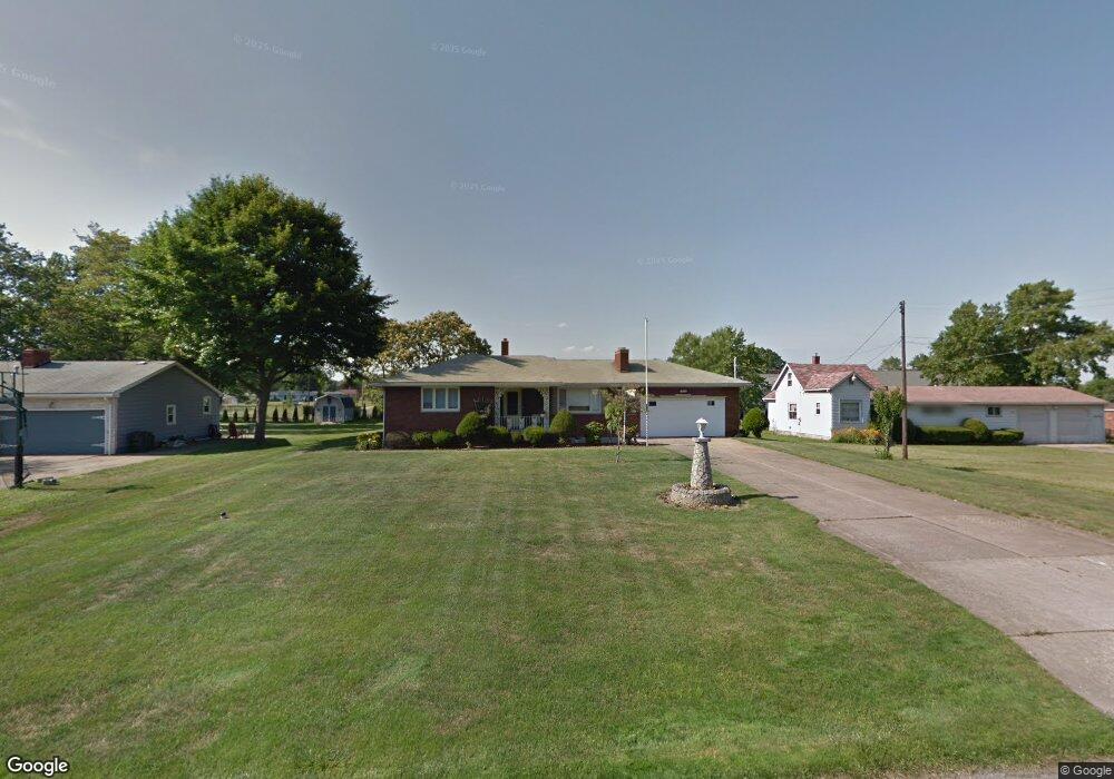
1738 Brandon Ave Youngstown, OH 44514
Estimated Value: $170,000 - $194,000
3
Beds
1
Bath
1,320
Sq Ft
$141/Sq Ft
Est. Value
About This Home
This home is located at 1738 Brandon Ave, Youngstown, OH 44514 and is currently estimated at $185,962, approximately $140 per square foot. 1738 Brandon Ave is a home located in Mahoning County with nearby schools including Paul C. Bunn Elementary School, Clear Horizons Early College High School, and Chaney High School.
Ownership History
Date
Name
Owned For
Owner Type
Purchase Details
Closed on
Dec 14, 2018
Sold by
Melia Michael A
Bought by
Mike And Michelle Melia Llc
Current Estimated Value
Purchase Details
Closed on
Nov 1, 2008
Sold by
Melia Rocco A and Melia Mary
Bought by
Melia Rocco A and Melia Mary
Purchase Details
Closed on
Apr 26, 1966
Bought by
Melia Rocco A and Melia Mary
Create a Home Valuation Report for This Property
The Home Valuation Report is an in-depth analysis detailing your home's value as well as a comparison with similar homes in the area
Home Values in the Area
Average Home Value in this Area
Purchase History
| Date | Buyer | Sale Price | Title Company |
|---|---|---|---|
| Mike And Michelle Melia Llc | -- | None Available | |
| Melia Rocco A | -- | Attorney | |
| Melia Rocco A | -- | -- |
Source: Public Records
Tax History Compared to Growth
Tax History
| Year | Tax Paid | Tax Assessment Tax Assessment Total Assessment is a certain percentage of the fair market value that is determined by local assessors to be the total taxable value of land and additions on the property. | Land | Improvement |
|---|---|---|---|---|
| 2024 | $3,294 | $56,540 | $7,420 | $49,120 |
| 2023 | $3,275 | $56,540 | $7,420 | $49,120 |
| 2022 | $2,844 | $36,980 | $6,700 | $30,280 |
| 2021 | $2,844 | $36,980 | $6,700 | $30,280 |
| 2020 | $2,857 | $36,980 | $6,700 | $30,280 |
| 2019 | $2,858 | $31,880 | $5,780 | $26,100 |
| 2018 | $2,596 | $31,880 | $5,780 | $26,100 |
| 2017 | $2,466 | $31,880 | $5,780 | $26,100 |
| 2016 | $2,359 | $31,020 | $7,060 | $23,960 |
| 2015 | $2,317 | $31,020 | $7,060 | $23,960 |
| 2014 | -- | $31,020 | $7,060 | $23,960 |
| 2013 | $2,275 | $31,020 | $7,060 | $23,960 |
Source: Public Records
Map
Nearby Homes
- 1828 Basil Ave
- 0 Lemoyne Ave
- 1720 Sequoya Dr
- 1830 Halbert Dr
- 1933 Brandon Ave
- 1913 Country Club Ave
- 1841 Wingate Rd
- 1919 Wingate Rd
- 0 Woodlawn Ave
- 1514 Thalia Ave
- 1543 Lynn Ave
- 0 Oles Ave
- 1890 Mathews Rd
- 1553 Bancroft Ave
- 0 Mathews Rd Unit 5149232
- 0 Mathews Rd Unit 5143059
- 1633 Wakefield Ave
- 5710 Youngstown Poland Rd
- 1661 Wakefield Ave
- 1579 Wakefield Ave
- 1820 Brandon Ave
- 1732 Brandon Ave
- 1726 Brandon Ave
- 1804 Brandon Ave
- 1739 Brandon Ave
- 1733 Brandon Ave
- 1745 Brandon Ave
- 1720 Brandon Ave
- 1801 Brandon Ave
- 1727 Brandon Ave
- 1806 Brandon Ave
- 1721 Brandon Ave
- 1805 Brandon Ave
- 5163 Lemoyne Ave
- 5131 Lemoyne Ave
- 1803 Brandon Ave
- 1852 Basil Ave
- 1846 Basil Ave
- 1858 Basil Ave
- 5129 Lemoyne Ave