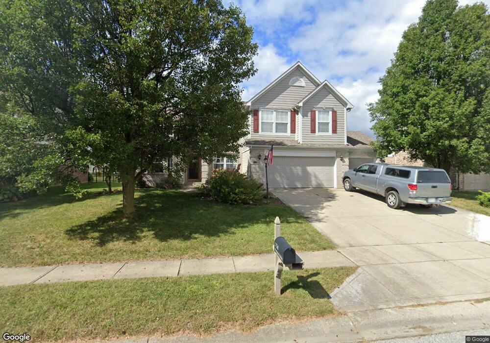
1738 Woodstock Dr Brownsburg, IN 46112
Estimated Value: $429,000 - $464,000
5
Beds
4
Baths
4,131
Sq Ft
$108/Sq Ft
Est. Value
About This Home
This home is located at 1738 Woodstock Dr, Brownsburg, IN 46112 and is currently estimated at $447,784, approximately $108 per square foot. 1738 Woodstock Dr is a home located in Hendricks County with nearby schools including Cardinal Elementary School, Brownsburg West Middle School, and Brownsburg High School.
Ownership History
Date
Name
Owned For
Owner Type
Purchase Details
Closed on
Feb 17, 2009
Sold by
Seifert Shawn E
Bought by
Carter Joseph A and Carter Judith M
Current Estimated Value
Home Financials for this Owner
Home Financials are based on the most recent Mortgage that was taken out on this home.
Original Mortgage
$159,200
Outstanding Balance
$100,418
Interest Rate
5.06%
Mortgage Type
New Conventional
Estimated Equity
$347,366
Create a Home Valuation Report for This Property
The Home Valuation Report is an in-depth analysis detailing your home's value as well as a comparison with similar homes in the area
Home Values in the Area
Average Home Value in this Area
Purchase History
| Date | Buyer | Sale Price | Title Company |
|---|---|---|---|
| Carter Joseph A | -- | None Available |
Source: Public Records
Mortgage History
| Date | Status | Borrower | Loan Amount |
|---|---|---|---|
| Open | Carter Joseph A | $159,200 |
Source: Public Records
Tax History Compared to Growth
Tax History
| Year | Tax Paid | Tax Assessment Tax Assessment Total Assessment is a certain percentage of the fair market value that is determined by local assessors to be the total taxable value of land and additions on the property. | Land | Improvement |
|---|---|---|---|---|
| 2024 | $3,946 | $394,600 | $50,400 | $344,200 |
| 2023 | $3,587 | $358,700 | $45,800 | $312,900 |
| 2022 | $3,376 | $337,600 | $45,300 | $292,300 |
| 2021 | $2,939 | $293,900 | $42,800 | $251,100 |
| 2020 | $2,759 | $275,900 | $42,800 | $233,100 |
| 2019 | $2,591 | $259,100 | $39,400 | $219,700 |
| 2018 | $2,565 | $256,500 | $39,400 | $217,100 |
| 2017 | $2,566 | $256,600 | $39,400 | $217,200 |
| 2016 | $2,504 | $250,400 | $39,400 | $211,000 |
| 2014 | $2,315 | $231,500 | $36,100 | $195,400 |
| 2013 | $2,222 | $222,200 | $34,400 | $187,800 |
Source: Public Records
Map
Nearby Homes
- 1628 Woodstock Dr
- 1027 Plum St Unit 39
- 56 Presidential Way
- 1030 Woodridge Unit 52
- 1139 Brunes Blvd Unit 139
- 1031 Woodridge
- 1119 Manchester Dr Unit 188
- 3 Fairwood Dr
- 35 Fairwood Dr
- 8524 Goldfinch Rd
- 8516 Goldfinch Rd
- 8520 Goldfinch Rd
- 8562 Goldfinch Rd
- 8558 Goldfinch Rd
- 8568 Goldfinch Rd
- 3959 Wren Dr
- 3921 Wren Dr
- 3931 Wren Dr
- 3947 Wren Dr
- 3883 Wren Dr
- 1732 Woodstock Dr
- 1744 Woodstock Dr
- 1726 Woodstock Dr
- 1752 Woodstock Dr
- 1741 Woodstock Dr
- 1747 Woodstock Dr
- 1735 Woodstock Dr
- 1753 Woodstock Dr
- 1758 Woodstock Dr
- 1720 Woodstock Dr
- 1729 Woodstock Dr
- 1119 Statesman Dr
- 1759 Woodstock Dr
- 1123 Statesman Dr
- 1115 Statesman Dr
- 1764 Woodstock Dr
- 1127 Statesman Dr
- 1037 Statesman Dr
- 1765 Woodstock Dr
- 1714 Woodstock Dr