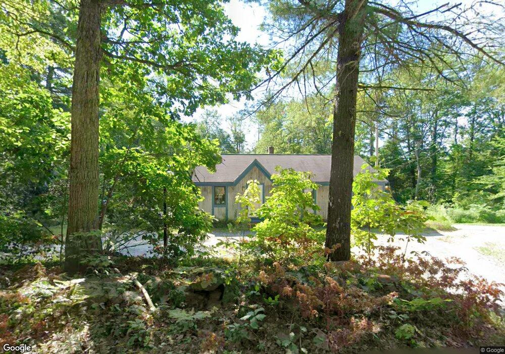
174 Butterworth Rd Orange, MA 01364
Estimated Value: $313,640 - $366,000
3
Beds
1
Bath
1,092
Sq Ft
$309/Sq Ft
Est. Value
About This Home
This home is located at 174 Butterworth Rd, Orange, MA 01364 and is currently estimated at $337,910, approximately $309 per square foot. 174 Butterworth Rd is a home located in Franklin County with nearby schools including Fisher Hill and Ralph C Mahar Regional School.
Ownership History
Date
Name
Owned For
Owner Type
Purchase Details
Closed on
Mar 30, 2015
Sold by
Arnot Roy and Arnot Jane P
Bought by
Arnot Roy and Arnot Jane P
Current Estimated Value
Purchase Details
Closed on
Jun 23, 2004
Sold by
Arnot Roy
Bought by
Gelinas David J and Townsend-Geli Katherine B
Purchase Details
Closed on
Aug 12, 1996
Sold by
Heyes Fred L
Bought by
Nolin Richard T and Nolin Martha B
Create a Home Valuation Report for This Property
The Home Valuation Report is an in-depth analysis detailing your home's value as well as a comparison with similar homes in the area
Home Values in the Area
Average Home Value in this Area
Purchase History
| Date | Buyer | Sale Price | Title Company |
|---|---|---|---|
| Arnot Roy | -- | -- | |
| Gelinas David J | -- | -- | |
| Nolin Richard T | $88,885 | -- |
Source: Public Records
Mortgage History
| Date | Status | Borrower | Loan Amount |
|---|---|---|---|
| Previous Owner | Nolin Richard T | $0 | |
| Previous Owner | Nolin Richard T | $79,500 | |
| Previous Owner | Nolin Richard T | $14,900 |
Source: Public Records
Tax History Compared to Growth
Tax History
| Year | Tax Paid | Tax Assessment Tax Assessment Total Assessment is a certain percentage of the fair market value that is determined by local assessors to be the total taxable value of land and additions on the property. | Land | Improvement |
|---|---|---|---|---|
| 2025 | $43 | $262,700 | $35,200 | $227,500 |
| 2024 | $4,995 | $286,400 | $35,200 | $251,200 |
| 2023 | $4,820 | $268,400 | $35,200 | $233,200 |
| 2022 | $5,040 | $263,600 | $35,200 | $228,400 |
| 2021 | $1,301 | $210,100 | $51,800 | $158,300 |
| 2020 | $4,153 | $204,300 | $51,400 | $152,900 |
| 2019 | $3,873 | $172,000 | $44,700 | $127,300 |
| 2018 | $3,649 | $166,300 | $41,700 | $124,600 |
| 2017 | $3,531 | $166,300 | $41,700 | $124,600 |
| 2016 | $3,567 | $164,400 | $41,700 | $122,700 |
| 2015 | $3,460 | $166,600 | $41,700 | $124,900 |
| 2014 | $3,358 | $170,100 | $41,700 | $128,400 |
Source: Public Records
Map
Nearby Homes
- 4 Elm Ave
- 15 A-B Tully Rd
- LOT Walnut Hill
- 78 Athol Richmond Rd
- 52 Creamery Hill Rd
- 900 N Main St
- 2791 Old Keene Rd
- 350 Athol Richmond Rd
- 15 Tully Rd
- 260 East Rd
- 3327 Chestnut Hill Ave
- 9 On the Common
- 2978 Chestnut Hill Ave
- 31 Pinedale Rd
- 0 S Royalston Rd
- 0 Adams Dr
- 660 Pinedale Ave
- 0 Northfield Rd Unit 73441997
- 0 W Royalston Rd
- lot 12 N Fitzwilliam Rd
- 146 Butterworth Rd
- 120 Butterworth Rd
- 104 Butterworth Rd
- 286 Butterworth Rd Unit 1
- 288 Butterworth Rd Unit 2
- 286 Butterworth Rd Unit 288
- 80 Butterworth Rd
- 62 Butterworth Rd
- 42 Butterworth Rd
- 92 Butterworth Rd
- 485 Tully Rd
- 497 Tully Rd
- 73 Butterworth Rd
- 517 Tully Rd
- 465 Tully Rd
- 75 Butterworth Rd
- 75 Butterworth Rd
- 75A Butterworth Rd
- 455 Tully Rd
- 527 Tully Rd