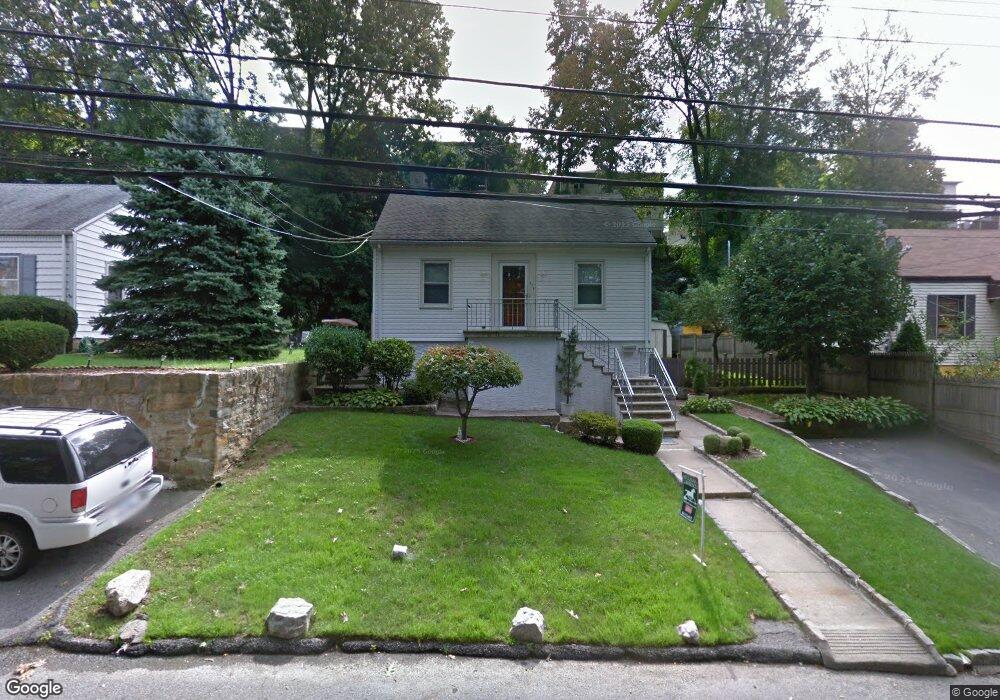
174 Cook Ave Yonkers, NY 10701
Dunwoodie NeighborhoodEstimated Value: $739,000 - $931,000
4
Beds
3
Baths
1,754
Sq Ft
$466/Sq Ft
Est. Value
About This Home
This home is located at 174 Cook Ave, Yonkers, NY 10701 and is currently estimated at $817,739, approximately $466 per square foot. 174 Cook Ave is a home located in Westchester County with nearby schools including St. John the Baptist Catholic Church and Andalusia School.
Ownership History
Date
Name
Owned For
Owner Type
Purchase Details
Closed on
Dec 12, 2011
Sold by
Varuolo Rocco and Varuolo Francesco
Bought by
Acosta Christian and Morel Yudelki
Current Estimated Value
Home Financials for this Owner
Home Financials are based on the most recent Mortgage that was taken out on this home.
Original Mortgage
$308,000
Interest Rate
3.92%
Mortgage Type
New Conventional
Purchase Details
Closed on
Jun 19, 2002
Sold by
Varuolo Vincenzo and Varuolo Adalgisa
Bought by
Varuolo Rocco and Varuolo Francesco
Create a Home Valuation Report for This Property
The Home Valuation Report is an in-depth analysis detailing your home's value as well as a comparison with similar homes in the area
Home Values in the Area
Average Home Value in this Area
Purchase History
| Date | Buyer | Sale Price | Title Company |
|---|---|---|---|
| Acosta Christian | $385,000 | The Judicial Title Insurance | |
| Varuolo Rocco | $92,734 | Fidelity National Title Ins |
Source: Public Records
Mortgage History
| Date | Status | Borrower | Loan Amount |
|---|---|---|---|
| Previous Owner | Acosta Christian | $308,000 |
Source: Public Records
Tax History Compared to Growth
Tax History
| Year | Tax Paid | Tax Assessment Tax Assessment Total Assessment is a certain percentage of the fair market value that is determined by local assessors to be the total taxable value of land and additions on the property. | Land | Improvement |
|---|---|---|---|---|
| 2024 | $1,978 | $11,100 | $4,200 | $6,900 |
| 2023 | $1,967 | $11,100 | $4,200 | $6,900 |
| 2022 | $1,955 | $11,100 | $4,200 | $6,900 |
| 2021 | $8,568 | $11,100 | $4,200 | $6,900 |
| 2020 | $8,475 | $11,100 | $4,200 | $6,900 |
| 2019 | $10,221 | $11,100 | $4,200 | $6,900 |
| 2018 | $7,823 | $11,100 | $4,200 | $6,900 |
| 2017 | -- | $11,100 | $4,200 | $6,900 |
| 2016 | $8,945 | $11,100 | $4,200 | $6,900 |
| 2015 | -- | $11,100 | $4,200 | $6,900 |
| 2014 | -- | $11,100 | $4,200 | $6,900 |
| 2013 | -- | $11,100 | $4,200 | $6,900 |
Source: Public Records
Map
Nearby Homes
- 43 Dunston Ave
- 39 Dunston Ave
- 20 Ashford Place
- 9 Brynwood Rd
- 7 Elaine Terrace
- 70 Cook Ave
- 41 Cowdrey St
- 30 College Place
- 900 Midland Ave Unit 2E
- 98 University Ave
- 194 Valentine St
- 90 University Ave
- 86 University Ave
- 174 Valentine St
- 419 Palmer Rd
- 140 Ramsey Ave
- 466 Palmer Rd
- 191 Dunwoodie St
- 219 Mile Square Rd
- 255 Glenhill Ave
- 180 Cook Ave
- 168 Cook Ave
- 182 Cook Ave
- 165 Bennett Ave Unit 2
- 165 Bennett Ave
- 169 Bennett Ave
- 160 Cook Ave Unit 3B
- 161 Bennett Ave
- 173 Bennett Ave
- 162 Cook Ave
- 177 Bennett Ave
- 157 Bennett Ave
- 157 Bennett Ave Unit 2
- 186 Cook Ave
- 1 Winston Place
- 181 Bennett Ave
- 181 Cook Ave
- 153 Bennett Ave
- 185 Cook Ave
- 185 Bennett Ave