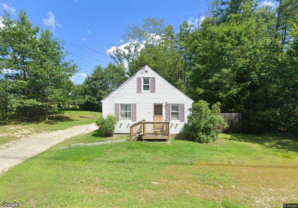
174 Kearsarge Ave Contoocook, NH 03229
Contoocook NeighborhoodEstimated Value: $292,000 - $376,000
2
Beds
1
Bath
916
Sq Ft
$356/Sq Ft
Est. Value
About This Home
This home is located at 174 Kearsarge Ave, Contoocook, NH 03229 and is currently estimated at $326,284, approximately $356 per square foot. 174 Kearsarge Ave is a home located in Merrimack County with nearby schools including Harold Martin School, Hopkinton Middle School, and The Contoocook School.
Ownership History
Date
Name
Owned For
Owner Type
Purchase Details
Closed on
Aug 9, 2019
Sold by
Broas Danyell and Salyer Shawn E
Bought by
Broas Danyell
Current Estimated Value
Purchase Details
Closed on
Jan 19, 2010
Sold by
Upper Valley Cmnty Cu
Bought by
Salyer Shawn E and Broas Danyell
Home Financials for this Owner
Home Financials are based on the most recent Mortgage that was taken out on this home.
Original Mortgage
$131,531
Interest Rate
4.71%
Mortgage Type
Purchase Money Mortgage
Purchase Details
Closed on
Sep 17, 2009
Sold by
Moore George J
Bought by
Upper Valley Cmnty Cu
Purchase Details
Closed on
Nov 28, 2001
Sold by
Stanley Sandra
Bought by
Moore George J
Home Financials for this Owner
Home Financials are based on the most recent Mortgage that was taken out on this home.
Original Mortgage
$91,200
Interest Rate
6.66%
Mortgage Type
Purchase Money Mortgage
Purchase Details
Closed on
May 2, 1996
Sold by
Johnson Ruth E
Bought by
Stanley Sandra
Home Financials for this Owner
Home Financials are based on the most recent Mortgage that was taken out on this home.
Original Mortgage
$39,673
Interest Rate
7.82%
Mortgage Type
Purchase Money Mortgage
Create a Home Valuation Report for This Property
The Home Valuation Report is an in-depth analysis detailing your home's value as well as a comparison with similar homes in the area
Home Values in the Area
Average Home Value in this Area
Purchase History
| Date | Buyer | Sale Price | Title Company |
|---|---|---|---|
| Broas Danyell | -- | -- | |
| Salyer Shawn E | $136,000 | -- | |
| Upper Valley Cmnty Cu | $171,000 | -- | |
| Moore George J | $114,000 | -- | |
| Stanley Sandra | $40,000 | -- |
Source: Public Records
Mortgage History
| Date | Status | Borrower | Loan Amount |
|---|---|---|---|
| Previous Owner | Stanley Sandra | $131,531 | |
| Previous Owner | Stanley Sandra | $91,200 | |
| Previous Owner | Stanley Sandra | $39,673 |
Source: Public Records
Tax History Compared to Growth
Tax History
| Year | Tax Paid | Tax Assessment Tax Assessment Total Assessment is a certain percentage of the fair market value that is determined by local assessors to be the total taxable value of land and additions on the property. | Land | Improvement |
|---|---|---|---|---|
| 2024 | $6,296 | $272,200 | $135,000 | $137,200 |
| 2023 | $5,725 | $155,900 | $71,500 | $84,400 |
| 2022 | $5,279 | $155,900 | $71,500 | $84,400 |
| 2020 | $4,786 | $155,000 | $71,500 | $83,500 |
| 2019 | $4,765 | $154,900 | $71,500 | $83,400 |
| 2018 | $4,340 | $117,800 | $47,000 | $70,800 |
| 2017 | $4,289 | $117,800 | $47,000 | $70,800 |
| 2016 | $3,952 | $117,800 | $47,000 | $70,800 |
| 2015 | $3,971 | $118,100 | $47,000 | $71,100 |
| 2014 | $3,845 | $118,100 | $47,000 | $71,100 |
| 2013 | $4,297 | $149,500 | $82,500 | $67,000 |
Source: Public Records
Map
Nearby Homes
- 104 River Grant Dr
- 56 Maple St Unit C
- 108 Maple St
- 38 Woodwells Garrison Rd
- 2 Granite Valley
- 455 Maple St
- 93-1 Pine St
- 0 Pine St Unit 38 5061613
- 0 Pine St Unit 50 5060731
- 20 Duston Dr
- 1036 Bound Tree Rd
- 7 Pleasant Pond Rd Unit 2
- 356 E Penacook Rd
- 0 Bound Tree Rd Unit 50 5060705
- 656 Dolly Rd
- 105 Clement Hill Rd
- 155 Pamela Dr
- 89 Old Henniker Rd
- 106 Stacey Dr
- 298 Battle St