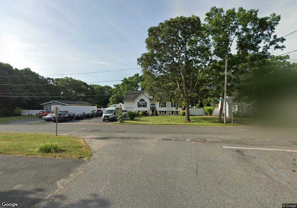
174 Mastic Blvd E Shirley, NY 11967
Estimated Value: $462,000 - $574,000
3
Beds
2
Baths
1,078
Sq Ft
$501/Sq Ft
Est. Value
About This Home
This home is located at 174 Mastic Blvd E, Shirley, NY 11967 and is currently estimated at $540,586, approximately $501 per square foot. 174 Mastic Blvd E is a home located in Suffolk County with nearby schools including William Floyd Elementary School, William Floyd Middle School, and William Floyd High School.
Ownership History
Date
Name
Owned For
Owner Type
Purchase Details
Closed on
Jul 11, 2003
Sold by
Pedersen John and Tyte Arthur
Bought by
Cedeno Joel I and Cedeno Monica D
Current Estimated Value
Home Financials for this Owner
Home Financials are based on the most recent Mortgage that was taken out on this home.
Original Mortgage
$229,500
Outstanding Balance
$97,645
Interest Rate
5.27%
Mortgage Type
Unknown
Estimated Equity
$442,941
Purchase Details
Closed on
Feb 28, 2003
Sold by
Suffolk Consulting Inc
Bought by
Pedersen John and Tyte Arthur
Create a Home Valuation Report for This Property
The Home Valuation Report is an in-depth analysis detailing your home's value as well as a comparison with similar homes in the area
Home Values in the Area
Average Home Value in this Area
Purchase History
| Date | Buyer | Sale Price | Title Company |
|---|---|---|---|
| Cedeno Joel I | $255,000 | -- | |
| Pedersen John | $70,000 | Fidelity National Title Ins |
Source: Public Records
Mortgage History
| Date | Status | Borrower | Loan Amount |
|---|---|---|---|
| Open | Cedeno Joel I | $229,500 |
Source: Public Records
Tax History
| Year | Tax Paid | Tax Assessment Tax Assessment Total Assessment is a certain percentage of the fair market value that is determined by local assessors to be the total taxable value of land and additions on the property. | Land | Improvement |
|---|---|---|---|---|
| 2024 | $9,289 | $2,320 | $200 | $2,120 |
| 2023 | $9,289 | $2,320 | $200 | $2,120 |
| 2022 | $10,346 | $2,320 | $200 | $2,120 |
| 2021 | $10,346 | $2,320 | $200 | $2,120 |
| 2020 | $10,568 | $2,320 | $200 | $2,120 |
| 2019 | $10,568 | $0 | $0 | $0 |
| 2018 | $10,161 | $2,320 | $200 | $2,120 |
| 2017 | $10,161 | $2,320 | $200 | $2,120 |
| 2016 | $11,009 | $2,520 | $200 | $2,320 |
| 2015 | -- | $2,320 | $200 | $2,120 |
| 2014 | -- | $2,320 | $200 | $2,120 |
Source: Public Records
Map
Nearby Homes
- V/L Versa Place
- 22 Garden Place
- 65 Essex Cir
- 17 Ostend Cir
- 41 Broadway
- 33 Wood Ave
- 53 Hounslow Rd
- 498 A William Floyd Pkwy
- 22 Laurel Ln
- 8 George Dr
- 8 Paul Dr
- 490 William Floyd Pkwy
- 30 George Dr
- 0 Bedford Ave Unit KEYL3488158
- VL Bedford Ave
- 7 Candido Ave S
- 0 Holly Ln Unit KEY894949
- 35 Strafford St
- 4 Laurel Ln
- 42 Revilo Ave
- 168 Mastic Blvd E
- 176 Mastic Blvd E
- 172 Mastic Blvd E
- 166 Mastic Blvd E
- 164 Mastic Blvd E
- 23 Ormond Place
- 143 Mastic Blvd E
- 21 Ormond Place
- 47 Northern Blvd
- 49 Northern Blvd
- 160 Mastic Blvd E
- 182 Mastic Blvd E
- 178 Mastic Blvd E
- 139 Mastic Blvd E
- 180 Mastic Blvd E
- 158 Mastic Blvd E
- 33 Northern Blvd
- 184 Mastic Blvd E
- 186 Mastic Blvd E
Your Personal Tour Guide
Ask me questions while you tour the home.